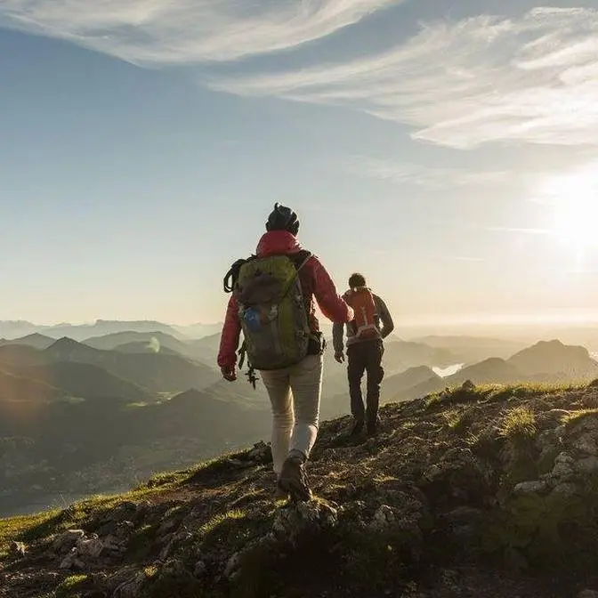
Mt Whitney is the tallest mountain in the Lower 48 and sits at over 14,500 feet in the Eastern Sierra Range. The hike is 21.5 miles round trip with over 6000 feet of elevation gain. We did the trail over 2 days with an overnight at Trail Camp in September of 2023. It was an incredible adventure and one that I will never forget. Let me know what you think in the comments.
Tips for Mt Whitney Hike - • 8 Tips for Hiking Mt Whitney: Permits, Wat...
Follow me: Facebook: / californiathroughmylens Instagram: / californiathroughmylens Pinterest: / cathroughmylens Twitter: / cathroughmylens Monthly newsletter and four day welcome series on California’s best spots: https://bit.ly/2AWSVMK
Want to mail something? California Through My Lens 5198 Arlington Ave # 937 Riverside, CA 92504
When you think of epic hikes in the United States, Mount Whitney is pretty close to the top of the
list. This awe-inspiring mountain is the tallest peak in the U.S. outside of Alaska and it is
climbed via a formidable 21 miles and 6,000 feet of elevation gain round trip. While it can be done
as a day hike, we set out to do it in two days with an overnight at trail camp. This was my
second summit of Mount Whitney and an experience with good friends that I will never forget.
If you're interested in hiking this mountain or just seeing what the adventure is like,
here's the full video of our climb up the tallest mountain in the lower 48. Let's jump into it.
We decided to do the Mount Whitney hike over three days and we started by driving up from
Los Angeles to Lone Pine. We grabbed pizza at Pizza Factory before heading up to our campsite.
Before any summit attempt, I usually try to stay at the campsite at the Whitney Portal,
which is a great way to acclimatize as it's over 8,000 feet. I'll cover this in the planning
video but one of the best ways to have a successful summit is to give yourself time
to adjust to the altitude. Most people come from sea level or somewhere near it and so being able
to sleep at 8,000 feet before starting your hike is a good way to do it. Plus it also gives you
time to head up to the Whitney store, buy any supplies or snacks you need, or get yourself
some dinner. Also be sure to head over to Portal Falls, which is really close to the store and is
a pretty big waterfall right near the parking lot. We did this hike in September of 2023 and
there was actually a pretty good amount of water coming through the falls that late in the season.
After that it was back to our campsite to eat our pizza, get our pack set up,
and to play cards before going to bed. We got up around 7 30 and we headed over to the Portal
store to grab some breakfast. If you're doing it as a day hike you would have already started six
hours before but if you're doing it as a two-day hike you can have a nice relaxing morning.
Look at the size of that pancake. Jackson's actually a normal sized dude by comparison too.
The Portal store is known for their pancakes which overflow the plate and we got one to share with
all three of us. Shout out to Doug who's always cooking up some amazing food when we're there and
we definitely do this for breakfast before we head out and dinner when we get back.
Before starting the trail be sure to fill up your water. This is the last time you can do it without
filtering and use the bathroom as this is the last bathroom you can do without using a wag bag.
All right here we go two days to hike the Mount Whitney trail and I'm here with Zach and Jared.
The trail always begins with walking to the information center and weighing your bags to
see who has the heaviest. See not that far off. 32. Yeah that's way better than before.
With water yes. 47. Yeah all right I'm last up. I don't have my camera so that's next a couple pounds.
Yeah 32. Zach and I are completely the same with the extra. I'm like 35 with the camera but
I'll take 32. So they're supposed to have wag bags at the trailhead but all of the wag bag
containers are completely empty. All right guys here we go confidence level out of 10.
8.9. 7. Yeah because of that bag weight.
From here our journey at Mount Whitney officially began. This hike is around 21 and a half miles
round trip with about 6,000 feet of elevation gain. Our plan for the first day was to do six
miles and 4,000 feet of elevation gain to get to trail camp where we were going to camp for
the night at around 12,000 feet. Then on the second day we would summit in the morning and
hike all the way back out. The first couple miles on the trail are basically just long switchbacks
that head in and out of the trees as you make your way up. This trail is insanely beautiful
right from the beginning. Our packs were a lot lighter than they were the first time we did this
trail as there was so much water that it was easy to filter along the way. We're doing this trail in
late September and we got as lucky as you possibly could. There's supposed to be no clouds, no wind,
just a nice sunny day today and tomorrow. Soak in the shade while you get it as when you get above
about 10,500 feet there's basically no more trees and no more shade the rest of the trail.
As long as you have hiking poles most of the water crossings are easy to navigate.
Officially entering the John Muir wilderness. If you do this hike the first mile and a half is the
part you're going to be cursing on the way back to the car. It feels like you can see the road
for a long time and then it still takes forever to get there. We're a little over a mile in and
just above 9,000 feet. We're gonna keep pushing until we get to Lone Pine Lake and that's gonna
be our lunch spot. As we gained elevation you could start to see the first of many waterfalls
that you'll see along this trail. One of the reasons I've never been interested in one daying
it, outside of the sheer physical conditioning you need to be in, it's just the beautiful views
you miss when you're hiking in the dark. While this is a long and grueling trail I have to say
it's probably one of the most beautiful I've ever done in my life. You'll see as the day continues
how epic the trail gets. You can see the portal road way down there noting where we started and
now we're all the way up here. This is definitely a tough trail lots of elevation gain but the
switchbacks in the beginning are relatively gradual and they're pretty well maintained
without a lot of big rocks. We're almost up to Lone Pine Lake it's right at the base of the
mountains right there. As we crossed the next bend we saw a collection of 30 horses or mules that
were making their way back down the trail carrying a bunch of gear. This gear was being used by a
group that was working to make the trail better. We're about a quarter of a mile away from Lone
Pine Lake we're gonna stop and have our lunch. Continuing on the trail is more of the same just
going up on switchbacks and in and out of the shade from the trees. Look at all the water flow
that's a lot more than I saw last time I was here. As you pass this waterfall and make your
way around the bend to Lone Pine Lake you'll see one of the most photographed spots on the trail.
This series of logs allow you to cross through a section that's basically always wet on the
Mount Whitney Trail. Plus they look pretty cool so they're always being photographed and put on
social media. We made it to the turnoff for Lone Pine Lake we're gonna stash our bags here and go
down and just have some lunch. It's crazy how easy everything feels when you take your pack off.
Lone Pine Lake is about a tenth of a mile off the trail and I think it's one of the most beautiful
parts on the Mount Whitney Trail so I definitely recommend you do it. If there's no wind then the
lake is basically glass reflecting the trees and the massive mountains that surround it.
Plus it's the perfect break spot for lunch or a snack if you're doing the hike in two days.
Have you ever seen a better place to have a lunch Zach than this? Definitely not. Also can we get a
comment as to whether or not a PB&J tortilla is okay? Zach and I both vote no but Jared votes
full yes. This is superb I love it. This was one of those spots that it was hard to pull yourself
away from and we spent about 30 minutes here just soaking in the views and having a break.
Also you can hike directly to this lake without having a Whitney permit so if you want to come
up here and explore you can go to here and then basically right past the lake you can't go any
further without a permit. Saying goodbye to our beautiful lunch spot at Lone Pine Lake
and on towards trail camp. So about two minutes past the turnoff for Lone Pine Lake you will
officially enter the Whitney zone and you'll get ticketed if you do not have a permit past this
spot. I talk a lot more about permits in the planning Mount Whitney video but of course I
don't recommend you do it without a permit. On both of my hikes I've been stopped by a ranger
to see the permits and I've known people who have gotten tickets and who have gotten turned around
close to the summit because they didn't have one. Check it out you can see how far we've come from
Lone Pine Lake down there and gaining some elevation pretty quickly. As you get your
last views of Lone Pine Lake the trail bends around and continues to head up towards outpost camp.
This is another section that will take your breath away on the trail.
Whoa that is a beautiful view right there. When you enter this area you see basically the most
green you'll see on the entire Mount Whitney trail. The lush valley has a small creek running
through it and massive rocks on either side. I remember this spot being beautiful but nothing
like this. This is stunning. This area is about three and a half miles in and 10,400 feet of
elevation. It's one of the two places you can camp on the trail so if you wanted to take three days
you could always camp here and go a little bit slower. I've never wanted to camp here as it just
seems too far away from the summit but I do have to say it's incredibly beautiful and there's a
massive waterfall on one side. This is a perfect place for a rest and to filter water. It's flowing
great right here and there's a waterfall out there it's not hard to beat. We were using one
of the squeezable filters which makes it really easy you just dip it in the water and then you
squeeze it through. As we said goodbye to the outpost camp area we had about 2,000 more feet
left to go and three miles to get to our camping spot. The thing I forget about this trail is just
how big everything is. I mean we're at 10,600 feet something like that and we still have massive
mountains all around us. For the entire rest of the time that you're on the trail you'll be above
10,000 feet so this is where altitude can start being an issue for people as well. I can't get
over how beautiful that area is even as you're climbing out and it's steep the views back toward
it make it totally worth it. As you continue to climb up you'll be greeted by another big water
crossing that you have to use stones to get across before taking the short spur over to Mirror Lake.
This spur is much shorter than the one to Lone Pine Lake and you should definitely do it.
We didn't take our backpacks off or stay long we just soaked in the views for about five minutes
and then continued up on the trail. Leaving Mirror Lake behind means that you're basically
leaving the tree line behind as well. There are some trees as you continue to make your way up
this steep rocky section but once you make it to the top the trees and with that the shade is
basically gone for the entire rest of the hike. Check it out from here you can see all the way
down to Lone Pine Lake way down there. This is the first of a few reminders to make sure you
bring sun protection. I recommend the shade shirts that have the hood which help a lot with the sun
plus a hat and of course sunscreen. Even at high elevations it can be really hot and the sun can
burn you pretty quickly. So we did just get stopped by the ranger for our permit she said
she turned nine people around yesterday who didn't have a permit so don't do it without a permit.
From here it's basically the same the trail just continues to go up there's no trees for shade but
the views are pretty epic. As you get close to about five miles in and 11,500 feet you'll reach
an area called Trailside Meadows. We made it to Trailside Meadows which is probably my favorite
place on the Mount Whitney Trail. We're gonna filter water have a snack before we head all
the way up to camp. The thing that makes Trailside Meadows so special is it's just not what you'd
expect to see as you're doing this part of the trail. Before this you're climbing over nothing
but rock then you get to this one section where there's a creek and there's grass and there's snow
and it's just serene. Do note that there's no camping allowed here but it is a great place to
filter water. I mean really though how stunning is this spot? The serene feeling of Trailside
Meadows goes away quickly as you start to climb the switchbacks that continue up towards trail
camp. All right I can officially say I'm getting pretty tired. Here the well-manicured trail that
you're used to becomes rugged with lots of big rocks that you have to constantly be looking out
for as you're walking up. It's so impressive every time you turn around to be able to see
how far you've gone on this trail just keeps going up. As you continue up you'll see the
mountain peaks that surround Consultation Lake. You'll only get a few views of this lake from the
trail but it is stunning to see. Plus when we were there this time there was even a little
waterfall that you could get in the front with the lake in the back. The first time I did this
trail I was too exhausted here to care about the lake but on this trip I was looking for every
viewpoint I could find. The best by far is when you cross over the small creek and you'll see
the lake on your left hand side before you head inland towards trail camp. We have almost made it
to trail camp. So close. I'm ready to sit down. With just a little bit more perseverance we finally
reached the sign that noted trail camp. Made it to trail camp. Yeah Jared! Yay! Trail camp.
Yay Zach! Did it. Yes. After arriving at trail camp there are lots of different campsites you can pick
out many of which have had rock walls built around them to protect you from the wind.
We set up two different tents as my friend Kirby was going to come up and spend the night but he
had to leave after work and so he hiked by himself. All right we got the tent set up we're filtering
water now next order of business is to make dinner and then get ready for tomorrow's summit day.
Rocking the beef stroganoff tonight. With this view how do you beat that? It's pretty nice to be
up at trail camp with time to kill as you get to watch the sunset and just soak in the beautiful
views all around you. There's a lake right next to the campground which has water flowing into
it from the west side and it's a great place to filter water for the next day's adventure.
So tomorrow we leave camp bright and early and then we head up the 99 switchbacks to trail crust
and then we have to go across the entire back side of this ridge line to Mount Weedy.
I'm pretty tired I think I'm going to sleep good tonight but I am pretty excited about the summit
but not going all the way back down. We're just sitting here playing cards and then look at who
showed up. This was my good friend Kirby's third summit of Mount Whitney and he was pretty excited
to do it with us as the previous times had been by himself. I headed over to catch last light in
the valley which is pretty pretty awesome right now and then that's our campsite and then that is
where we're heading tomorrow but we're heading to bed because we got an early start.
Five o'clock in the morning time to start the summit hiking. Rehydrating my breakfast of
champions. Zach is getting ready with his red light on. How are you feeling confidence level?
Oh confidence is an 11.5 right now. I got about 30 minutes sleep. I'm doing good. Half a
burrito from yesterday. Yeah we're in good shape right now. We're gonna do this. Let's do it. Zach's
going up the rear. You can see the headlights of people up on the switchbacks in front of us.
Both of the times I've done this hike I've woken up at 5 a.m and tried to start by 5 30.
This does two things for you. First it allows you to see the sunrise from the switchbacks or
from trail crest depending on how fast you hike and second it usually allows you to start before
most of the other campers and day hikers get to the switchbacks. This allows you to have the
summit mainly to yourself if you get there relatively quickly. You can see the sun is
starting to rise and you see all the headlamps coming up from trail camp and from day hikers
below us and we are way up here. I actually have a shot of you guys hiking with some stars above you.
Maybe it's just me but I also feel like the switchbacks go a lot faster in the dark as
you're just putting one foot in front of the other and you're not thinking about much.
Such an incredible morning. No wind. Beautiful weather on the trail and that sunrise.
Every step we took the views changed with the way that the light was coming in from the sunrise.
I feel like this is some of my favorite hiking footage I've ever taken.
We're about 30 switchbacks in. Views are getting incredible. The 99 switchbacks are a pretty
infamous part of the Mount Whitney route. Here the route climbs about 1,600 feet in a little
over two miles. This is the section known as the cables because the snow can be here pretty late
in the season and make it a little sketchy but right now it's not too sketchy as long as you
stay to the side. The problem with this section is how icy it can be and the long drop-offs on
the right side. It's definitely a section that people will bring micro spikes for especially
if you do it early in the season. You may be saying that two miles and 1,600 feet doesn't
seem that bad but do remember that you're starting at 12,000 and going up past 13,000 feet.
The altitude can really get you in this section. As you can see some of these switchbacks are so
tiny. That's why they can call them the 99 switchbacks. That's where we started from way
down there. It's a lot to bring your pack up here and to camp and everything but I mean
I think this is worth it don't you? Right before the sun popped out over the horizon we were
greeted with a beautiful alpine glow on the mountains. Oh my gosh I can't get over this. This
is so incredibly beautiful. The glow on the mountains. Having been able to hike I've just
been stopping too much but can you blame me? Look at this. Wow and there's the sunrise.
I've been blessed to see a lot of amazing sunrises but I don't know if I can compare
any of them to this one. You guys I hope you're sharing this magical moment with me. I'm not even
tired. This is just one of the most beautiful sunrises I've ever seen in my life. By this time
we are probably around switchback 75 and we didn't have too many more to go before we reached
trail crest. There's a small snow section right before you reach trail crest. Before doing any
hike that might have potential snow sections I recommend reading all trails reviews so you can
see what the up-to-date conditions are. I already knew going in that I wasn't going to need my
microspikes for this section but if there was a section where I did need them and I hadn't read
about it I wouldn't have been prepared. I am getting tired but we are almost to trail crest
and then we go along the back side all the way over to Whitney which you can't really see. During
this section the trail unfortunately heads downhill which it does a few times on the way
to the summit. Here we are we have made it to trail crest. Trail crest sits at 13,600 feet
and when you cross over here this is where you enter Sequoia National Park.
Saying goodbye to the sunshine and into the cold shade. The first time I did this hike there was
wind on this backside section and it was one of the coldest I've ever been in my life.
This part of the trail is not as fun because you're at 13,100 feet at trail crest and then
you have to go downhill and back up. This is the junction with the High Sierra Trail and the JMT
right here so people leave their bags to go hit Whitney and then they come back and get them and
go out the portal. From this junction you're still two miles from the summit of Whitney.
Also there's a sign noting extreme danger from lightning and if there's any storm coming in you
should definitely not be this high. During this section it's a lot of mental strength just putting
one foot in front of the other as you continue to trudge along. Luckily the views out towards
the left over Sequoia National Park are pretty impressive. There's a few lakes down there and
of course the mountains out in the distance. The summit is finally in view right up there.
The trail here is incredibly rocky as it hugs the side of the mountain and has big drop-offs
on the left-hand side. It's crazy that once you finally see Mount Whitney it's still a long ways
to go to get to that summit. It feels like this part takes forever as you continue to go up and
down on gradual slopes as you make your way forward. This is also where you'll reach the
first of three windows which are big bricks between the rocks that you've been walking alongside
and that give you amazing views down towards the trail you came up and out into the distance.
This is windows number three. There's a couple more windows you'll get to before the summit
and they provide great break points as the views here are spectacular and there's usually a rock
you can sit on. We have made it to 14,000 feet and everybody says that they feel like they're
at 14,000 feet. Only 500 feet left to go. Again if you do this be prepared for the cold. It wasn't
too bad for us because there wasn't a lot of wind but it can be absolutely freezing up here.
So there's a lot of snow right now on the original path. Kirby and Zach elected to do the snow.
Jared and I are taking this alternative path that they set up which is steeper but
doesn't have any snow. The trail that they created to go around the main snow field was super steep
so we took lots of breaks on this section. We're making the final push to the summit.
Should be able to see the summit hut on the top of that hill. We knew we couldn't be far away and
we were just waiting to cross the ridge and see the hut. Jared what is it? It's the hut!
We're almost to the summit. There's no better view in the entire world than seeing that summit hut
when you're on this trail. It was hard to conserve our energy and not want to just
run to the summit hut. Jared you're on top of the world. Seriously. Tallest in the lower 48.
How's it feel? Feels amazing.
Heck yeah. 14,500 feet. We have made it to the summit of Mount Whitney. The tallest
spot in the lower 48. This is incredible. I feel emotional about it. I haven't been
here in 12 years and just seeing these views and having this epic adventure with friends
it's pretty hard to beat. Even though this was my second time getting to the summit
words cannot describe how amazing it feels to be up here. Standing on the tallest mountain
outside of Alaska and seeing the 360 degree views that go over multiple national parks
and out over highway 395 and into the distance is just something you cannot comprehend without
being here for yourself. Plus the sheer physical and mental challenge that it takes to get up here
is just something that I'll never forget. Oh and also there's reception so you can facetime from
the summit if you want. I obviously didn't make it so I got him on facetime right here
seeing the summit views. Wow look at that. I know it's been 12 years since I've been up here
but yeah it's pretty pretty sweet. Here's just a few more views from the 30 minutes we spent
hanging out at the top. Of course remember that getting to the top is only halfway and you still
have to get all the way back down. How do you feel about this summit Zach? Feeling pretty good.
It's beautiful up here. Compared to 2012 which you can watch up here if you want a good laugh.
Oh that was pretty savage. This is much nicer. Much nicer. This is Kirby's third summit. Number
three baby. How does it compare to the other two? You know the other two were good but I'm here with
you guys so that just takes it to a whole nother level. Oh I'm getting a phone call. Leave a like
for Kirby's being sentimental for once. Oh why thank you Jared I will take some of these. Jared
how does your first Whitney summit feel? Freaking epic dude. Yeah. I'm like on a freaking high.
I'm just like adrenaline rush like I'm excited. I could go do another mountain.
I think that means Jared's carrying our bag down the hill right? I think so.
I gotta carry my own heavy bag. Unfortunately we decided it was time to head down so we went
over to the summit hut to sign the register before making our descent. All right we're leaving the
top of Mount Whitney. Awesome time hanging out with these guys hiking to the top of the tallest
mountain the lower 48. Hopefully you enjoyed coming along with us. We'll see you on the next one.
Do remember that getting to the summit is only halfway. You still have to make it all the way
back down. This is especially true if you backpacked as you have to get back, pack up all
your stuff, and then carry it all the way back down. It's a long haul and we got very tired by
the end but we made it back just in time to get dinner at the portal store. Thanks for sticking
around to the end to see this monstrosity of a burger that I'm about to demolish. Cheers Zach.
Cheers to Mount Whitney. I'll see you on the next one.