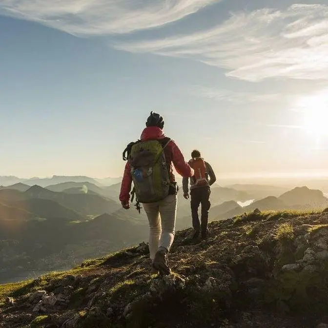
After spending the night in a natural cave, the journey continues towards Stongde La, one of the high mountain passes on this remote traverse through Zanskar.
The day begins in the wilderness and climbs steadily towards the pass, crossing a vast, barren high-altitude landscape before descending towards Stongde. After days of travelling through remote valleys, trails, and river crossings, crossing Stongde La marks the final major obstacle before reaching civilization.
This is the final episode of this four-part Skypacking Zanskar series.
Route: Cave Shelter → Stongde via Stongde La Region: Zanskar, Ladakh, India Pass: Stongde La Elevation: ~5,140 m
About the Skypacking Zanskar Series: Skypacking is my approach to moving fast and light through remote mountain terrain, carrying only what I need and navigating largely on foot.
This four-part section of the journey covers: Episode 01: Purne → Yugar — Phuktal Gompa Episode 02: Yugar → Shadey — Crossing the Niri Chu Episode 03: Shadey → Cave Shelter via Shingri La — 20+ stream crossings and a night in a natural cave Episode 04: Cave Shelter → Stongde via Stongde La — Crossing the mountain pass back towards civilization
Download the GPX: I document my hikes and expeditions on my hiking timeline: https://manav.in/hikes
You can explore the routes and download the GPX files for hikes where I have made them available.
HikeX Hiking Field Course If you want to learn how to plan and undertake your own hikes independently, check out the HikeX Hiking Field Course (HFC) — a practical field-based course covering navigation, route planning, camping, wilderness safety, nutrition, first aid, risk assessment, and other essential hiking skills. https://hikex.in/hfc
Connect: Instagram: / askmanav Strava: / strava
AI Generated·May contain errors
Video Summary
AI Generated
The narrator completes their sky-packing journey in Ladakh by hiking from a cave campsite over the 5,150-meter Tongde La pass to the village of Tongde. The trek concludes a two-month expedition involving 23 passes and approximately 500-600km of hiking, ending with a descent into the Zanskar river valley and a final trip to Padum.
Good morning everyone. Hello from the beautiful sort
of a natural overhang shelter, sort of a cave.
Today is September 1st. Time is 8.20 am. We had a pretty
Pretty amazing sleep last night. The cave was nice and warm.
Now the aim is to hike all the way to Tongde
La and then reach the village of Tongde.
Now in the Ladakhi language, Tongde means one thousand.
This is how the village sort of got its name
because there were like a thousand houses
which were there so it was a very lively sort of a settlement.
So following the leave no trace policy, I'll quickly show you the
campsite. This is where we had slept.
And we have taken all the small little wrappers
and sachets and peanut butter jars that we had.
Rest everything that you see was anyhow already here.
So this was our little home for yesterday night.
Let's begin hiking all the way to Tongde via
a 5200 meter pass called Tongde La.
The initial approach
to the pass is more like
a rolling flat the first two
and a half kilometers from the cave.
It's a nice trail.
In the last one hour,
I've done some three kilometers.
Time is 9.24 a.m. Now this is the Lalung Nala and we have to go on
the other side. Early morning I think it's easy
to cross using the big rocks and stones. Shouldn't be
a big problem doing that one.
No major stream crossings today. Easy side streams that you
could just hop across.
In the first two hours I've done some 6.7 kilometers which I think is
It's pretty fast at 4800 meters.
There is no major navigation challenge.
You can see the trail ahead of you.
We can see Tongde La.
So that's the pass.
And you can see some tiny black dots here.
These are yaks.
So people in the village of Tongde,
you know, make their yaks
cross this pass from the other side
and then leave them in the meadows to graze.
Great views.
A lot of clouds in the sky.
So when the sun's gone,
basically it feels cold instantly.
Most of the trail is through
these chips of stones and rocks.
And the trail again is wrongly mapped.
It's not correct. It is
mapped on the other side of the water stream
that is coming from that major glacier. But the more
logical, more efficient trail is actually on the left bank.
Today is first of September
and I think there's enough water in this little stream. So even if you
Come here and hike. In the coming weeks of September,
I think you'll still have water on
the trail. Nice. And this one is very close to the pass.
That makes it very helpful. I have another
50 meters to climb to reach to the saddle.
Magnificent mountain range. Super windy.
We have made it to Thangde La. Wow.
Let's do a final stretch check. So it was
11.11 kilometers, time is 11.55, took me 3.5 hours,
3 hours 31 minutes to come all the way to Thangde La.
Our present altitude is 5150 and I gained some 881 meters
of altitude while hiking up to the pass.
Now Thangde La is another beautiful pass that is within Zanskar
basically and it connects the village of Shadeh or Shadet.
Or you can say Purnay or Fuktul Gumpa on one side
and then Thangde village which is near Padum
on the Padum sort of lay highway on the other side.
It is a big sort of a flat space on top of
the pass with some magnificent views
of the of the Zanskar mountain range on the other side.
Super happy. Time is 11.58 am.
Now I'll just wait for my friends and then
we'll just descend down, descend down together.
Welcome to the top of the Thangde La, the last
of my passes in Ladakh and this thus,
this thus marks the end of my skypacking journey.
So I'll try not to be too emotional. By this evening we'll be in Padum.
And then I think it's time for me to head south
in search of some thicker oxygen.
Um...
Yeah, I don't know what to say really,
to summarise it all, but it's been an amazing time.
I think we worked out last night that in my two months
in Ladakh I've done about 23 passes,
probably 500-600km and I think that's a pretty good effort
for the first time. I'm happy with that.
And if Manav will allow me to be sincere for a moment,
which is not something I like to do,
I can't thank him enough for letting me into his world this year
and for tolerating me.
And we've shared a lot of miles together
and Manav will be a friend for life.
And I honestly really, really appreciate it.
It's been, I can't think of a better, I was going to say guide.
I know you're not a guide, but a better
guide to this landscape, you know,
This is a place you, uh...
You have been exploring now for a few years
and yeah I've learned a lot, I really have.
And hopefully we'll get a chance to hike together in years to come.
But no thanks G, I honestly really really appreciate it.
What a place, what a place!
But all good things come to an end.
So the whole team is here, four and a half hours.
So I stayed at the pass for exactly 55 minutes, almost an hour.
Time is 12.51 pm and now we descend down all the way
To the road head, you can see some sort
of an unpaved road coming all the way up to the pass.
Pretty windy
landscape
and we are taking
the descent
really fast.
This is a nice
soft pebble ground
and one single track to follow would be such a good trail addition
to the map trail network here near Tomde.
Very beautiful shepherd colony also known as
Pulu in Ladakhi language.
Trying to stick to the trail and avoid the road.
As much as we can. This trail is like a nice shortcut.
Super windy. Beautiful settlement.
We are looking back at Stong De La. That was the pass.
A long descent and finally the trail sort of
merges with the road. See a faint trail going
and now it's better to hike on the road.
We are back
in the big wide valley of the Zanskar
river and at the distance
at the in the center on this
Little hill, you see the Stongde Gompa.
The time is close to 3 p.m.
The landscape is super windy.
But it feels so nice to look back at the Zanskar mountain range
and the beautiful farmlands of the villages in the valley.
We have some 200 meters of descent left
in the next 1 kilometer of distance, roughly.
We are on the roadhead, but there's some work going on.
So the road is closed, which means we'll have a...
Hard time hitchhiking back to Padum.
Done, done, done, done, done, done, done, done, done, done, done, done.
Here are the stats. It was exactly 20 kilometers.
Time is 3.06. We were able to do it in under 7 hours.
We climbed up some 950 meters, but we descended down some 1500 meters.
Can I sit here?
Adjalee.
Adjalee.
What a way to end a hike.
This is a quick ride to Padum. Just 15 minutes, I guess.
Hungry, thirsty, but we still have like half a day left,
so that way it's nice.
We've got network.
You've started networking already.
I don't know what to do.
Shut up!