
Go HERE Instead If the Tetons Are Too Crowded For You! (SUV Camping/Vanlife Adventures)
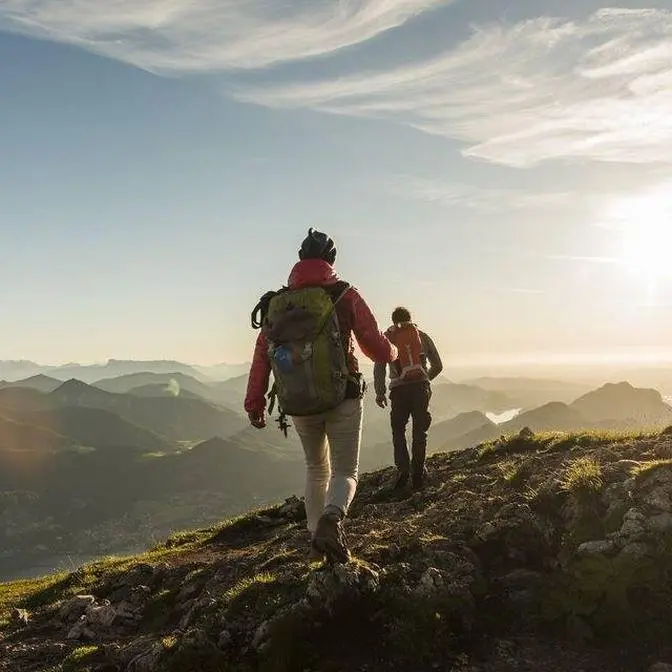
Good morning everyone and welcome to this beautiful mountain lake where we're going
to start the day's adventures. We're heading deeper into the mountains over in this direction.
It's just before nine in the morning and I'm leaving the RAV4 behind to continue around the
lake on foot here. I've got about... I think it's about five miles and a few thousand feet of
elevation gain to get to where I want to go today. And again it is a beautiful morning.
It's going to be a beautiful day. I am worried a little bit about the weather. The clouds don't
look especially welcoming but we'll work with what we've got here. This is Middle Piney Lake.
I'm in the Wyoming range in western Wyoming. This is a mountain range that's a little bit
overshadowed by some other mountain ranges in the area, namely the Tetons and the Wind Rivers.
This range isn't quite as rugged and dramatic as those ranges but it is still really beautiful. I
mean as we can see here. Again, awesome lake views even just from the start of this hike here.
It took me about two hours, maybe a little bit more, to drive here this morning from home. It's
a good morning so far and it's going to be a long day but I'm really excited. This is a mountain range
that I've driven through and I've done a little bit kind of around the periphery of the range
but I haven't really penetrated this mountain range before and so I'm looking forward to it.
I've been hiking for a little under an hour and a half now and I've gone about three miles.
Beautiful scenery. Whoa! Beautiful scenery. It's a little bit overcast but that's keeping it cool
and I've stopped at this pretty little waterfall here. I tried to cross the creek the first time
by stepping on the logs and the rocks in there but right away my foot slipped off into the water so
then I just walked right through the creek. Let's see what we have for a snack here. I think I'll have
a bobo bar, lemon poppy seed oat bar, and some beef jerky as I enjoy the sound of the forest
and the sound of the waterfall here. From here on out I'm going up the mountain. I've been sort of
more or less in in this valley here but I think from here on we're going to gain a few thousand
feet in elevation so I'd better have some calories in me. One more thing before I leave this spot. As
I was just sitting here I realized that this waterfall is actually much taller than I thought
it was. I don't know if you can see it but there's a little bit of white water right here so the
cascade starts at least up here but it's hidden by the foliage and it tumbles down here and the
sign said that this was the upper falls. The sign is over here and I think there's a lower waterfall
too but I've scoped it out and it seems pretty tricky to get to so I think we'll skip that one
and continue on up the trail and up the mountain. You know what? Nuts to that. I've gone a little
bit further and I think I found a little path that leads down to the left to where we can maybe
get a view of the lower waterfall. It's a steep, steep little traverse here though.
Well, I think I've gone as far down as I can. There's this neat little like, I don't know, six or eight foot
high waterfall here and I'm close to the top of the main lower waterfall but I can't really see
any way to get around it. To get around to the bottom, I mean. So I would like to be able to get
down to here and look up and give you guys and myself a nice view of the waterfall here but
I mean this slope is just... I mean that's not really something I want to tackle right now
on the left side. And then on the right side, there's another creek coming down
through here and so this is just all steep and brushy and basically inaccessible. I think that
if you wanted to view this waterfall from down below, you'd have to go way downstream.
Bushwack down to the creek and then bushwack up to the bottom and that's just not something that I've
I've budgeted time or energy for. So we'll take a look at this from here. Enjoy the view of the
falls. Enjoy the view of this little one right here and now I'll get back up to the trail and
continue my way on up the mountain. Well, not a whole lot to report. Just been hiking and
enjoying the beautiful scenery. I'm not quite above tree line but the trees are getting pretty
thin up here. This mountain over here is about 10,500 feet high and this one over here is
11,300 and something and that's the one that I've come up here to climb. That is called Wyoming Peak
which is a fitting name for the highest mountain in the Wyoming range. It's not the highest mountain
in Wyoming. It's far from that. I think this is like the sixth or seventh highest mountain range
in Wyoming but it is the highest in this area and so I had to climb it. I came up from down here and
I've been traversing along horizontally more or less along this bench here and when I came up here
I took a right turn on a on the trail that went like this and that trail is called the... I think
it's called the Wyoming Crest National Recreation Trail or something like that and it's a 75 mile
long footpath that goes along the full length of this mountain range. I think that'd be a really
fun adventure to do at some point in the future and if you're a backpacker looking for an off
the beaten path adventure I think that would be a pretty darn good one. So again I'm heading up
here. I think I go to this gap first between these two mountains and then kind of hang a left and
wend my way up the mountain and then this is looking in the other direction. The sky has
remained gray and a little bit threatening and it's raining a little bit now but as of now the
weather is pretty tame. It's just a little bit of a sprinkle. Pretty benign. If I start hearing
thunder then I'll get concerned but for now it's pretty pretty tame up here and if the rain really
starts to come down I do have a rain jacket. I think I have a poncho in there somewhere in my
backpack somewhere and I can always take shelter in some of these trees up here if I need to.
Hopefully it won't come to that but you never quite know when the mountains do.
Oh I made it to that pass between the two mountains
and this is where I'm going in a minute once I catch my breath. Once I have a snack.
On the map that I have it shows a trail going up to the mountain here but I don't see anything.
Maybe once I actually get going I'll be able to be able to find a semblance of a trail but for now
climb. I've made it up to a line of cliffs here that I need to tackle but it's raining again so
I'm gonna see if I can find like a an overhang in the cliffs and try to wait out the rain.
Well I found my little lair that I'm gonna try to hole up in here. There's a little bit of an
overhang above me that I think will keep the worst of the rain off of me. I'm getting rained
on a little bit but I think this is the best I can do for now. I'm about 400 vertical feet
up from that little saddle down there and still about 600 vertical feet from the summit above me.
Looking out you can see how it's a little bit misty. A little bit rainy. It's beautiful though.
Well it's been about 15 minutes and I think the rain has mostly blown over. At least this
particular section of rain cloud has blown over and this isn't a very comfortable
perch. It did the job. It sheltered me most of the way from the rain but I think it's time to
rounded ridge. I'm going up this slope that's just loose rocks here and it's times like this that I
just think to myself, why am I doing this? Like this terrain is so just unpleasant to walk on.
There's loose rocks, you know. With every step your foot shifts a little bit and it's just like
but I don't regret it because this is beautiful scenery. I love this part of Wyoming. It doesn't
matter which mountain range you choose in Wyoming. It's going to be a good one and
that's proving to be the case here but let me show you what I still have ahead of me here.
This is where I'm headed. It is more of the same all the way to the top. I'm about,
I don't know, 200 or 300 vertical feet below the top which I think
is this unless that's a false summit but I think that's the actual top of the mountain.
Onward and upward and it's raining again now. I'm only about 100 feet from the top now
and the rain has stopped. It only lasted a few minutes and I'm starting to see some debris here
which means I'm getting close to the top. Very close. And here we are finally at the summit.
Let's go stand on top of the pile of rubble here preferably without stepping on a nail and
getting tetanus. I think this is about it. I think this is the high point.
This pile of rubble here behind me used to be a fire lookout. I did see a picture online from the
80s where this was still standing so sometime after that, I'm guessing in the 90s, this thing
collapsed and so now it's just a pile of junk. A pile of wood and there are some cans and some
broken glass thrown in here for good measure. It's a shame because otherwise this is a beautiful
place. Beautiful summit. Great views. So I came up from over here. The lake where I started,
Middle Piney, is kind of near the bottom of these landslides here. It's down in here and so from
there I went up this valley and then kind of came over and then that pass was down here so I went
straight up from the pass and here we are. So this is the highest mountain in the Wyoming range
like I said and the second highest is right here. This is called Mount Coffin. This is looking north
down out here so you might remember if you're a longtime viewer of the channel a video I recorded
last year and I called it something like this place is free campsite heaven or boondocking
heaven and in that video I drove for dozens and dozens of miles along a dirt road that followed
the Grays River. It followed Grays River through here and I drove past this mountain down here.
There's a road you can take that goes all along this mountain range and I decided back then last
year to climb this mountain. I'll put a picture or some video of this mountain from out here
somewhere if I can find that footage. But interestingly there is another group here.
Another party on the mountain next to me. Probably won't be able to see them but
they are right on the top. There are two or three people right on the summit there. I think that
mountain is called March Madness Peak and then here is the rest of the Wyoming range.
This is awesome. I haven't seen anyone else today. I don't think there's anyone hiking
on this side of the mountain where I've been. There is more activity, more climbing activity,
of this mountain from the other side. From the the Grays River road side. From there there's
a trailhead somewhere over here and you can hike up to here. It's a shorter trail I think and not
as much elevation gain but I've already been over on that side so I wanted to see what the other
side of the mountains was like. If it were a clear day we'd be able to see the Wind River range. I
can kind of see the outline of those mountains on the horizon over there and then we should be able
to see the Tetons somewhere to the north too. But again it's clear right now in my immediate
vicinity but there are a lot of clouds around and so somewhere over here are the Tetons. But
no matter. We've got beautiful mountain scenery around here and if the Tetons are too crowded
for you then I think this mountain range, the Wyoming range, is a great alternative. It's not
as rugged as the Tetons but still just a beautiful, beautiful mountain range. I think this
this pipe bomb looking thing is a summit register. Let's see if I can... oh yeah.
Got the top off. Let's see when the last person was to climb this. Looks like a week ago.
The last time people were up here. Alright I'm gonna sign this and have a snack and
enjoy the view a little bit but then I want to get out of here. There's, you know, the weather
is holding but over here... here let me show you. There's a storm over here and I can hear thunder
coming from that storm. You can see the see the rain coming down over there and I think
the wind is blowing it toward me and so let's get out of here. It's still several miles away. I'm not
in immediate danger here but best not dilly-dally while we're while we're up here. And then I guess
one more thing I wanted to point out. These mountains to the west of me here, this is the
Salt Range I think it's called or Salt River Range. It's the the mountain range that parallels
the Wyoming range. So this is the Wyoming range here and then there's the Grays River that
separates this range from the Salt River Range over there. And if you're familiar with this area,
Star Valley, Wyoming is over here and then Jackson, Wyoming is to the north. I was considering
climbing Mount Coffin today also but given the not perfect weather, not stellar conditions here,
I think we're gonna scrap that. But I am gonna head down in that direction. My game plan is to
go down to this little saddle, this notch between the two peaks, and from there I'll descend down
into this green bowl and then I think I can find a trail that leads back out out this valley over
here which is the neighbor to the valley that I came up. So I came up here. I'm gonna go down here
and I'll need to get back to the starting trailhead because the the two trailheads here do not
connect but we'll cross that bridge when we come to it. And by the way, it took me about five hours
to get here. The distance was six miles with 2,642 feet of elevation gain. So like I said,
I'm gonna have a snack up here and then head down that way to the saddle and then down into that
there and I've made it down into the bowl, into the green basin, and I've made it to the trail. So I'm
following an actual path now instead of, you know, just making my own way cross country.
And it's beautiful. Beautiful place here. Here's a look up at Coffin Peak. Oh, there's a hummingbird
right here. I doubt you guys can see it but there's a hummingbird hanging out. Anyway, this is
Coffin Peak. Impressive aspect of the mountain here and just lots of green. And the sun has
actually come out and there's blue sky. It's amazing. I thought this was kind of neat. This creek here
just kind of starts. You know, there's not a spring. It just starts. I think it's probably snow melt from
higher up the mountain which we can't really see here. I think it's gone underground and then it
emerges right here. Isn't that neat? Anyway, this is the way I'm heading. Heading down out of the bowl and
down further down into the canyon. Alrighty, I am back at the trailhead. At the other trailhead.
A different one from the one I started at but I'll talk a little bit more about that in a second.
I left the top of Wyoming Peak which is back there somewhere three hours and 20 minutes ago.
7.2 miles ago. And this trailhead is actually really really pretty. It starts on the side of
this valley here. Beautiful rocky craggy peaks with a little meadow stream running through here.
And this is the high country. This is where we were a few hours ago. But we're now at the
trailhead. And this here is my secret weapon. I brought my bike up this morning and I drove to
this trailhead first before I drove to the other one where I parked my car. I dropped off my bike
here and so I'm going to use this to bike that I think about four miles back to the other trailhead
which is basically on the other side of this mountain over here. So I'm gonna ride a couple
miles this way, turn the corner, ride a couple miles this way to the lake which is on the other
side over here. And the weather's been holding. The weather's been decent on the hike down. And
I didn't film too much on the way down because it was just forest and so I just wanted to cover
miles and get back to the bike here. But it is starting to rain yet again for like the, I don't
know, fourth or fifth time today. And I'm hearing some thunder over there too. So I think I'm just
gonna start biking and if I have to pull over and take shelter under a tree, you know, wouldn't be
welcome to camp. The original plan was to try to get to where I want to be tomorrow but I ran out
of daylight. So I've pulled over and I'm camping here on BLM land. You can see this is, I think
this is Fontenelle Reservoir over there. The Green River is over here. And it's a nice spot.
Again, the weather is a little bit threatening but should be fine tonight. And for this being
the desert, there are actually quite a few mosquitoes out. More than I would have thought. So I'm gonna
hop back in the car but I did want to walk out over here a little bit. As I was just kind of
walking around my campsite here, I heard what sounded like a dog barking over here. I just want
to make sure that there isn't a little dog with a broken leg or something out here. It didn't
sound like a coyote and so I just want to want to double check here. But I hope you guys enjoyed
the video. This one was a little bit more tame, I think. Or at least less frantic than some of
my other videos in that, you know, today I just wanted to go for a hike. And, you know, we saw a
couple waterfalls and that was fun but mostly it was just a hike in the beautiful mountains up to
the the top of a mountain. And just gorgeous scenery. And I, again, I hope you guys enjoyed
this video. Thanks for watching. Let me know what you think as I try to... Oh man, I'm getting eaten
alive here. Let me know what you think. Let me know what your favorite part was. Let me know if you
have any questions and I'll see you guys in the next one. And I'll put on the screen here if I
if I find a dog. But I don't think I will. I haven't heard it's barking for a little bit which
is a little bit worrying. But I'll wander around a little bit. Otherwise, I'll see you in the next one.
Be sure to check out Adventure Know How, my new site, where you can gain access to a map of all
of my free campsites plus monthly bonus videos that you won't find anywhere else. Learn more at
adventureknowhow.com. And for links to everything else SUV RVing related,
visit SUVRVing.com. Links to these sites and more will be in the video description.