
My 3 day backpacking trip | The Derwent Valley Heritage Way
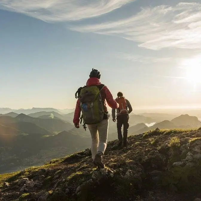
Hello again guys and welcome to another video. Today I'm at Ladybow Reservoir which is the start
of a 55 mile backpacking trip along the Derwent Valley Heritage Way. So the route starts at
Heatherdean which is where we are now and it's a 55 mile journey along the Derwent Valley.
So I'm starting here beside Ladybow Reservoir. I'm going to follow the Derwent River all the
way down through places like Baslow, Rosely, Matlock through Derbyshire till we get into Derby
itself and then where the Derwent meets the River Trent which is not far from Long Eaton. So I've
started a little bit later than planned. It's now 12 40 and I'm hoping to do about 18 to 23 miles
today. 18 miles will take me to Rosely and 23 miles will take me to Matlock and hopefully there
I'll find somewhere to pitch my tent. Ladybow Reservoir is looking fabulous and down there we
get our first view of the River Derwent. There's a nice shot of Bamford Edge in the background.
Awesome place to camp. If you've not seen the video I'll leave a link in the top corner now.
It looks like the route's well signposted.
So this is how the other half live. I would kill for a pad like that. One day keep on dreaming Paul.
I'm not sure if the GoPro will pick this up but you might be able to
make out the cross at the top of Highlow which is the hill in the centre.
Still following the Derwent. I've been walking for an hour and a half, two hours, something like that
and I've not had to go up a hill yet. There's an awful lot of this horrible stuff about.
It looks quite new as well. I didn't think you were allowed to put barbed wire up anymore.
It's dangerous and I don't think there's any need.
I think that is Froggett Edge. Further down over there somewhere is Kerber Edge.
Some lovely little villages around here. This is Froggett. This is gorgeous. Let's have a look at the
other side shall we. It's really peaceful. Not a bad place to live is it? I've just passed through
the little village of Carver. Barely saw any of it to be honest but the path's still following
alongside the River Derwent. To be honest I've not needed to get the map out once. The signposting
is absolutely brilliant. The whole of the route so far has had these little purple circles with a
yellow arrow and you just follow the arrow and it leads you to the next one. You really can't get
lost on this walk. A decent size weir. So after spouting off about all the signs I've come to a
junction and there's no sign. So I'm at the Co-op Charlie's. I think that's a cafe.
So I've dug the View Ranger app out. That tells me.
I've just crossed the bridge there so I need to go up that way. But I will double check in
about 50 yards just to make sure I'm going the right way. All right so we're back on it.
We're opposite Rowley's and the church. Just walking through the grounds of Chatsworth House.
Looks like somebody's been quite creative. Loads of wooden things and sculptures and stuff like that.
All right so there's a really good view of Chatsworth House from the bridge and I think
that's my path down there. I reckon another two miles and then I'll be at Roselye and then I'll
think about finding somewhere to pitch up and have some supper. Getting a dab on now. Just coming
into Darley Dale. As you can probably see the light's fading a little bit. I've done about
21 miles. I was going to stop in Roselye at the pub called The Grouse and Claret.
It's a campsite but apparently they only do caravans. I had a look and it's about empty
the site but they wouldn't let me have a little pitch for the night. Turned me away. So a big thumbs
down for The Claret and Grouse or Grouse and Claret, whatever you're called. So moving on,
there's another one up the road. Well here we are in Darley Dale. I haven't found anywhere to
wild camp as you can see. It's not full of my regular locations so unless I pitched up on
someone's garden I think a campsite would be better and that way I can take my time. I can
even go and have a pint if I want. My feet are starting to feel it. I could do with a little
bit of admin. I've got about a mile to go then hopefully I can get in at the Square and Compass.
I'm gonna have a pint as well probably even before I pitch up.
Right hopefully there's room at the inn. Trying the Square and Compass. I'm getting a pint no
matter what. Fingers crossed. Morning guys. Sorry I didn't get to film me pitching up last night.
It was a little bit dark and I got into the pub, the Square and Compass.
Had a couple of pints and even though they stopped serving, they knocked me up a beef
sandwich and some chips so really good hospitality in there. So this is where I spent the night.
Got the place to myself really. It's a bit near a main road but it only cost me a fiver
so I can't complain at all. I'm just going to have a quick snack and then I'll get everything
packed away. I'm not going to show you the full kit this morning. When I get pitched up tonight
I'll have a little bit more time and I'll go through everything that I brought with me.
All right that's it all packed away. Crack on with day two and see how far we get.
So I've just reached the market town of Matlock. Quite busy here today. Not much of a market though.
I've just had a quick cappuccino from the shop down the road and I've got to head back on to
the Heritage Way. Kids used to love it here when they were little. You can just see the castle in
the centre. The route doesn't go up there though. Well I'm guessing that ridge is Hightor then.
Well if yesterday was pretty flat going I'll make an outfit today a little bit.
So this is Hightor. Looks like they did a bit of lead mining here back in the day.
Lots of chasms. Everything's blocked off and I bet it's quite cool to check out those caves
but that's not for me today. There's a better view of the cable cars. There's Gulliver's Kingdom
in the centre. Not even I'm mad enough to pitch my tent here. This is the cable car station
for the Heights of Abraham. We might see one heading up in a second. Here we go look.
Not my cup of tea that though. So this is Matlock Bath. It's quite a nice old little town.
All the buildings here have got so much character. So in the background we've got
the Derwent Valley Mills. This was one of the mills owned by Sir Richard Arkwright who was
a pioneer in the cotton industry in the late 18th century. He was famous for inventing things like
the spinning frame and the water frame where Arkwright managed to use the power
of the River Derwent to power his machines, changing the way that the industry produced
cotton. But if you get any cotton from there nowadays it'll have to be from the little
shopping village that they've got in there along with the museum. This is the Cromford Canal.
I'm heading to Wattstanroll. So I've got about three miles and then I'm going to have a break.
If anyone's got a narrowboat they want to lend me I'd love to spend a couple of days
adventuring on one of those. Although there's loads of beautiful scenery in the Peak District
you also find lots of historic industrial things as well. We've already seen the cotton mills,
we've got the canals that transported the raw materials and then right alongside it
we've got the railways. So I imagine there was lots of things going off in this area
around the late 18th early 19th century. I may get to test my rain kilts out.
I've dug out the big guns, hiking poles, should take the strain off the knees a little bit.
I just need to learn how to use them properly now. Ambergate two miles, looks like we're tunnelling.
Whoa, quite dark in here. Let's hope there's no booby traps. There we go. A few fish popping
their head up every now and again. I've had some serious house envy along this trip. It's gorgeous.
Weeping willow in your front garden. Want one? Just had a stop off at a little cafe called
The Family Tree. A lovely bit of cheesecake. I thought that would sort me out a little bit but
legs are a bit stiff after half an hour sat down. So I've got to warm up again.
So this is the point that we leave the Cromford Canal at Ambergate.
Dig out the waterproofs again.
The rain can't make its mind up. Another little downpour for about five minutes
and then it stopped. I'm digging this rain frock or kilt I'd reckon. It might look a little bit
daft but it's definitely more comfortable than wearing trousers. So we've just passed
through Ambergate. I think the next town's Belper. All right, so I've made it to Belper.
I'll try and find myself a little shop, grab some lucasade, see if I can pick up a new pair of feet
as well. I don't think that's it for the day though so I'm going to be pushing on towards
Little Eaton. It's really pretty. There's another one of those mills. Well the petrol station came
up chumps. I got a chicken and bacon sandwich and a bottle of lucasade. I had 10 minutes sat on a
wall and I'm ready to go again. The last thing I need is steps at this time of day.
I haven't seen the river in ages. I'm guessing it's somewhere down there in the valley
but I'm definitely going the right way. Hello. He's like me. Can't disturb him when he's eating.
There's a few in this field. This is the village of Makeney. I'm not sure how it's pronounced.
It does look very nice though. A random tower. There's no information to say what it is.
It's almost eight o'clock. I still haven't found anywhere to pitch the tent so it's looking like
at the minute a picker field but to do that I'll have to wait till the sun goes down.
Pretty much pitch in the dark. All right, so this is looking a bit like a disaster.
Half past eight just gone. I can't find anywhere to pitch. Back in Little Eton was just like
everybody's back garden. I couldn't find anywhere that I wouldn't be seen. Now I've got main roads
and this scatty little bit of wood with a ditch next to it so I don't really know what to do.
Choices are tap out, get Joe to come and rescue me. Next choice is to finish the walk
which is probably another 15 miles. That'll kill me and then still Joe will have to come and rescue
me. I'll just push on a little bit further and see if I can find somewhere to pitch the tent.
Bugger. Well I've managed to get a pitch. The light won't be on for too long
because I shouldn't really be here but I was running out of options
so this will have to do a job. I'm going to get these boots off, make myself some food
and then get tucked up. So you'll have to forgive the fact that I don't do much filming guys.
I shouldn't really be here so I'm going to limit the amount of light that I use.
Just about to make supper. I'm going to use the Soto Windmaster stove you saw in the last video.
Get it lit up, large flame so we'll get it a bit further away from the tent.
Some water on, crank it up. As per usual I'm having a summit to eat meal,
chicken fried rice today. For pudding it's rice pudding with strawberry. I'll turn the light off
while the stove does its stuff. Somewhere in there's that sachet that, oh there it is,
I always forget to take it out. The chicken with rice once filling up to line A and the rice pudding
to line E. They make it really easy for you. Water's almost there. Turn that off.
Use them little micropot grippers that come with the Soto thermo stack.
Pulling up to line A. This one's got two of those. He tried to trick me. Line E. I'll give them both
a stir. I'll do rice pudding first, not bothered if my chicken tastes of rice pudding. It's only
up and thickened up a bit though. There's the chicken. Fill them up. Just leave them to stand
for about 10 minutes. I didn't time it but it took about three minutes to boil 750 millilitres.
Really impressed with this stove. It should be done so let's take a look what's going on. I'm
going to tuck in, get fed and I'll come back to you in a bit. Oh yeah, I really needed that today.
So that's me done. Nice two course meal. Probably a bit more than I wanted but
I've put a lot of miles in so I probably need to replace the calories. I'm going to get my head down now
because I've got to be up at the crack of dawn. I don't want to be hanging about where I've pitched
so I will show you a quick look around tomorrow when we've got daylight. So until then I'll see
you tomorrow. Good morning. I managed to beat the alarm clock. It's quarter to five. I don't think
we'll do a sunrise till just after half past five. I'm going to get up, get myself washed and dressed
and then when we get a little bit more light I'll show you my setup. Tent's got a fair amount of
condensation. Somebody mocked me in the comments on my last video for bringing a sponge. This is
what I bring it for and you can just wring out the excess water and if I undo a couple of these toggles
I can wipe out almost the whole tent without getting out of bed. Still dark. I don't think the
sunrise is going to be too far off. Apologies in advance for the grainy footage but there's
been a few drops of rain so I want to get packed up while it's still dry. Looks a bit messy but
I've only been up 15 minutes. I'm really impressed with the Astukas quilt.
I used it for the last two nights with the foot box fully open so it's more like a conventional
duvet. I find that much more comfortable than a sleeping bag. Gives me lots of options for
ventilation. It's toasty warm and any condensation just brushes off. In my last video I showed you
all the kit that I've brought for this trip however I made one or two minor changes. I brought a
dry bag for the quilt. The only reason I've done that is to show Robin from Walk with Wallace,
check his channel out by the way, just how small this packs away. Get all the air out.
It could pack down even smaller than this if you use a compression sack but I like to use a dry bag
so I can mould this to the shape of my pack. While I've got the Osprey Levity 45 on screen
I will say how comfortable it's been over the last few days. I've done over 40 miles
with this on my back over the last two days anyway and I've got another day to go.
The hip belt does a really good job of taking all the load. My shoulders don't even notice that I've
been carrying a pack. You saw the Soto Windmaster stove and thermo stack in use last night.
Just got to pack the rest of that up really and then I'll be on my way. So everything packed away.
That orange has gone a little bit. This is where I pitched up. I think I've got about 12 miles to go
till I reach the mouth of the Derwent. I'm not sure if I mentioned earlier in the video but
I'm using the Viewranger app. It's the premium version that comes with the OS Maps.
I do like this feature. I think it's called Skyline. It tells you where things are. I had
been using the app that is supplied by OS Maps but the subscription's just expired but when I
tried to download the full route as an offline map it wouldn't allow me to do it that size
and the Viewranger app does. So it's about the same price so I thought I'd give it a go.
I read one of the latest comments from one of my subscribers last night.
Tony Hall. How you doing mate?
He was asking why M&Ms haven't had an honorable mention in my last video. Well I haven't had time
to have any breakfast yet. So Tony this is just for you. I'm in Derby city centre once again
following the Derwent. I'm hoping I pass somewhere where I can pick up a bit of breakfast. Half a
dozen M&Ms just doesn't cut the mustard. I have a Derby Cathedral refuelled. Had a sausage and
egg McMuffin from McDonald's. Not exactly trail mix but I needed something and that large
cappuccino has definitely done the trick. I need some medical assistance though to get me through
these last nine and a half miles. I've got quite a few aches and pains and a few blisters on my feet
so hopefully the tablets will help. There's Pride Park which is the home of Derby County
Football Club. This is a bit more off the beaten track. I've parted company with the river for a
little while but I'm guessing this is the right way. Some of the arrows just point in a general
direction and if the path's not clear it's always handy to have the backup of the map. All good.
Steps are just getting higher and higher. Either that or my boots are getting heavier and heavier.
I finally reached the village of Shardlow which means which means I'm now on the home straight
and in typical fashion started raining. I'm quite excited to see the finish line now
but before I show you how the walk ends I'll just give you a little bit of information.
I'm probably going to be doing a video reflecting on this trip. I'll be going through what gear
worked and what gear didn't and what gear I may change on my next backpacking trip
and if you've not already seen it I'll drop a link in the description below
to my last video where I go into detail all the kit that I've used for this trip
and finally if anybody is interested in hiking the Derwent Valley Heritage Way I'll put a few
links down below also for where you can find out some more information about the hike
and I highly recommend that you check out Dean Reed's video. He's much more knowledgeable than
me when it comes to Peak District hikes so all that's left to do now is to finish the walk.
So according to my reckoning this is it. We have a Derwent there rolling in to the River Trent.
I can't find any sort of sign or plaque to say that this is the official end
but I'm really pleased that I've got my first 50 plus
hike under my belt so I'm going to take this in for a little bit and then I'll think about how I'm
going to get home. Right that's it for this one then folks. If you've managed to stay to the end
thank you very much. I'm going to head over this way towards Sawley where I should be able to get
a bus or train home back to Sheffield. So all that's left to say is thanks again for watching
and I'll see you in the next one.