
The Golden Bridge, Chichen Itza, Salvador of Bahia | The 100 Wonders of the World
2 Video Views·May 20, 2023
The site of Angkor in Cambodia is made up of a large group of monuments spread over
an area of roughly 230 square kilometers.
The hundreds of temples comprised on the site were once part of an extraordinary administrative
and religious center.
Angkor is divided into three principal sites, Angkor Wat, the city of Angkor Thom, and the
Tha Prohm.
Angkor Wat is not only the largest, but also the best known and most majestic temple.
In Khmer, Angkor Wat means Pagoda of the City.
The building is a perfect example of Khmer art.
Started in the 12th century, it took 37 years to complete.
But Angkor Wat was also a town.
Built as the capital of the Khmer Empire, it's centered around the state temple dedicated
primarily to Vishnu, the supreme deity of Hinduism, who is represented by the central
tower.
Everything in this temple is symbolic.
It's decorated with a wealth of sculpted bas-reliefs depicting many different war scenes.
The Khmer decorative style is characterized by images of gods, men, and animals.
There's a very strong sense of iconography.
Also deeply symbolic are the external walls which represent the mountain chain surrounding
Mount Meru, the center of the Hindu universe.
For the Cambodians, this place is a source of inspiration, comfort, and great national
pride, worshipped and adored by all.
Another distinctive feature are the sculptures of young women on the walls, and monuments
bare-chested with large breasts.
These are the asparas, the celestial dancers.
When faced with such marvels, one can't help but think of the words of one of the first
Western visitors to the temple, a Portuguese monk arriving on the site in 1586 declared,
The temple is such an extraordinary construction that it's impossible to describe it on paper.
It is so different to any other building in the world.
It has towers, decorations, and all of the refinements that human genius might conceive
of.
The whole area has been listed as a UNESCO World Heritage Site since 1992.
Not far away, Tonle Sap is the largest lake in Southeast Asia.
Like a heart, the lake expands and contracts to the rhythm of the monsoons.
The waters are low from February to June, and high from July to November.
Its surface area increases by four times, and its depth by ten times, a phenomenon caused
by the floodwaters of the Mekong River, into which it flows.
This immense inland sea, which floods surrounding forests and fields, is also one of the richest
areas in the world in terms of bird and fish populations.
Tonle Sap supports a population of almost three million inhabitants, mostly fishermen.
More than half of them have lived in the lake's floating villages for many generations.
In the village, the majority of the population is made up of fishermen and peasants.
Along the main street are hundreds of houses on stilts.
The most beautiful are made out of wood, others of straw.
The women chop up fruit, the men carry the wood, the children play with the pigs, and
the militiamen play cards.
Agriculture is still the country's primary economic sector, and a large percentage of
the population continues to live in severe poverty.
Cambodia's economy is still largely dependent on international aid.
However, thanks to the growing textile and tourism industries, quality of life is slowly
improving.
Buddhism, the official state religion since 1989, accounts for 96.4% of the population.
The third most famous monument of Angkor is the Tha Phrom Temple.
It means ancestor of Brahma.
At one time, there was a monastery here, surrounded by a huge town.
But in this case, all that is left is ruins.
In fact, in the early 20th century, archaeologists from the École Française d'Extrême-Orient
– French School of the Far East – campaigned for the site to be left as it was, so that
visitors might get an idea of what the site looked like when it was first discovered by
19th century explorers.
Nonetheless, a great deal of work had to be done to make the site suitable for visitors
and control the tree growth.
Located at the center of this ancient area, the temple is reminiscent of Preah Khan, another
site on which vegetation has enveloped the stones, leaving just a glimpse of former glories.
Introduced into the Khmer territory in the 13th century, Buddhism finally managed to
win over the Angkor sovereigns, replacing Hinduism as the primary religion.
But the Khmers also preserved their animist roots.
Their universe is still full of genies and good and evil spirits.
This animist foundation, combined with Buddhism and Hinduism, explains the mystic attitude
of the Khmers towards the harmony of the cosmos.
Most believers hope that their prayers and offerings will ensure them a future life free
from suffering.
They are good at adapting to obstacles, and are resigned to their fate.
The Cambodians are a people steeped in spirituality.
San Francisco is probably the most European of all American cities.
Located in California, on a peninsula surrounded by the Pacific Ocean, it provides some of
that old continental charm in a context which is very clearly New World.
San Francisco is perched at the water's edge.
San Francisco is one of the few American cities which is built on a human scale.
Its unusual topography has prevented it from being developed on a larger scale.
The opulent curving hills provide welcome relief from the rigid lines of the American
grid system.
Built on a range of more than 40 hills, the street grid is forced to mold itself to the
undulating terrain of the city.
The colorful houses of the old town have a bohemian feel to them, true to the relaxed
lifestyle of this western city.
The cable car is a small wooden carriage with no motor.
It first appeared in San Francisco in 1873, designed by the English engineer Halliday.
A network of eight lines once serviced an area of 180 kilometers.
Only three lines, each of about 17 kilometers, are still in use today.
The cable to which the carriages are attached runs between the tracks, and it hauls them
up San Francisco's incredibly steep hills, sometimes at a slope of more than 20 percent.
To stop and start the car, the driver uses a lever to release or tighten the grip on
the cable.
Four different brake systems enable them to control the staggering descents.
After a quick glance at the famous prison of Alcatraz, we have arrived in Chinatown.
San Francisco's Chinatown, founded in 1848, is the largest Chinese community outside of
Asia.
The fish markets, shops and restaurants give the area a very authentic feel.
It really feels like China.
Fisherman's Wharf runs along the northern edge of San Francisco.
Very popular with visitors, this area is famous for its many museums, including the Maritime
Park, for the ferries which shuttle passengers back and forth to the island of Alcatraz,
and also for its seafood stalls.
The local specialties are Dungeness crabs and bread bowls of clam chowder.
Some of these restaurants are real culinary institutions, they have been run by the same
family for generations.
The Golden Gate Bridge is the famous suspension bridge which spans the Golden Gate, the passage
out to the Pacific Ocean.
It connects San Francisco to the northern Bay Area, and on to Sausalito.
At the foot of the bridge is Fort Point, the main defense stronghold for the city during
the Civil War.
Over 2,700 meters long, the Golden Gate was, until 1964, the longest suspension bridge
in the world, and even today it is San Francisco's most famous monument, the Maritime Port to
Asia and the East.
During construction, the German architect Strauss faced an enormous number of challenges.
Started in 1933, the construction took more than four years, but once finished it transformed
the economic profile of this once isolated area.
The Golden Gate Bridge is immediately recognizable
for its international orange color, for its elegant curves, often shrouded by the mist,
and for the form of its two towers, each measuring over 230 meters.
With 1,280 meters distance between the north and south towers, the Golden Gate Bridge was
for many years the longest suspension bridge in the world. It is a vital road link, connecting
the city of San Francisco with the other major cities of Northern California, especially
the town of Sausalito.
Sausalito, the floating town, is unique within the Bay of San Francisco. During the Second
World War, the town served as a naval shipyard and then a marine scrapyard. In the 60s, a
hippie community settled here, making their homes in houseboats, turning Sausalito into
a wonderfully eccentric floating town, an image of the great liberty in which America
claims pride.
Salvador is the capital city of the state of Bahia in northeastern Brazil. It was also
the national capital until the political center was moved to Rio in 1763. Since then, Salvador
has been idling under the warm tropical sun. However, since the 1990s, the classification
of the city as a UNESCO World Heritage Site and the re-emergence of Brazil as an international
power has given the city a new lease of life. Salvador also has a reputation for being safer
than southern cities such as Rio and Sao Paulo.
Founded by Tomé de Souza in 1549, the colony became the seat of the Portuguese government,
as well as being an important center for both the sugar cane industry and the infamous slave
trade.
The majority of the population of Salvador are of African origin, hence its nickname
the Black Pearl of Brazil.
Beside the historical center, Prachatomé de Souza, the Jesuits constructed a magnificent
church, considered to be the most impressive 17th century church in Brazil. Even the façade
of the church was constructed with local Portuguese stone.
Inside, the church has beautiful sculpted wooden ceilings and a magnificent Mannerist
and Baroque style altar.
Awash with iconography and symbolism, the church is decorated on all sides with gold,
intricate marquetry and bright paintings. Nothing is too precious to devote to the God
of the Catholics.
In front of the cathedral, the Terreiro de Jesus Square, home to Brazil's first Faculty
of Medicine, is a place of great historical and cultural significance, right in the center
of Salvador da Bahia.
Salvador's streets are lined with churches. This deeply pious city contains no less than
165 places of worship, each more richly decorated than the last.
Baroque style was defined by the exaggeration of movement, abundant ornamentation, exuberance
and grandeur, all intended to add dramatic effect and tension.
The churches are almost overloaded with decoration, beautiful aceleros imported from Portugal,
trompe-l'oeil frescos and allegorical sculptures.
Bear in mind that the Portuguese presence in Brazil was a missionary one. Their aim
was to convert the local population to Catholicism. The goal of the Baroque religious structures
was to impress.
Listed as a UNESCO World Heritage Site in 1985, Pelourinho is the historical center
of Salvador da Bahia.
With its narrow streets bustling with people, its art galleries and concert halls, and its
street cafes, this area has a fantastic buzz.
Many years ago, this was where slaves were publicly executed.
Nearby is the Do Carmo Church and Convent. Built in the 16th century, it is one of the
largest monasteries in Brazil. After a fire in 1788 destroyed the original building, the
church was rebuilt in 1803.
The Júl de Greja da Ordem Terceira de Do Carmo is a cedar wood statue of Christ's death
dating from 1730. His dripping blood is portrayed with 2,000 rubies.
The statue is made by the slave Francisco Javier da Chagas. It is carried out on display
annually as part of the Easter Monday procession.
It is easy to become attached to San Antonio, also found in the upper town, but a far cry
from the hectic bustle of Pelourinho. It's a residential area with polychrome houses
in bright colors, often decorated with intricate stucco work. The sugar barons and wealthy
commerce and slave traders lived in this area.
But the real reason why tourists travel from around the world to Brazil and also to Salvador
is for its magnificent white sandy beaches.
Thousands dream of diving into the clear blue ocean in Pituba, Armasa or Itapoa, or of drinking
a cheap caipirinha watching the sunset over the Bay of Saints.
Now we'll leave Salvador and take a boat out to Moro.
Moro de São Paulo is a hill on the island of Tinhare, two hours by boat to the south
of Salvador de Bahia. During the colonial era it served as a hideout for pirates and
privateers. There are no cars here, just a few wheelbarrows for carrying luggage.
The restaurants are aimed at the backpacker trade, so the general atmosphere is pretty
laid back. We take a trip along the four main beaches, each one has its own individual identity.
The Primeira Praia, first beach, is where you'll find the restaurants and shops.
Despite the influx of tourists, Moro de São Paulo has succeeded in preserving its identity
as an island haven, hidden from the crowds. The sand is hot enough to burn your feet,
the water's so clear you can almost make out the coral underneath. And for those on a quest
for peace and calm, there's the Cataria Praia, the fourth beach, with dreamy white sands
and coconut trees. Perfect for a romantic getaway, the fourth beach is a popular spot
for honeymooning couples.
Many choose to prolong their stay on Moro, drawn in by the relaxing pace of life. Some
backpackers end up staying for several weeks. And when the time does come to leave, don't
look back, for you might well regret ever leaving this island paradise in the Bay of
All Saints.
Rising from the sands, like a heavenly vessel, one cannot help but be drawn in by the spiritual
dimension of Mont Saint-Michel.
Located on the border between Normandy and Brittany, the granite islet of Mont Saint-Michel
rises up to 92 meters above sea level. It was at the request of the Archangel Michael,
he who fought against evil, that the Bishop of Avranche, Aubert, built and consecrated
the first church on this isolated spot in 709. In 966, on the instruction of the Duke
of Normandy, a community of Benedictine monks settled on the rock. The pre-Roman church
was built before the year 1000. With time, the mount developed into one of the most popular
pilgrim destinations of the medieval Christian church. Twelve monks still live in the monastery
today. Now, the second most popular tourist destination in France after Paris, Mont Saint-Michel
is world famous, not only for its historic and architectural value, but also as a place
of great spiritual and symbolic resonance. Many traces remain from the age-old custom
of pilgrimage, such as the Auberge de la Mer Poulard. Its famous omelette has become
the city's gastronomic emblem.
The recipe was created by Mother Poulard. She realized that by the time the pilgrims
arrived at the abbey, they were generally famished. She needed to create an easy dish
that she could whip up at any hour. More like a soufflé than a traditional omelette, the
yolk and the egg white are beaten separately, sometimes with a little crème fraîche. It's
cooked over a hot flame. Any pilgrim, be he rich or poor, could pull up a pew and enjoy
the simple pleasure of a hot meal after a long journey.
The Grande Rue is the main street of Mont Saint-Michel. It spirals around the rock,
leading visitors up to the foot of the abbey. Visitors climb past the souvenir shops and
boutiques, weaving their way through the crowds to get to the top. From here, we have an excellent
view over the sacred site and its 11th to 16th century medieval architecture.
The Gothic buildings of the abbey were completed during the 13th century, two three-story buildings
crowned by the cloisters and the refectory. During the One Hundred Years' War between
England and France, the abbey's defences were reinforced with tall military ramparts.
Having been used as a prison during the 1789 French Revolution and the Napoleonic Empire,
the town surrounding the abbey is one of few towns in France whose medieval fortifications
are intact to this day.
The history of Mont Saint-Michel is intimately linked to that of France. Burnt to ashes a
number of times, the buildings of the mall were rebuilt each time a little better than
before. It was in the 13th century that it took on the architectural form which we see
today. Because of its highly unusual topography, the bay around the mount has the strongest
tidal fluctuations in all of Europe. At low tide, the sea goes out at incredible speed,
receding by almost 10 meters, and it returns like a galloping horse, recovering the shifting
sands. At high tide, the rock is completely surrounded by water. Many an unlucky pilgrim,
unaware or overly confident, has lost their life to these tides.
The abbey itself was built on top of a collection of primitive crypts. It combines two architectural
styles. The nave and the transepts, built over the former Carolingian church in the
11th century, are Romanesque in style, while the chancel and the side chapels are Gothic.
The statue of the archangel Saint Michael, protector of the mount, stands at the top
of the abbey at a height of 170 meters above sea level. Every year, almost three million
visitors flock to admire the statue, which is entirely covered in gold leaf.
The chancel, a masterpiece of Gothic art, was built to replace the Roman chancel which
had collapsed in 1421. It took more than 70 years to build this chancel. Started in 1446,
it was still under construction in 1521. The design of the chancel combines weightlessness
and light to lift people's minds and spirits to the heavens. The monks of the monastic
fraternities of Jerusalem lead Mass in the abbey every day.
Unusually, the cloister is not at the center of the monastery and neither does it connect
to all the other areas of the monastery, as is so often the case. Its function is purely
spiritual. It provides a place of meditation for the monks.
The cast stone enabled them to carve intricate decorative details. The refectory lies along
one side of the cloisters. A structure of huge dimensions and perfect symmetry, it could
accommodate the whole monastic community. Silence was obligatory throughout mealtimes.
As a result, the monks developed a detailed gestural code for communicating during meals.
The chapter house was the meeting hall where the daily life of the monastery was organized.
After the foundation of the Order of St. Michael, it became the Hall of the Knights.
A marvel of Gothic art.
Another marvel, but this time of civil genius, was this. After the collapse of the Roman
chancel in 1421, they needed to construct the crypt of St. Martin before the new Gothic
chancel could be built.
The so-called crypt of the Great Pillar serves as a foundation for the Abbey Church. The
ten pillars, of which eight are a full five meters in circumference, are impressive as
much for their density as their diameter. Aside from the crowds of anonymous pilgrims,
Mont Saint-Michel also attracted a great number of artists. Both Madame de Savigné and Victor
Hugo were fascinated by the site. For them, it was a vital source of inspiration and mysticism.
Many artists and romantic painters traveled to the Mount to capture its unique beauty,
mystery and charm. Guy de Maupassant wrote,
The steep abbey, rising there, far from the land, like a fantastical manor, it appears
as a dream palace, unbelievably strange and beautiful.
In around 800 BC, Athens developed from the fusion of a number of small villages around
the Acropolis site. Today it is the capital of Greece, a member country of the European
Union with a population of 750,000.
Syntagma Square is the most populous square in central Athens. Here we find the tomb of
the unknown Greek soldier and parliament and also a mass of shops, a reminder that thanks
to its history, much of Athens' revenue comes from tourism.
During the first century BC, Athens was one of the dominant cities of ancient Greece and
indeed of the Western world. At its peak, under the reign of Pericles, it was the dominating
political, financial, military and cultural power.
The National Archaeological Museum of Athens has one of the largest collections of Greek
antiques in the world, with more than 20,000 pieces dating from pre-history to the end
of classical ancient history.
Mount Lycabettus has one of the most stunning views ever Athens. It stands above the city
at a height of 277 meters and at its summit is the magnificent Chapel of St. George.
Plaka, the old town of Athens, spreads out around the foot of the Acropolis, a maze of
tiny streets where tourists can spend their time wandering through the multitude of restaurants
and souvenir shops.
The area is full of beautiful neoclassical houses and through it runs Adrianou Street,
the oldest street in Athens.
A little further, though still at the foot of the Acropolis, is the Olympiaion, the Temple
of Olympian Zeus. Its construction was started in the 6th century BC and completed by Hadrian
in 131 AD.
The initiators of the project set out to build the greatest temple in the world, but of this
108-meter-long Corinthian temple, only 15 columns are still standing today, each 27
meters high.
To the west of the Acropolis, overlooking the Agora area, is the hill of Pnyx. The word
Agora referred to a gathering place, the city market. But not only was it a lively, fragrant
market, this is also where the political and religious buildings of the city stood, the
great democratic institutions.
Nearby is the Temple of Hephaestus. Much like the Parthenon, the temple dates from the 5th
century BC and it is the best-conserved ancient monument in Athens.
In ancient times, the Stoia of Attalos housed roughly 40 shops. This is an exact copy of
the ancient commercial center, which was recreated in the 1950s and is now the site of the Agora
Museum of Athens.
The Theatre of Dionysus stands at the foot of the Acropolis. Considered to be the birthplace
of ancient Greek theatre and tragedy, this was where the famous classic tragedies of
Aeschylus, Sophocles and Euripides were first performed.
Close by, built into the slopes of the Acropolis, is the Odeon of Herodotus Atticus. The theatre
can seat 5,000 people on the original 2nd century BC-tiered seating and is now used
for the annual Athens Festival of Music and Theatre.
The Acropolis, meaning high town, is the highest point of the city. It is one of the great
monuments of humanity and undoubtedly the most beautiful architectural ensemble remaining
from the height of Greek civilization. This collection of 12 monuments testify to the
city's former power.
The only access to the citadel is by way of a torturously steep slope on the western side
called the Panathenaic Way. After the ancient stronghold was burned by the Persians in 480
BC, Pericles decided to build the Parthenon along with the other temples on the site.
This was the golden era of ancient Greece. Battered by wars and the wear of time, since
the 19th century the site has been undergoing intensive excavation and restoration.
The Erechtheion Temple, to the north of the Parthenon, is the most perfect example of
Greek architecture. Built subsequently to the Parthenon, it's dedicated to Athena and
Poseidon Erechtheus. A tour around the temple demonstrates the complexity of the structure.
This was partly due to its double dedication and partly to the slope of the land.
Supremely majestic, the Parthenon was constructed between 447 and 432 BC.
The monument and the Acropolis as a whole were built in honor of goddess Athena, protectress
of the city. The Parthenon is her residence. Built over 15 years, entirely in marble, it
has been considered since ancient times to be the perfect example of Doric architecture.
The capitals of the columns are simple, and the design follows very strict rules of proportion.
Pericles, governor of ancient Greece at the time, saw this masterpiece as a status symbol,
manifesting to the world the power and values of the city of Athens. That's why he employed
highly talented craftsmen and provided the most precious materials for the construction.
The Parthenon was listed as a UNESCO World Heritage Site in 1987.
Merida, with its population of just over one million people, is the capital of the state
of Yucatan in Mexico. Built on the ruins of Toho, a Maya town which had been destroyed
by the Spanish conquistadors on their arrival in 1542, the town's architecture is European
in style.
Merida has a rich colonial past. The area around the Plaza Grande, the historical center,
is filled with historical architecture and painting. Its buildings and museums take us
on a journey through four centuries of colonial history. In the evening, the streets come
to life with traditional local art forms, an array of concerts, dancers and street performers.
During the colonial era, the Spanish destroyed the religious and political buildings of the
Mayas, replacing them with their own civil and religious structures. Finished in 1590,
this was the first cathedral to be built in the New World. It was built with stones from
an ancient Maya pyramid which once stood in the site of the present-day municipal palace.
The Governor's Palace is considered to be the most outstanding example of Puk decorative
architecture. It was discovered in an excellent state of repair, so very little restoration
work was needed on it.
It was built in 1890 on top of an immense triple terrace. The symmetry created by the
dimensions and positioning of the doors serves to highlight the exuberance of the paintings
which cover the top two-thirds of the palace.
The Teatro Peón Contreras is the oldest theater in Merida and one of the most important theaters
in Mexico. Work started on the building in 1900 and it was inaugurated in 1908. Built
in French neoclassical style, the main hall contains a monumental staircase made entirely
out of Carrara marble. First a theater, then a cinema, it is now the Yucatan Cultural Center.
Luckily, the Spanish did not wipe out all traces of the ancient Maya civilization.
Less than 80 kilometers to the south of Merida, Uxmal, an ancient Maya city from the classical
period, is the second most visited site in Yucatan, after Chichen Itza. Its development,
climax and decline took place over a brief period during the 9th and 10th centuries.
Ruled by a string of combatant governors and stimulated by an alliance with Chichen Itza,
Uxmal maintained a strong political and economic status for more than 150 years. The stones
were cut and placed with such precision that there was no need for the use of plaster.
The complex consists of various pyramids and temples and a mixture of other buildings.
This is a typical model of Puk architecture and decoration, in that the decoration is
added directly onto the basic structure of the building.
At the back of the complex is a huge nine-level pyramid, the Great Pyramid of Uxmal. The building
has a square base with sides of about 80 meters and is 35 meters tall. The temple, situated
on the upper platform, accessible by way of large staircase, is known as the Temple of
the Macaws because of the macaw reliefs which decorate the front façade.
The level of road traffic in Ixamal is still relatively low and the paved roads with their
original streetlights give the place an old-fashioned, provincial feel.
In Yucatan, Ixamal is often referred to as the Yellow Town because of the enormous convent
at the town centre, which is covered in a browny-yellow paint, along with many of the
colonial houses in the immediate area.
The Franciscan Monastery of San Antonio de Padua was completed in 1561. The convent was
an important academic centre in the 16th century, providing a school for the local Indians as
well as a seminary for Spanish monks.
Even today, Ixamal continues to be a place of pilgrimage within the Yucatan region.
The small town of Valladolid has preserved its colonial style, built by the Spanish over
the ruins of the Mayan city of Xachi.
One shouldn't be fooled by the town's calm provincial appearance. Valladolid is known
as the Ciudad Heroica. From the start of the Conquests, right up to the early 20th century,
the town witnessed a series of bloody clashes between the colonizers and the indigenous
people.
The church, which sits on the central square, has a beautiful sculpted exterior, but the
interior is rather more austere.
The adjacent museum houses a number of original paintings which depict the town's history
and the horrors of the Spanish conquest.
Wandering on through the colourful streets of Valladolid, we come to the church of San
Bernardino de Siena and the old Alcizal convent.
In true Franciscan style, the building is architecturally impressive, but the interiors
are pure and simple.
These are the oldest buildings in Yucatan since the arrival of the Spanish.
Today the site of Chichen Itza consists of a collection of terraces, temples and wonderful
mystical pyramids.
It includes a number of monuments such as El Castillo, one of the new wonders of the
world.
Not only is it the most visited Maya site in Mexico, it is also the most studied and
the most controversial.
The ruins of the site, which once covered an area of 25 square kilometers, have been
very carefully restored.
In 1988, in recognition of the genius of the Mayan builders, the site was listed as a UNESCO
World Heritage Site.
In 2007, the town was declared one of the new seven wonders of the world.
No doubt the most controversial given that, after almost a century of study, archaeologists
still have not found an answer to questions such as, what was the chronology of the site?
Who really lived there?
Where did they come from?
The general belief is that there were three main influxes of population to Chichen Itza
and that each period had its own distinct architectural style and identity.
The town peaked between the 7th and 9th centuries, at the apogee of the Mayan civilization.
After that, the site emptied and not until the 12th century, when the Toltecs invaded
Yucatan, did it thrive again.
The two cultures combined, which explains why the site now contains representations
of the gods of both the Mayan and the Toltec civilizations.
As many hieroglyphs have not yet been deciphered, the site of Chichen Itza is still steeped
in mystery today, leaving a great deal to the imagination.
Islands.
A key port on the ancient Silk Route, these islands were a refuge for traders and pirates
alike, before developing into a dream holiday spot.
With idyllic beaches, lush vegetation and unique flora and fauna, many consider the
115 islands of the archipelago to be a small slice of heaven on earth.
Almost half the territory has been classified into conservation zones.
Local government has a strong commitment to preservation, and their work is facilitated
by the country's geographical isolation.
A population of less than 100,000, mostly young and of mixed race, live on the most
accessible islands of the archipelago.
The country is poor and there is little by way of agriculture, so for the locals, life
potters by to the rhythm of the changing seasons.
The economic activity centers around tourism and fishing.
The capital, Victoria, is the largest town in the Seychelles and is the political, economic
and administrative center.
It's located on the northeastern coast of Mahe, the main island of the archipelago.
In 1502, when the Portuguese navigator Vasco da Gama discovered it, the island was still
uninhabited.
During the 18th century, France and England fought for power over this part of the Indian
Ocean.
At the time, the town was little more than about 100 wooden houses.
Today, Victoria, the entry point to the Seychelles Islands, has more than 25,000 inhabitants,
one quarter of the country's total population.
From here, we set out by boat to go to the Vallée du Mets on Pralins, the second biggest
island in the Seychelles.
The majority of the island is covered by rainforest, so that it's very dark even during
daylight hours.
The Vallée du Mets is covered by a massive canopy of leaves.
Its floor is a tangle of roots, creepers, moss, leaves and rocks, and the only sounds
are the birds and the streams.
During the southern summer, from October to March, the forest is awash with heavy rains.
The average monthly rainfall in January reaches almost four meters.
The monsoon breezes from the northwest bring a heavy, humid heat.
This is when the flora of the forest really blossoms.
The Vallée was set aside as a nature reserve in the 1960s.
The fauna and flora coexist in perfect harmony.
You can find the famous sea coconuts, vanilla plants, and some of the rarest bird species
in the world.
La Digue is the third most populated island in the Seychelles.
It's well-loved for its glorious fine white beaches.
People get around mostly on foot, on bicycle, or... in ox carts.
Only six kilometers from Pralins, this granite island is well-known as a haven of calm.
The island has a number of sites open to visitors, such as the copper oil factory, where copper
oil is extracted from dried coconuts, and further inland, the incredible Chateau Saint-Clou.
Visitors come to La Digue not only for the calm, but also for the superb beaches and
the incredible landscapes, sculpted by the wind and the sea over millions of years.
En Source d'Argent is undoubtedly Pralins' most famous beach, and it rates among the
most beautiful in the world.
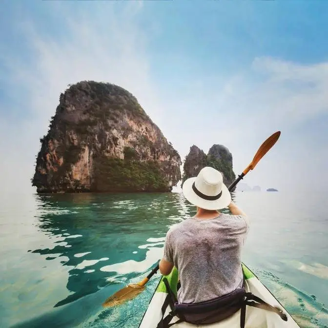
Granite rocks, white sand, turquoise waters... a real picture postcard.
If people come from far and wide to visit the Seychelles, it's partly thanks to this
one cove.
En Source d'Argent is the showcase of the islands, captured in a million photographs.
The 1976 erotic film Goodbye Emmanuel was also filmed here.
A few minutes' bike ride away, Grand Anse is the Seychelles' prime surf spot.
A great spot for a family picnic or simply a day out to recharge the batteries.
And this is Petit Anse, protected by its rocky backdrop.
This beach is a dream come true.
Granite blocks and varying tones of greys and pinks, a long stretch of fine sand and
a sparkling blue sea.
Incredible beauty lies not only on shore, but also in the depths.
The sea around the islands is dotted with granite outcrops where coral grows in abundance,
and it's swarming with colorful fish, turtles, rays, sharks.
Four marine reserves have been established around Marin-Pralin to preserve the plant
and animal life of the Seychelles' coral reefs.
A fabulous lifestyle, magnificent landscapes, the Seychelles is the ideal getaway, a place
where privileged few can come to experience paradise on earth.
The population of the Seychelles has a mixture of European, African and Indian origins.
The inhabitants are French-speaking, though the native language is Creole.
Like a piece of clay marked by giant fingerprints, these massive granite blocks are a characteristic
feature of the Seychelles beaches.
Beaten down by erosion, polished by the sea, the color of these incredible natural sculptures
varies with the changing light of the day.