The second half of the Alaska Highway took us through the Yukon and WOW, what a magical place!
The Yukon is one of Canada’s three territories and is known for the Klondike Gold Rush and its immense wilderness and wildlife. We spent 3.5 days driving through the Yukon and were constantly in awe by the sheer beauty of the landscapes around us.
⌚Timestamps 00:00 Introduction 01:01 Exploring the Sign Post Forest 04:13 Back on the road + plans for the day 04:56 We saw a MOOSE! 05:41 Driving to Teslin 05:57 Sleeping at the Teslin Lake rest area 07:01 Our plan for day two in the Yukon 08:08 Visiting the smallest desert in the WORLD! (Carcross Desert) 10:32 Quick stop at Emerald Lake for lunch 12:18 Miles Canyon in Whitehorse 14:26 Exploring Whitehorse 15:23 Walking the Whitehorse Millennium Trail 16:35 Seeing the S.S. Klondike 17:43 Lunch at Klondike Rib & Salmon 20:23 Coffee at Midnight Sun Coffee Roasters 20:53 Heading to Kluane National Park 21:47 Hiking the King’s Throne trail at Kluane National Park 25:47 EPIC boondocking spot by Kluane National Park 26:29 Our plan for day four in the Yukon 27:08 Visiting Long Ago Peoples Place 34:02 Hiking the Solider’s Summit trail at Kluane National Park 36:08 Small van mishap 38:24 FREE camping on Kluane Lake __________
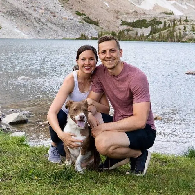
👋🏼 About us Hi y’all! We’re Adam, Kathryn, and Kona, an adventurous married couple (+ pup!) living on the road in our self-converted sprinter van! You can often find us driving all around the US and Canada, scoping out the best coffee shops, eating tacos and ice cream (we're a 5+ taco and 2+ scoop household), and enjoying nature.
We help travelers spend less time (and stress!) planning their trip and more time enjoying it! Our detailed travel guides, YouTube videos, and travel resources share the must-visit local eats, popular and off the beaten path sights, and tons of tips to make planning your next adventure a whole lot easier.
Note: We’ve linked a handful of items so you can see exactly which products we take with us. Full disclosure--if you click on these links and make a purchase, we get a small commission at no extra cost to you. We will only ever recommend products we truly love, actually use during our adventures, and think you can benefit from too!
After spending the last eight days driving up through British Columbia,
starting from Vancouver, we have made it to the Yukon!
Canada is made up of 10 provinces and three territories and the Yukon is one of the
territories. It is known for the Klondike Gold Rush and its immense wilderness and wildlife.
In fact, the territory is about 80% wilderness and there are more moose than humans.
Over the next few days, we're going to be driving over 575 miles through the Yukon,
mostly on the Alaska Highway, to finally get to Alaska. We have many stops we plan to make
and the first is just 10 minutes up the road, the Signpost Forest.
The Signpost Forest is located in Watson Lake and was created during the construction of the
Alaska Highway in 1942. A U.S. soldier named Carl Lindley spent time in Watson Lake recovering from
an injury and was tasked with repairing directional signposts. When completing the job, he added a
sign that showed the direction and mileage to his hometown of Danville, Illinois. Eventually,
others followed suit and there are now over 91,000 signs here from all over the world.
The town encourages visitors to add a sign to the forest and they actually put up signposts
all the time. That way, there's always somewhere to attach your sign to. So, we couldn't come here
and not put up an Adventures of A plus K sign, so we made our own. Check it out. Look at little
Kona in the passenger seat. You may be wondering, well, what is the sign? Like, what material did
you use? A lot of people use wood, but we use the wear of dog sign. And what's really cool is
the Visitor Center will actually let you borrow a hammer and then obviously they don't let you
borrow nails. They give you nails to use, that way you can put it up. Visitor Center also has
a really awesome display on the history of the Alaska Highway, so definitely go check that out
too. And now we have to find the perfect post to hang up our sign. This is such a fun and quirky
stop. We're just walking up and down all these aisles just looking for places we've been,
places we have some kind of connection to. Oh, we've been there. Oh, we've been there. Oh,
remember that place? It's a lot of fun to bring back a lot of memories.
It's so hard to find a good spot to put our sign. All the good spots have been taken,
I guess, for like 91,000 signs too late. I think we found the spot.
That fits right there, huh? Adventures of A plus K will now forever live on in Canada.
If you come to the signpost for us, try to come find our sign and send us a photo with it.
We probably saw about 50,000 of the signs. We wish we could have seen them all, but
time to get back on the road. Our plan for the rest of the day is to drive 155 miles to Teslin.
It doesn't look like there's that much to see and do along this stretch of the drive. It looks
pretty remote, so we're just going to book it there because it's already 4.30 and it's about
a three-hour drive and we are getting very, very tired. Come to the Yukon. They said you'd get
chips in your window on the Alaska highway. Just got one. First one. We just saw our first moose.
I was just thinking how we haven't seen any wildlife since getting here to the Yukon,
and I'm assuming it's because it's raining and maybe they're all hiding in the trees,
but that was so exciting. We've been keeping track of all of the wildlife we're seeing,
minus the bison, because that's just too many to count on my phone. That way,
at the end of our time up in Alaska, we can count it up and just see
all the different animals we saw. And actually, we realized we haven't seen any wildlife in the
Yukon because this road dipped back into British Columbia, which is where we are now, but we'll be
back in the Yukon here pretty soon. Finally made it to our home for the night. It's been a very
long day, about 13 hours of just go, go, go. We're staying at a rest area just on Teslin Lake,
and yeah, we are pooped. We're going to make some dinner and go straight to bed.
It's almost 10 p.m. right now, and it is still so bright outside. We looked up what time the sun
sets, and it's like 11, 15, or something like that, and then the sun rises at 4.30.
It is a gorgeous morning here in the Yukon, quite a bit different than yesterday's drive-in,
and today we're taking a slight detour off the Alaska Highway to check out a couple spots on
Klondike Highway. This highway actually takes you all the way to Skagway, Alaska,
which we would love to visit, but we're going to save the inland passage for a future trip.
The lady at the visitor center yesterday told us that the Yukon is paradise, and to be careful,
some people don't leave. Based off the scenery we've seen so far, I totally get it.
For our first stop today, we're at something you may not have expected to see here in the Yukon,
a desert. We're at the Carcross Desert, which is said to be the smallest desert in the entire
world at 1.6 square kilometers. However, it's not technically a desert, because the area receives
too much precipitation, and it's actually a collection of dunes, and it's one of the few
dune collections in Northwest North America. If you're curious how these sand dunes got here,
you have to go back about 10,000 years ago, when much of North America was covered in sheets of
ice. These sheets of ice started to melt, and it created ice dams, which then created these
glacial lakes, and tons of sand and silt collected at the bottom of these lakes. These lakes started
to disappear, and now today, the Watson River flows into Bennett Lake, bringing lots of sand
into the lake, and in the spring, the water levels of Bennett Lake starts to go down, exposing some of
the sand, and then the winds pick up the sand, and it collects here on these sand dunes. We climbed
up one of the dunes, which was a bit of a workout, but look at this view. The combination of the sand,
the green, the snowy peaks, the lake. It's one of the most interesting mixes of scenery we've ever seen.
Next up, we're heading less than 10 minutes up the road to Emerald Lake.
Man, look at that. Wow, those colors are popping. It's like a little, a mini muncho lake. This lake is one of
the most striking blue and turquoise lakes we've ever seen, and what's really cool is there's a mix
of colors in there, so you get to see like the contrast between the different shades of blue,
and according to the sign, this color is created by the sun reflecting off of a white layer of
marl on the lake bed, and marl is a white calcium carbonate clay that forms in the water, and then
settles, often unevenly, onto the lake bottom, and it forms when enough carbonate from dissolving
limestone reacts with calcium in the water. So that's your science lesson for the day.
Actually, that's your second science lesson, because Adam already dropped some science
knowledge earlier. We thought this would be the perfect spot to have some lunch. We made some green
chili pork in the Instant Pot. We actually had it cooking while we were hanging out at the desert
just down the road. Pulled up here, made some veggies, and ba-da-bing, ba-da-boom. We are heading back
towards the Alaska Highway to get to our final destination of the day, the city of Whitehorse,
but first there's a neat looking spot along the way called Miles Canyon that we're going to check out.
Miles Canyon is located on the Yukon River, which is the second longest river in all of Canada at
3,190 kilometers long. First Nations used this nearby area as a fishing camp, and they referred
to it as Kwanlan, which means running water through a canyon. Later on, Gold Rush prospectors
called it the Grand Canyon and used it as the main thoroughfare when traveling north during the Gold
Rush. Today it has a suspension bridge to walk across and some other trails to check out the
canyon. The walls of the canyon are made up of basaltic lava, which originated from a low volcanic
vent about eight kilometers south of here, and the lava flowed eight and a half million years ago.
They drilled near the canyon and determined that the lava is 110 meters thick, but you can only
see about 10 meters of it right now, and before they put a dam in along the river, the water was
about 10 meters lower, exposing more of the lava. For the rest of the day we're going to head into
Whitehorse and we'll explore more of it tomorrow, but for today we're going to get some chores done,
go to the library, take advantage of the wi-fi so we can get some work done. Whitehorse is the largest
city in the Yukon and is named after rapids on the Yukon River, which resembled flowing mains of
charging white horses. While the area was home to First Nations for many years, it experienced a
rush of prospectors during the Klondike Gold Rush, and the area grew as a staging and distribution
center. The area boomed again during the construction of the Alaska Highway as one of
the largest camps on the road. Today it is the capital of the Yukon, taking the title from Dawson
City in 1953, and to see more of the area we're going to walk the Millennium Trail, which is four
and a half kilometers, takes you around town along the Yukon River. This is an amazing trail. So far
it's been paved the entire way, so it's doable for anyone. It has incredible views of the river and
the surrounding mountains. We saw on a sign in town that Whitehorse is nicknamed the Wilderness
City, and I can't think of a better description of the city because not only do you have tons of
gorgeous nature surrounding you, but there's nature right in town too. Well it seems the other half of
the trail is closed for whatever reason, so it looks like we'll be heading back the same way we
came. This beauty behind me is the SS Klondike, which is a sternwheeler boat that ran freight
between Whitehorse and Dawson City along the Yukon River. There were two Klondikes that ran over time
with the first hitting the water in 1929. It was the first sternwheeler on the Yukon River, large
enough to handle a cargo in excess of 300 tons without having to push a barge. It originally
hauled ore, but over time began to haul passengers and cargo as well. However, the first SS Klondike
hit a rock wall and sank in 1936, and a second SS Klondike was built in 1937 to resume the tasks
of the first. The second SS Klondike is the one that you see here today, and it was moved here
from Dawson City in 1967. We had hoped to tour the inside, but unfortunately the inside is closed
currently for restorations, but you can still walk around and check it out on the outside.
For lunch we came to Klondike Ribbon Salmon, which is a very popular spot here in town,
and it's housed in the two oldest working buildings still in use here in Whitehorse.
They specialize in northern foods like fresh northern ocean fish, wild game meats, and smoked
meats. And I got the kick A Klondike burger, kick A because there's kids out there, and it comes with
a patty on here with a blend of elk, bison, and wild boar, cheese, bacon, crispy onion ring, and then all
your usual burger fixings. It's kick A, but it's like big A. It's huge. All right, let me stretch my jaw.
All right, let's go all in on this. That tastes so delicious and so fresh. This burger is nice and
but a good amount of fat in there. Great like grilled smoked flavor on there.
The bun is nice and, you know, pillowy. Got good flavor to it. Tastes really fresh.
Fresh veggies, bacon, and cheese, and then also this barbecue mayonnaise on there just wraps it all,
ties it all together. And because it's called Klondike Ribbon Salmon, I had to get ribs, and
they asked me if I wanted half a rack or a full rack, and I didn't know, and I panicked, and I
figured Adam was gonna have some of it, so I got a full rack, and look how massive this is. It has this
molasses sauce on top. It just smells so barbecue-y and smoky. I think I'm gonna have to prepare
myself for this experience. There you go. It's already messy, and I haven't even tried it yet.
Uh-oh. Oh, wow. Yeah, buddy. All over my face.
That's really good. It's super messy. It's all over me. As it should be. As it should be. If it
ain't messy, it ain't eating. I don't know. No, it's really good. The sauce is nice and thick and sweet.
The meat comes off the bone super well. It's definitely worthy of naming a place after,
I'd say. There are also a bunch of government officials from Canada eating here, and they all
just watch me completely make a mess of myself, so I'm making a really good impression.
We are in major food comas from that lunch. That was so much food, so we just grabbed some cold
brews at Midnight Sun Coffee Roasters to hopefully wake us up a bit, because for the rest of the day,
we're gonna take advantage of this midnight sun and go for an afternoon hike at Kluane National
Park. This park is located two hours west of Whitehorse and is home to tons of wildlife, the
largest non-polar ice fields in the world, and the highest peak in Canada, which is the second
highest peak in North America, Mount Logan, at 5,959 meters. This stretch is just nuts. There are so
many mountains all the way behind over my left shoulder here, just all the way stretching to
directly in front of us. This would be a destination on its own, and we haven't even
gotten started yet. It is, wow, it's crazy. This park is mostly wilderness, but there are some day
hikes to enjoy, and for the rest of the day, we're hiking the King's Throne Trail. There are a couple
different ways you can hike this trail. You can either hike to the seat, which is 10 kilometers
round trip, or you can continue to the summit, which is 16 kilometers round trip, but isn't a
maintained trail. Our plan is to just hike to the seat, but we may continue on a little bit depending
on how the conditions are, how we're doing on time, and how the weather is, because it looks sunny,
but it's actually raining on us right now. This trail has been mega steep so far. We're finally
starting to get above the tree line, and it's only getting steeper, it looks, up behind us, but
we have got us a view right here. So many mountains, this giant beautiful lake, wow,
and giant mosquitoes. Are you having fun? This trail's pretty tough. We haven't done very many
hard hikes this year, so we're not in our best hiking shape. It's not even just the elevation
that we're gaining, it's also just the kind of trail it is. It's a lot of really loose rock and dirt,
which is kind of my least favorite kind of trail. It just makes it harder to really book it because
you kind of slide around a little bit, but these views are fantastic. So we have made the difficult
decision to turn around. It felt like we were making a lot of progress towards the where we
think the seat is, but looking at the map, it doesn't really look like we're getting anywhere
very fast, and there are some dark clouds coming behind the mountain, and we know it's supposed to
rain. These mosquitoes are awful. We know it's supposed to rain in a few hours or so, and we
just don't want to risk being above the tree line if it comes sooner, so we're a little bummed. We
kind of feel a little lame for turning around, but we are so happy with the views we got to see,
and we weren't planning to make it all the way to the tippy top anyway, so we'll just have to
come back. Even with turning around on the way up, I think I was thinking to myself,
this this might just be the most, one of the most beautiful places I've ever been. I mean,
come on, this is, this is beautiful. All these dang mosquitoes.
It seems like every single time we turn around on a hike because we think the weather might turn bad,
it ends up being insanely beautiful, but it's better to be safe than sorry, and thankfully
our views are not over for the day because tonight we're hoping to camp at a free campsite
that should have some really gorgeous views. This is our backyard for tonight. We have this
glacial runoff river just rushing through here. The amazing mountains on either end.
We are happy campers. It has been a bit rainy this morning, so we've just enjoyed a slow morning
working in the van, and our original plan was to spend the day hiking at Kluane National Park,
but it's still a bit cloudy out, so we're going to push off hiking for a few more hours. We've
come up with a possible plan B. Last night we were reading this magazine, this Yukon magazine,
and learned about a place called Long Ago People's Place, which is a recreation of a First Nations
village and gives tours sharing the history and culture of the Southern Shoshone people.
It's a bit of backtracking to get to, and we're not even sure if they're offering tours today,
but we've really been wanting to learn more about the First Nations here in the Yukon,
so we're hopeful that it works out. We made it, and we were told that we can get a tour,
so we're just waiting on Harold to show us around. This is Harold, who runs Long Ago People's Place.
We learned so much from him, and it's impossible to share it all, but a good place to start is
with an understanding of the different First Nations and languages in the Yukon. It is all
Afghabaskan, and these are dialects of the mother language, and we are right here about a kilometer
or two kilometers away from the village of Champaign, so we're right in the central
Southern Shoshone, and to the north of us is the Northern Shoshone, and that's up around Carmax,
Mayo, El Sallaquino area, and then for a little bit further to the north and to the west is the
Han people, and that's around Dawson, Eagle, Alaska, and then further up north is the Gwich'in,
and they run up around Old Crow, and then the Inuvit are right up along the top.
Southeast is the Kaska, Teltan, the Inland Tlingits, and then the Tagish people are right
in the middle of it. Harold also took us to a cabin that his grandfather had built and lived in,
which was moved onto this property. He explained to us how families would have multiple cabins in
different areas depending on the season. This cabin was lived in during the fall through the
early winter to hunt and harvest fur, but they'd migrate to a different cabin in the summer for
salmon runs. He also explained to us a bit about the two clans in the Yukon. The Wolf people,
and then there's the Crow people, and in ancient times around this area,
everybody would be born into a clan, and you'd follow your mother's lineage. So like for myself,
I'm a Crow, and that's because my mother was a Crow, and my grandmother was a Crow,
and my great-grandmother goes back forever, and the main law of the clan is that a Crow
has to marry a Wolf, and therefore all my children are Wolves, and my daughter, she's a Wolf,
so her children will be Wolves, but my son is a Wolf, and he has to marry a Crow,
and therefore all his children will be Crows. One thing that really impressed us is the resourcefulness
of the First Nations, their relationship with the environment, and how they utilize the land
and animals to provide for themselves. We got to see some living structures, which were made out of
natural elements, as well as learn a bit about the different tools for hunting and processing
their harvest, including both large contraptions and smaller tools. This here is a moose's shoulder
blade, and this is a hunting instrument, and what they would do with this is you'd rub this on the
spruce trees in the fall, and on the willows, and this will replica a bow moose scratching the
velvet off its horns, and a moose will hear this sound and come to that noise, so if you start
doing this, you have to have your gun ready, or your bone arrow ready. It's part of a leg bone of the moose,
and it's for a fleshing tool for tanning hide, and in our language we call it
tugwut. What we're looking at here is technology that could be 10,000 years old, and it's as humane
as anything going on today, as far as harvesting fur-bearing animals. Comes in through here, he
smells the bait in the very back, goes in down in here,
gives it a pull, and that all drops on his spine. This is a model of a double cone fish trap, and the
creek would be flowing this way. This creates a natural eddy in the river, and salmon swimming
upstream from the ocean look for these places to to rest, and they just swim in through the
opening in the center, and are caught in the maze of the of the outer cone. And for the end of the
tour, we got to try a first nation's food staple, bannock. Flour, baking powder, a little bit of salt,
a little bit of sugar, and water. Okay, so you just break it open and put your stuff on it. Okay, first
try of bannock. Oh yeah, the outside has a nice little crisp to it, you can see some little burn
marks there on the inside. You know my favorite word, and you know what I'm gonna say, it is so
pillowy. Look at this. Yeah, man, that is good. It's so dense, but light at the same time. It kind of
has a little bit of a stretchiness to it. Oh, this is amazing. Yeah, I love it. Thank you. That was such
a great experience. The host, Harold and Mita, were so nice and welcoming, and obviously knowledgeable.
I love learning about first nations and indigenous culture, so it was just even better that I'm not
just reading it from a book, I'm actually learning it from the people who have lived it.
Just such an insightful and great learning opportunity, and at the end we got to end with
tea and bannock, and that was a great way to end it. What I loved about it is just how authentic
it felt. It did not feel touristy at all. We were just on their land, we got to see a home that
Harold's elders had built, we got to see the tools that his elders had used. It just doesn't get any
more authentic than that, and if you'd like to visit for yourself, you can actually email them
in advance, or they'll eventually have like a scheduling tool on their website in the next
month or two, so make sure you do that so you don't just show up unannounced like we did.
They thankfully were so welcoming, and they still gave us a tour even though they had zero warning
that we were coming, and it cost 41.50 Canadian per person, which is more than worth it because
this is their livelihood. They run camps here, and their whole goal was to educate
others, both first nations people as well as people just like us on their culture, and I
seriously, I don't have the right words. I'm still processing it all to explain just like what a
special experience that was. Out of everything we've seen on this entire trip up to Alaska,
this is hands down one of the things that's going to stick with me the most forever.
We're now on our way back to Kluane National Park, but to a different area to go on another hike.
We had hoped to attempt a longer hike here in the park today, but we got kind of a late start,
so instead we're hiking the Soldier's Summit Trail, which is a short trail that takes you
along part of the original Alaska Highway. Along the trail there's lots of signage about the
building of the highway and how the building of the highway negatively affected the First Nations
in the area, and then finally how the park today is working with those First Nations to manage the
park and also restore the relationship with the First Nations, and the trail ends right here where
the actual ribbon-cutting ceremony happened in 1942. I'm speaking to you from an improvised
control room in the rear of an American Army truck parked way up here on the Soldier's Summit,
a high path on the Canada-Alaska Highway, and we're at this moment some hundred yards from my
vantage point. The official opening of this great road is taking place. We shared some history about
the Alaska Highway in our last video, so go check that out to learn a little bit more, but one thing
I did not know is that the first trip from Fort St. John to Whitehorse took 71 hours, which is
five times as long as it takes today, and I will say I would gladly be on this road for 71 hours.
It has been gorgeous the entire time, and even this hike, which is meant to just be like an
informative short hike, has sweeping views of the area. It is so beautiful out here.
We got back into the van, went to turn the van on, and the instrument cluster isn't lighting up,
and we had this issue back in Tucson a few months ago, and it's randomly back again. It hasn't done
it since then, so what I think I need to do is take, pull this out somehow, and then unplug it,
plug it back in, just like any other electronic that starts to mess up. Everything was just going
too smoothly. Yeah, there's a tool that you can buy that's like, there's little holes on here
that'll like go in there, and it hooks in, and it'll pull it out. I don't have it, but one time
a few months ago, we were driving around and going over a bumpy road, and this whole thing just
jiggled out, so it should be pretty easy to get out. Also, when this issue happens, you cannot
turn off the van without holding down the button for like 10 seconds, and the whole dash just is
blank, like you can't see your speed, your fuel, nothing. I finally got this. Did a little damage
up here trying to squeegee this, or squeeze this out, but all right. Let's, if you ever wanted to see
the insides of a sprinter. Okay, there we go. Instrument cluster undone. Look at that! It worked!
Good as new? Still working. A little bit of a road trip excitement. Yeah, nothing like it. Yeah,
good stuff. I'm just happy that when I plugged it back in, it worked, and like, look, it's a good
job here. I'm just glad it worked. We'll figure this out. We're definitely not in the right area to be having
issues. Yeah, yeah, so if something didn't, if it didn't turn back on or something, we'd be in a bit
of trouble right now. All right, we're back on the road. Everything's going smoothly. Yeah, thank goodness.
It's only gonna stay smooth. That's right. Manifested. Tonight we're camping for free right off of
Kluane Lake, and just like everywhere else we've been in the Yukon, it is crazy gorgeous. We have
loved our time here in the Yukon. It just has a rugged, raw, and just vast beauty to it. We're
gonna be really sad to leave, but thankfully we'll be back in a couple months, and to explore a
different area of the Yukon. But tomorrow, we're doing it. We are going to Alaska.
They kick a Klondike bar, and it comes with a burger. Oh, what did I say? Klondike bar.
I wish it was. He's been talking about Klondike bars all day. I've been singing the jingle.
About the Alaska, ah, mosquitoes getting my hand as I do this. Okay, watch them suck my blood.
Can you, like, come over here and just, like, swat them away from me? Can you be my swatter, Adam?
Kona, you know why the walls of the canyon are so cool? Why? Because lava rocks.
We have a new fun game. It's called, is it a bear, or is it a rock,
or a tree stump, or a bush? And usually it's not a bear.