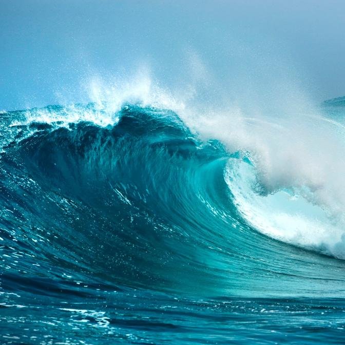
The Drake Passage lies between the southern tip of South America and the Antarctic Peninsula. It is the narrowest point where the Southern Ocean circles the globe without interruption. Here, powerful currents, strong winds, and long open stretches of water combine to create some of the most violent seas on Earth.
For centuries the passage has been one of the most difficult crossings in the world. Early explorers faced enormous waves, freezing storms, and constant uncertainty. Hundreds of ships attempted the route, and many never returned. With no nearby coastline and little communication in earlier centuries, entire vessels could disappear without leaving any trace.
This documentary explains why the Drake Passage is so dangerous. It looks at the geography that shapes its storms, the Antarctic Circumpolar Current that drives its waves, and the long history of ships and sailors who struggled to cross it. The film also examines modern crossings and why even today the passage is still respected by sailors and expedition crews.
From early exploration to modern Antarctic voyages, the Drake Passage remains one of the most feared stretches of water on the planet.
00:00 - Inside the Drake Passage 01:40 - The Geography of Violence 05:40 - Early Explorers 06:10 - Francisco de Hoces 07:45 - Sir Francis Drake 09:40 - Willem Schouten & Jacob Le Maire 11:20 - Shipwrecks in the Southern Waters 13:00 - HMS Wager 16:15 - San Telmo 19:40 - Gauss 23:30 - Endurance 28:15 - Drake Lake vs Drake Shake
Disclaimer: The images, audio, and video featured on Epic Adventure Archives include a combination of licensed stock media, attribution-based content, royalty-free assets, public domain materials, and content used in accordance with fair use guidelines. No copyright infringement is intended, and all rights remain with their respective owners. If you are the copyright holder or a representative of the copyright owner and have concerns regarding the use of specific materials in this video, please contact me directly.
As authentic images and footage of historical events are not always available, historically relevant visuals may be used for illustrative purposes. Every effort is made to ensure visual accuracy and maintain historical integrity. All content on Epic Adventure Archives is thoroughly researched, produced, and presented within its historical context for educational and documentary purposes.
AI Generated·May contain errors
This is the Drake Passage, the most violent waters on Earth.
500 miles of open ocean between South America and Antarctica.
No land blocks the wind. No continent calms the sea.
Storm systems circle the planet here without interruption.
Wind regularly exceeds 60 miles per hour.
Waves rise past 30 feet, and when they build, they build fast.
This is not a coastal crossing. There is no harbor nearby, no shelter along the way.
Cape Horn is behind you. Antarctica is still days ahead.
If something breaks in these waters, help is not hours away, it is days.
For five centuries, ships have entered this stretch of ocean.
Wood, iron, steel. Some crossed without incident. Some did not.
Because here, the sea does not negotiate. It sets the terms.
The Drake Passage sits between two landmasses that almost touch.
To the north, Cape Horn, just under 56 degrees south latitude.
To the south, the South Shetland Islands and the Antarctic Peninsula, near 62 degrees south.
At the narrowest common crossing route, the gap spans roughly 500 miles.
For a ship, that is a long transit. For a planetary ocean current, it is a funnel.
Around Antarctica flows the Antarctic Circumpolar Current,
the only major current that circles the globe without interruption.
It moves west to east at full strength. Unlike other currents, it never collides with a continent.
It carries an estimated 100 to 150 million cubic meters of water every second,
more than all the rivers on Earth combined.
As that flow narrows between South America and Antarctica,
speed increases in parts of the passage.
Surface movement intensifies. Now layer wind over it.
Between 40 and 60 degrees south, persistent west to east winds dominate.
These latitudes earned their names from sailors who survived them,
the furious 50s and the screaming 60s.
Storm systems travel long distances over open ocean before reaching the passage.
By the time they arrive, wave energy is already established.
Wind-driven seas ride on top of long swells generated thousands of miles away.
They rarely move in the same direction.
When they intersect, the surface becomes irregular.
Ships lose predictable motion.
And when motion becomes unpredictable, control disappears.
Wave heights in the Drake commonly exceed 20 to 30 feet.
In stronger systems, they rise past 40.
Instrument data has recorded extreme waves significantly higher.
Depth plays a role as well.
The passage plunges in places to more than 13,000 feet.
Deep water allows long-period waves to maintain power without breaking early.
There are no shallow continental shelves to bleed off energy.
Beneath the surface, underwater ridges disrupt flow.
Turbulence increases.
Surface patterns shift.
Icebergs drifting north from Antarctica introduce moving hazards.
Large tabular icebergs are visible on radar.
Smaller fragments are not always easily detected in rough seas.
Weather changes rapidly here.
Low-pressure systems move east around Antarctica.
When pressure drops quickly, wind gradients tighten.
Conditions escalate.
This is why the Drake rarely offers steady rhythm.
It offers moments where a captain has seconds to react, not minutes.
And once a ship commits to the crossing, there are no alternate routes along a coastline.
There is only forward.
The first Europeans who entered these waters did so without charts, without forecasts,
and without knowing what lay beyond the horizon.
And they were not searching for the Drake Passage.
They were blown into it.
And what they stumbled into would reshape global navigation.
In 1525, the Drake Passage did not have a name.
Spanish ships were moving along the coast of South America,
searching for a route to the Pacific through the Strait of Magellan.
One of those vessels, part of the Loaiza Expedition, was commanded by Francisco de Othez.
As his ship cleared the eastern entrance of the Strait,
a violent storm drove it south.
Farther south than planned.
Farther than charts suggested was possible.
Through spray and wind, the crew saw something unexpected.
Open water.
Not a coastline.
Not the edge of a southern continent.
An expanse of sea stretching beyond Tierra del Fuego.
At the time, many European maps still showed a vast southern landmass,
Terra Australis, believed to connect with South America.
de Othez' displacement suggested otherwise.
He had not intended to explore a new ocean corridor.
He had been forced into it.
Navigation in 1525 relied on dead reckoning, compass headings, and estimates of speed.
Longitude could not yet be measured accurately at sea.
In heavy weather, positional error multiplied quickly.
A wooden hull, square sails, and hand-drawn charts were all that separated the crew from open ocean.
They survived the storm and turned north again.
Spanish sources later referred to the waters south of Cape Horn as Mar de Othez, the Sea of Othez.
But the name did not spread beyond Spanish circles.
Half a century later, another fleet would enter these latitudes, this time under an English privateer.
In 1578, Sir Francis Drake passed through the Strait of Magellan with three ships,
His objective was not exploration. It was raiding Spanish interests in the Pacific.
As the fleet exited the Strait, a storm struck.
The Marigold was lost with all hands.
The Elizabeth turned back toward England.
Drake's flagship, the Golden Hind, was driven south,
into waters no English vessel had intentionally charted.
Like de Othez before him, Drake had not set out to define a new passage.
But the storm pushed him into open ocean south of Tierra del Fuego.
The experience confirmed that South America did not connect to a southern continent.
There was open sea below it.
That mattered.
A navigable route existed around Cape Horn.
It was wider than the Strait of Magellan.
It was also far more dangerous.
Drake survived the encounter and continued north into the Pacific.
He did not map the passage in detail.
He did not formally discover it in the modern sense.
But English accounts associated his name with the southern waters beyond the Strait.
Over time, the gap between continents became known in the English-speaking world as the Drake Passage.
The irony is simple.
Neither de Othez nor Drake went looking for it.
Both were blown into it.
And neither truly understood the scale of the forces moving through that stretch of waters.
It was not until 1616 that the route was intentionally sailed.
Dutch navigators Willem Schouten and Jacob Lemaire set out to find a new passage into the Pacific.
One not controlled by Spain and not limited to the Strait of Magellan.
They sailed south of Tierra del Fuego and discovered a new cape at the continent's edge.
They named it Cape Horn.
From there, Schouten deliberately steered into the open ocean south of the continent
and successfully navigated the full route around it.
Unlike de Othez and Drake, Schouten was not blown into these waters.
He chose them.
His voyage proved that ships could intentionally round Cape Horn
and enter the Pacific through the open ocean corridor that would later be known as the Drake Passage.
But proving it could be done did not make it safe.
It only meant more ships would try.
Once the route was known, it became a gateway.
And a gamble.
Merchant vessels, naval ships, and whalers began rounding the Horn in increasing numbers.
They did so knowing the strait to the north was narrow and unpredictable.
They also learned that the open passage to the south was wider and far more violent.
And as traffic increased, so did loss.
Once the route around Cape Horn became known, ships began using it in growing numbers.
Merchant vessels, naval squadrons, whaling ships.
All of them entering the same narrow corridor between continents.
But the Drake Passage did more than damage ships.
It made them disappear.
Across three centuries of sail, historians estimate that hundreds of vessels were lost in these waters.
Some estimates place the number near 800 ships and more than 10,000 sailors.
Many of those losses were never recorded in detail.
There was no coastline along most of the passage.
No settlements.
No rescue stations.
If a ship disappeared here, there were often no survivors to explain what happened.
Communication at sea was limited to signal flags and passing vessels.
Wireless radio would not appear until the early 20th century.
A ship could leave port, vanish in the southern storms, and simply never return.
No wreckage.
No final log entry.
No grave.
Only the assumption that somewhere in the vast waters between South America and Antarctica,
another vessel had been claimed by the Drake.
And occasionally, one of those stories did survive.
The wreck of HMS Wager did not occur inside the Drake Passage itself.
It happened farther north, along the remote coast of southern Chile.
But the storm that destroyed her was born in the same system that dominates the Drake.
The violent waters surrounding Cape Horn.
In 1741, the Wager was part of a British squadron under Commodore George Anson.
The mission was to strike Spanish interests in the Pacific during the War of Jenkins' Ear.
To reach the Pacific, the fleet had to round Cape Horn.
That meant entering the same wind corridor that feeds the Drake Passage.
The ships left England with over 1,900 men.
By the time they reached the southern tip of South America, scurvy and disease had already weakened the crews.
Then, the weather closed in, and rounding Cape Horn stopped being a route.
It became survival.
For weeks, the squadron fought headwinds and towering seas.
Progress was measured in miles per day, sometimes less.
Masts cracked, sails tore, men were swept overboard.
The Wager, a sixth-rate warship carrying around 250 men, became separated from the rest of the fleet in heavy weather.
Alone, she was driven west by relentless winds and cross seas.
Charts were incomplete, visibility was poor.
Navigation relied on dead reckoning and guesswork.
On May 14, 1741, the ship struck rocks off what is now known as Wager Island.
The hull split.
Freezing surf pounded the wreck.
Those who made it ashore faced a different threat.
Isolation.
The coastline offered no settlements, no rescue stations, no passing ships.
Supplies were scarce.
Discipline collapsed.
Within weeks, the stranded crew fractured into factions.
Accusations spread.
Authority broke down.
A mutiny erupted.
Some men attempted to sail north in a makeshift vessel.
Others remained behind.
Starvation and exposure claimed lives.
Of the roughly 250 men aboard the Wager, only a fraction would eventually make it back to England.
The wreck did not occur in the open waters of the Drake Passage, but it was shaped by the same forces.
And the lesson was clear.
If a Royal Navy warship could be broken before fully clearing the Horn,
what waited beyond in the open passage was worse.
Because farther south, there were no rocks to run aground on.
And when ships disappeared there, they often left nothing behind.
In 1819, a Spanish warship entered the southern latitudes under full sail.
Her name was San Telmo.
She was not a small vessel.
She was a 74-gun ship-of-the-line, built for battle, built to endure punishment at sea.
More than 640 men were aboard.
Sailors, soldiers, officers.
She departed Spain earlier that year, bound for the Pacific coast of South America.
To reach it, she would have to pass through the same southern corridor that had broken ships before her.
By late summer in the southern hemisphere, September 1819,
the San Telmo was approaching the waters near Cape Horn.
Then she vanished.
No wreck report.
No survivor account.
No final entry in the log.
The last confirmed sighting placed her near the South Shetland Islands,
just north of the Antarctic Peninsula,
inside the storm belt that feeds the Drake Passage.
After that, nothing.
No distress signal.
No drifting survivors.
No returning crew.
Months later, fragments believed to belong to the San Telmo were discovered along the shores of Livingston Island,
remains of spars, sections of hull timber,
evidence that a large vessel had been destroyed there.
If the ship had reached those islands intact, even briefly,
it would mean her crew set foot on Antarctic land years before any officially recorded landing.
But there is no surviving testimony.
Only debris.
The waters in that region hover near freezing.
When a hull fails in those temperatures,
survival time in open water is measured in minutes.
There were no rescue fleets in 1819.
No wireless communication.
No organized search.
If a ship was lost in the Drake Passage,
it was simply lost.
The southern ocean does not preserve stories.
It erases them.
All 644 men aboard the San Telmo are believed to have perished.
No graves.
No confirmed final log entry.
Just wreckage scattered along a remote Antarctic shore.
The San Telmo is the closest thing the Drake Passage has to a ghost fleet.
A full warship.
And unlike the wreck of the wager,
there was no coastline to cling to,
no mutiny to record,
no trial transcripts to reconstruct the disaster.
There was only open water.
By the early 20th century,
expeditions were no longer limited to routes around Cape Horn.
Some ships approached Antarctica from entirely different oceans.
But entering the southern ocean from another direction did not make the journey safer.
In 1901, Germany launched its first Antarctic expedition.
The ship was the Gauss,
built specifically for polar exploration.
Reinforced oak hull.
Auxiliary steam engine.
Scientific instruments packed into every available space.
The expedition was led by the geographer and polar scientist Erich von Drigalski.
Unlike earlier ships that battled their way through the Drake Passage,
this expedition sailed south from Cape Town,
entering the southern ocean through the Indian Ocean sector.
But the ocean surrounding Antarctica does not become calmer
simply because the route is different.
Heavy seas rolled beneath the hull as the expedition pushed south toward East Antarctica.
The ship survived the passage,
but Antarctica had other plans.
In February 1902,
the ship became trapped in dense pack ice in the Davis Sea off East Antarctica.
The ice did not smash the hull immediately.
It locked it.
Pressure built slowly.
The crew attempted to free the vessel using saws and manual labor.
They cut channels.
They shoveled snow.
They waited for shifts in wind.
Nothing worked.
Eventually, they resorted to explosives.
Charges were placed against the surrounding ice
in hopes of fracturing the pressure ridges and creating movement around the hull.
The blasts cracked ice,
but the sea remained frozen solid.
Gauss drifted with the pack for nearly a year.
Every creak in the hull meant pressure building somewhere unseen.
Winter closed in.
Temperatures plunged.
Darkness settled for months.
Communication was impossible.
No rescue was coming.
The crew adapted.
Scientific work continued.
Observations were recorded.
Sledge journeys mapped new coastline.
A volcanic cone rising above the ice was discovered
and later named Gaussberg.
But the ship remained captive.
For 12 months, she moved only as the ice allowed.
Not broken.
Not sunk.
Just held.
Finally, in February 1903,
shifting winds and ocean movement loosened the grip of the pack.
Leeds opened.
Steam power pushed the hull forward.
Gauss broke free.
She had survived the ice.
Not every ship would.
She turned north into the Indian Ocean
and made for Cape Town before returning to Germany.
The journey back to Germany
completed one of the most disciplined polar expeditions of the era.
Years later, the ship was sold.
She eventually entered Canadian service
before disappearing from records in the early 20th century.
Gauss was not wrecked.
But she proved something important.
Even reinforced steel,
even steam power,
even careful planning
could not overpower the southern system.
The Gauss survived the ice.
But the next ship to enter Antarctic waters would not.
In January 1915,
the expedition ship Endurance
became trapped in pack ice in the Weddell Sea.
For months, the pressure increased.
By November, the hull could no longer withstand it.
The ice crushed the ship slowly.
Frames buckled.
Timbers snapped.
On November 21, 1915,
Endurance sank beneath the frozen surface.
28 men were left standing on drifting ice
thousands of miles from home.
The loss did not happen in the Drake Passage.
But to survive what came next,
they would have to cross the same violent ocean corridor that defines it.
After months camping on unstable sea ice,
the crew escaped in three lifeboats.
In April 1916,
they reached Elephant Island,
a remote outpost at the edge of the Antarctic Peninsula.
It was desolate, uninhabited,
outside normal shipping routes.
No rescue would arrive on its own.
To save his men,
Ernest Shackleton made a decision.
If he failed, the men on Elephant Island would die.
He would take one of the lifeboats,
a 22-foot vessel named James Caird,
and attempt to reach South Georgia Island.
The distance was roughly 800 nautical miles.
Between Elephant Island and South Georgia lay open Southern Ocean,
the same system of wind and current that drives the Drake Passage.
On April 24, 1916,
six men pushed the modified lifeboat into freezing surf.
The boat had been strengthened with extra decking and ballast.
Even so, it was barely longer than a pickup truck.
There was no engine.
Navigation relied on a sextant
and brief sightings of the sun through cloud breaks.
Frank Worsley, the expedition's captain,
would later write that he managed only a handful of usable readings
during the entire voyage.
For 16 days, the James Caird rowed heavy seas.
Freezing spray coated the boat in ice.
Men bailed constantly to prevent swamping.
Waves broke over the bow without warning.
Sleep came in minutes, not hours.
A small error in navigation would have meant missing South Georgia entirely
and drifting into the open Atlantic.
They did not miss.
On May 10, 1916, after more than two weeks at sea,
the James Caird struck the western coast of South Georgia.
The men were exhausted, frostbitten,
and barely able to stand after crossing
one of the most violent stretches of ocean on Earth
in a small, open boat.
But they were not yet safe.
The whaling stations were on the opposite side of the island,
separated by unmapped mountains, glaciers, and crevasses.
After days of recovery,
Shackleton and two companions crossed South Georgia's interior on foot,
the first recorded traverse of the island's mountains.
36 hours later, they reached the whaling station at Stromness.
Help was finally within reach.
Months later, after repeated attempts through ice,
Shackleton returned to Elephant Island and rescued every man left behind.
No one from the Endurance crew was lost.
But the margin between survival and disappearance
had been measured in inches of freeboard
and seconds between waves.
They crossed one of the most unforgiving stretches of ocean on Earth
in a boat barely fit for coastal water.
And they survived.
Most ships that enter these waters are larger, stronger,
reinforced with steel and powered by modern engines.
But even today, the Drake does not guarantee safe passage.
It remains one of the few places on Earth
where modern engineering still bows to scale.
And sometimes, it still reminds crews that technology is not control.
Not every crossing is violent.
There are days when the Drake lies flat.
Low swell, light wind, a steady horizon stretching clean between continents.
Passengers walk open decks without holding railings.
Cameras stay steady.
The sea looks almost cooperative.
Sailors call it the Drake Lake.
High-pressure systems settle over the region.
Wind slackens.
Long swells smooth out.
For a brief window, this stretch of ocean feels manageable.
That is when it becomes deceptive.
Because the same geography that allows calm can reverse powers.
Wind tightens.
Swell builds faster than forecasts predict.
In November 2022, the expedition cruise ship Viking Polaris
was returning north through the Drake Passage.
The vessel was modern, ice-strengthened, stabilized, designed for polar waters.
Then a single wave struck the ship, estimated at roughly 50 feet.
Windows shattered.
Water forced its way inside.
Passengers were thrown from their seats.
A 62-year-old woman was killed.
Several others were injured.
This was not a wooden hull rounding Cape Horn in the age of sail.
This was a 21st century expedition vessel built specifically for Antarctic travel.
And one wave was enough.
The Drake does not need to rage for days to prove itself.
Sometimes it takes seconds.
Drake Lake and Drake Shake are not different places.
They are different moods of the same sea.
Control in these waters is temporary.
Preparation helps.
Experience matters.
But when the wind tightens and the swell rises,
the outcome is never guaranteed.