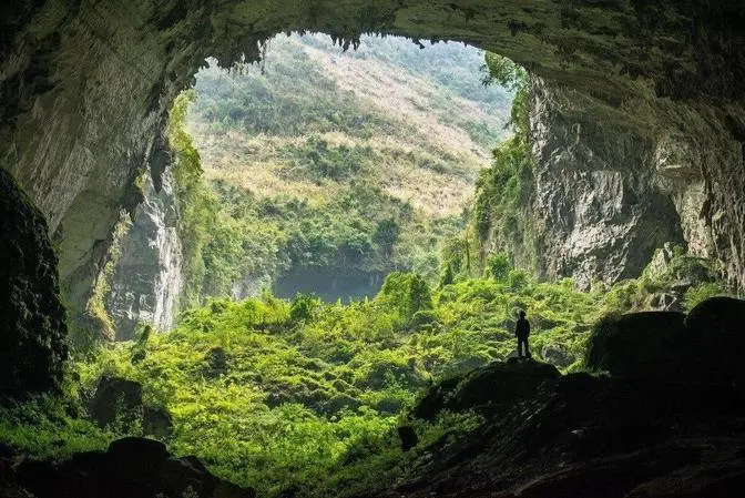
ALGERIA: The Hidden Secrets of an Ancient Land | 4K Travel Documentary
If you ask for directions here, people won’t just tell you where to go – they’ll walk you there themselves. Algeria, beneath that warmth and kindness, is a country where 80% of the land is barren desert, yet it hides a history deeper than any map on Earth can show. It feels like a secret garden… In less than a single day, the scenery can shift from snow-covered mountains to dunes burning under 50°C sun. Beneath sandstone cliffs lie 12,000-year-old cave paintings. And perhaps what we see today is only a very small chapter of Algeria.
► See More: LEBANON: Far From What Most People Think | 4K Travel Documentary • LEBANON: Far From What Most People Think |... The Real IRAN Most People Will Never See • IRAN: The World’s Most Misunderstood Place... ►Best Playlist: • Asia Travel Documentary ►Subscribe: / @trueglobe66
Algeria is a land of dramatic contrasts, blending snow-capped mountains with the vast Sahara. The country's identity is shaped by a fierce spirit of independence and a rich tapestry of Phoenician, Roman, Ottoman, and French influences, reflected in its diverse architecture, ancient ruins, and breathtaking natural landscapes.
If you ask for directions here, people won't just tell you where to go,
they'll walk you there themselves.
Algeria, beneath that warmth and kindness, is a country where 80% of the land is barren desert.
Yet it hides a history deeper than any map on Earth can show.
It feels like a secret garden.
In less than a single day, the scenery can shift from snow-covered mountains
to dunes burning under 50°C sun.
Beneath sandstone cliffs lie 12,000-year-old cave paintings.
And perhaps what we see today is only a very small chapter of Algeria.
Let us begin at the capital of country,
a city shaped by every chapter in Algeria's history.
Algiers, the White City, sits along the southern curve of the Mediterranean,
spilling over steep hills that face the sea.
The first coastal settlers arrived here more than a thousand years ago,
but the timeline stretches further back.
Phoenician and Carthaginian traders first made this a base.
The Romans followed, building roads and aqueducts
that can still be traced beneath modern streets.
In the centuries that came after,
Islamic dynasties turned the city into a political and cultural center.
Then, in 1830, French colonial rule took hold and lasted for 132 years.
But no era shaped the city more clearly than the Revolution.
In 1954, the resistance began here, led by the National Liberation Front.
After seven and a half years of struggle,
Algeria declared independence on July 5th, 1962.
To this day, Algerians from around the world
return to the capital to sing the revolutionary anthem,
a song once banned by colonizers,
now echoing through the city as a symbol of survival.
Only when you hear that song can you fully see Algiers.
Mediterranean facades whitewashed in lime rise above narrow Ottoman alleys.
French-style boulevards intersect with Arab arches.
Modern metro lines run beneath neighborhoods
where coffee is still served from street-side stalls.
You won't find Starbucks or KFC here,
not because they never tried to appear,
but because the city chose to preserve what is its own.
Covering 363 square kilometers,
Algiers is the largest urban center in the country,
but its real scale is measured in the number of historical layers
it has built upon its own walls.
Tassili Naja, the largest national park in Africa,
stretches across a vast Precambrian sandstone plateau
of around 72,000 square kilometers.
Recognized by UNESCO as a World Heritage Site,
this highland resembles a network of stone forests,
arches, pillars, and deep ravines
sculpted not by human hands, but by wind and time.
Sandstone blocks eroded over millions of years
have become vertical towers and sweeping stone walls,
the aftermath of a geological reaction that has never repeated itself.
Reaching many areas of the park
requires precise off-road driving skills.
Some tracks are only just wide enough
for a vehicle's tires flanked by unstable ancient sediments.
Many expeditions describe the experience
not as driving on land, but as driving over exposed history.
Among the many surreal rock formations,
the Elephant Rock near Tagat is one of the most recognizable.
From a specific angle, the massive sandstone block
outlines the shape of an elephant resting in the heat,
a strange yet unmistakably real natural wonder.
Not every coastal region becomes a destination.
In 1851, the arrival of Spanish settlers
reshaped an area once known in Roman times as Albula,
later transformed into an early Arab stronghold.
With its mineral-rich basaltic soils,
Ain Tamuchin became ideal for vineyards and orchards,
giving the region an agricultural value far beyond its urban size.
Soft golden beaches stretch along the shoreline
with minimal intrusion from development.
The town stands at the intersection of multiple historical layers,
yet it has not been radically rebuilt.
Instead, it carries subtle traces stones worn down since Roman occupation,
remnants of early Arab architecture,
and an urban layout influenced by Spanish colonial planning.
Just off the coast, a solitary limestone cliff juts into the sea,
as if a fragment of land had broken off and refused to sink.
Its rugged surface is dotted with low shrubs
and sunburned vegetation clinging to rock.
The contrast between the dry, weathered summit
and the deep cobalt water surrounding it
makes the formation stand out sharply against the Mediterranean.
Above that stillness, movement dominates flocks of seagulls
circling and gliding together,
catching rising air currents warmed by the rock.
Their flight traces shifting spirals,
sometimes dipping low
as if they were reading the outline of the island with their wings.
Amid scattered stones at Gemela,
the Temple of the Severans stands out against a valley of intense green.
Built in the late 2nd or early 3rd century CE under the Severan dynasty,
the temple was dedicated to the imperial cult,
a political statement carved onto an unforgiving slope.
Set at the eastern edge of the Forum,
its platform rises above the incline,
held in place by a massive substructure
engineered to resist gravity rather than complement it.
The columns, now broken, once supported a portico
that framed the winding mountain landscape like a ceremonial procession.
The base remains intact enough to reveal the temple's proportions.
A rectangular foundation,
a frontal staircase aligned with the axis of the Forum
and pedestals where statues of Emperor Septimius Severus
and his successors once stood.
Even cracked, the surviving column drums
still preserve their smooth fluting and anchor marks
for bronze fittings, traces of craftsmanship
brought here from the empire's core to a remote site
beyond the usual political centers.
Standing high above Algiers,
facing the Mediterranean and the historic El Hama district,
the monumental Maqam-e-Chahid was built on ground
that once hosted a colonial military base,
a place where occupation once anchored itself.
Today, it honors those who destroyed that system.
Completed in 1982,
on the 20th anniversary of Algeria's independence,
the monument rises 92 meters.
Its structure consists of three massive concrete palm fronds,
each supporting the others,
symbolizing the unity of the Algerian people in their struggle.
At its base, three statues of soldiers guard the monument,
each representing a different phase
of the resistance against colonial rule.
The memorial commemorates the 1.5 million lives
lost over 132 years of brutal occupation.
It also honors the seven and a half years
of the Algerian War of Independence,
one of the longest and most intense
anti-colonial movements of the 20th century.
The Kasbah of Algiers rises up the hillside above the bay,
overlooking waters once crossed by Phoenician ships,
Berber traders, and Ottoman fleets.
It is not a neighborhood, it is a labyrinth.
The Kasbah was strategically built on natural elevation
as a unique medina using narrow passageways
and stacked housing to create a living defensive system.
Homes are so close that during the War of Independence,
local fighters could move across entire blocks
over the rooftops without being seen or heard
by colonial patrols in the streets below.
It is said that on the most intense days of resistance,
the Kasbah functioned less as a district
and more as a hidden fortress.
Dar Aziza, a 16th century palace built
in the early days of the Ottoman Regency,
belongs to a different register of power.
Constructed when Algiers served
as the capital of the Ottoman Regency,
the palace is believed to have been a wedding gift
for Princess Aziza Bey,
one of the rare powerful women of her time.
Some accounts suggest it was commissioned
by the ruler of Constantine as a residence
for his consort while in Algiers.
Its spaces revolve around the Waist-ad-Dar,
a wide central courtyard with a fountain at its heart,
where light falls from above
rather than entering from the sides.
Surrounding galleries are framed
by four-centered horseshoe arches resting
on marble columns imported from Italy.
Yet the carved woodwork and decorative motifs
of the doors and panels bear a distinctly Moorish character,
a cultural convergence between the Maghreb
and the Mediterranean.
A reception hall functions as a ceremonial space,
with high wall niches used
to receive diplomatic delegations.
The earthquake of 1716 damaged large parts
of the structure,
and during the French occupation,
the palace was restored and repurposed
at one point serving as the archbishop's residence
until 1962,
before becoming a central tourism office.
Timmermaun, known as the Red Oasis,
mirrors the iron-rich earth
that saturates its landscape.
Tsar fortresses, abandoned caravan inns,
and ruins of old castles stand
in deep rust and ochre tones.
Some of these structures date back centuries,
rising from the dunes like extensions of geology
rather than human construction.
Time has softened their edges,
but never their colour.
The old Tsar of Timmermaun, partially restored,
once served as the defensive core
of the Oasis community.
Thick walls shielded inhabitants
from both invading forces
and suffocating desert heat.
Ventilation shafts and low passages
were carved with careful intent,
drawing in cooler air after sunset
and creating naturally regulated interiors
long before mechanical climate systems existed.
At golden hour, the ancient walls ignite.
Red minerals react to angled light,
creating the illusion
that the Khasar glows from within.
The sky shifts from warm white
to a faint violet haze,
and the desert floor reflects light,
like burnished metal.
Tagitz stands at the threshold of the desert,
where dunes more than 100 metres high
press against groves of date palms,
forming a fragile biological corridor.
This frontier town marks the boundary
between cultivated oases
and the untouched Sahara.
For centuries,
caravans from West Africa
stopped here to replenish water
before continuing toward the Maghreb coast.
The palm groves function not as decoration,
but as storage units of commerce,
each tree marking a stopping point
along trans-Saharan trade routes.
Oral histories describe Tagit
as a waystation
where travellers read the dunes
as if they were a nautical chart.
The fortified quarter,
dating from the 11th century,
partially restored,
reveals building methods
designed to conceal rather than impress.
Narrow alleyways were arranged
not merely for shade,
but to break lines of sight,
a tactic used to protect merchants from raids.
In the late afternoon,
light interacts with minerals in the ground,
staining facades in shades of red and cinnabar.
As the sun slips behind the dune crests,
the silhouettes of mosque minarets
and palm crowns
seem to hover rather than anchor.
Covering 80% of Algeria's landmass,
the Sahara here
is the hottest desert environment on Earth.
Surface temperatures
regularly exceed 50 degrees C.
Dunes can rise up to 180 meters
and are reshaped constantly
by unstable winds.
Scattered remnants of ancient volcanoes
and ravine networks
form isolated clusters
of oasis communities.
Wildlife survives
through physiological adaptation
more than spatial adjustment.
Most emblematic is the Fennec fox,
with its unexpectedly large ears
acting as thermal regulators.
Its small body,
no more than 41 cm long
and under 1.6 ki,
conserves energy and water.
A strictly nocturnal predator,
the Fennec avoids heat entirely,
relying on extremely sensitive hearing
to detect even the smallest movements
of insects or rodents beneath the sand.
Capable of jumping up
to 60 cm vertically,
it strikes with accuracy
rather than speed.
Communication within the species
is low volume and low frequency,
minimizing the risk
of attracting larger predators.
The Algerian Sahara
is not just extreme,
it is one of the few places on Earth
where biology, geology and history
are forced to operate
at the speed of the wind.
This is the first building
to break the skyline,
Jamaa el Jazair,
the Great Mosque of Algiers.
With a minaret rising 265 meters,
it is currently
the tallest religious structure
in the world.
Built in a city
once dominated by foreign powers,
the mosque reflects a moment
in Algeria's history
when the country chose
not to rebuild what had been lost,
but to construct
what had never existed before.
The prayer hall covers
20,000 square meters,
accommodating up to
120,000 worshippers at once.
Octagonal white marble columns
rise through the vast interior,
bearing intricate Algerian mosaics
that echo centuries of Islamic art.
Beneath its serenity,
the structure is reinforced
with advanced anti-seismic technology
designed to withstand
powerful earthquakes,
a quiet proclamation
of the resilience of its people.
Built over 14 years
and inaugurated in 1872,
this basilica was designed
by architect Jean-Eugène Fromageau
in a rare Neo-Byzantine style
for North Africa.
The building once housed
46 stained glass windows
installed in the late 19th century.
They were blown out
during a bombing raid
in April 1943
in the midst of World War II
and later restored
twice after the war.
Again in 2003,
the basilica sustained
serious damage
in the Boumedesse earthquake.
A comprehensive restoration
began four years later
and was completed
after three years of work.
Although it is a Catholic sanctuary
in a predominantly Muslim country,
the basilica is known more
as a spiritual space
than a religious boundary.
Behind the altar,
a single sentence
is carved into stone.
Notre-Dame d'Afrique,
priez pour nous et pour les musulmans.
Our Lady of Africa,
pray for us and for the Muslims.
Once a Phoenician outpost
before Rome rose to dominance,
this coastal settlement
became a strategic
Carthaginian station
and, after the Punic Wars,
one of Rome's most important
maritime hubs in North Africa.
Trade routes connecting
Hispania, Gaul and Italy
converged here,
fostering cultural exchange
long before written records.
Today, waves still break
at the feet of ancient structures
and, during heavy swells,
seawater crashes directly
against the stone foundations
of an old amphitheater.
Locals say
that if you close your eyes,
you can still hear applause
mixed with the sound of surf.
The archaeological site
preserves fragments of three churches,
two cemeteries,
thermal baths,
a theatre, memorial structures
and the outlines of defensive walls
and harbour installations.
Alba Camus once wrote about Tipasa
as a place where the sun
measures the value of all things.
He described walking
among olive trees,
surrounded by silent columns,
eroded by sea wind,
a setting where history
feels less like a timeline
and more like sediment.
Today, Tipasa
is a UNESCO World Heritage Site,
yet it does not impose grandeur.
Roman stones,
Punic ground layers
and later Byzantine structures
form cultural strata
that meet open Mediterranean air.
Some monuments reveal
their purpose immediately,
others hide their story
across millennia.
The Royal Mausoleum of Mauretania,
built around 3 BCE,
is one of the most enigmatic.
Associated with King Juba II
and Queen Cleopatra Selene XVIII,
daughter of Egypt's Cleopatra VII
and Roman general Mark Antony,
it represents not only a burial place
but an architectural identity
forged after Mauretania
was politically absorbed by Rome.
The massive circular base,
about 60 meters in diameter
and nearly 33 meters high,
is composed of stacked stone blocks.
Sixty engaged columns
decorate the outer façade,
blending Roman architectural language
with North African funerary tradition.
Whether its form was aligned
deliberately with celestial paths
or simply symbolic imperial representation
remains a matter of debate.
Some theories suggest
royal treasures may lie
hidden beneath its inner foundations,
others propose astronomical alignments
intended to mark solstices.
None have yet been conclusively proven.
A city conquered many times
but never truly subdued,
Oran emerged in the 10th century
under Andalusian influence.
Spanish control in the 15th century
imposed fortifications
and redirected urban growth.
Ottoman administration
then restructured governance
before French colonial rule
reshaped its administrative grid
in the 19th century.
In 1970, a devastating earthquake
destroyed much of the city's original structure,
forcing large-scale rebuilding.
Architectural contrast here is unavoidable.
French boulevards intersect
with earlier Spanish colonial street patterns.
Ornate facades reflect European classicism
while certain neighborhood layouts
follow a more North African spatial logic.
Locals often describe Oran
not as a city that celebrates
but as a city that insists on continuity.
During a devastating 19th century cholera outbreak
that swept through Oran
and claimed countless lives,
French authorities responded
not by fortifying military installations
but by establishing a sanctuary,
Santa Cruz Chapel.
Built in 1850 beneath an old fortress,
it faces the bay
and the city sprawled below.
A statue of the Virgin Mary
was placed at the highest point,
arms outstretched,
in a gesture meant to shield residents
from the spreading epidemic.
People gathered there
to confront the disease together
when no effective medical options
were available.
The stone structure was built
in a restrained colonial religious style,
almost devoid of elaborate decoration,
in stark contrast
to the expressive churches
of Central Europe at the time.
Structural reinforcements
focused on withstanding wind
and harsh weather
rather than visual splendor.
Some archival records suggest
the statue's orientation was adjusted
so it could be seen clearly
as storms approached.
Power is not always expressed
through height,
sometimes it resides in walls.
El Mechouar Palace
was once the principal residence
of the Zayana dynasty
during the height
of Tlemcen's political influence.
Located at the heart
of a former fortified complex,
the palace formed part
of a wider administrative
and ceremonial area,
including prayer spaces,
reception halls,
landscaped courtyards
and strategic infrastructure.
Its spatial organization
reflects Andalusian Maghrebi principles,
interconnected residences,
elevated galleries
and geometric gardens.
Architectural details
demonstrate a high level of precision
in brickwork
and zeligital craftsmanship.
Some corridors were designed
to allow rapid movement
between decision-making rooms
without crossing open courtyards,
enabling secure circulation
during periods of tension.
Distinct residential units
created transitional zones
between formal ruling chambers
and private quarters.
It is said that the silence
inside the palace
once served as an indicator
of stability.
The fewer echoes heard,
the safer the seat of power.
The desert never prepared itself
for snow.
Yet here,
winter arrives unannounced.
Craya National Park
rises through abrupt shifts
in elevation,
replacing dry lowlands
with dense forest
in a matter of minutes.
Ancient atlas cedars,
some centuries old,
grow tightly together
dark trunks,
branches often veiled in snow.
On clear mornings
after heavy nightfall,
the landscape resembles
alpine terrain
more readily associated
with Switzerland
than North Africa.
The park shelters
one of the remaining populations
of Barbary macaques,
the only wild
non-human primate species
still found in both
North Africa and Europe.
Once widespread
around the Mediterranean,
they now survive
in only a few small groups
in Algeria,
Morocco,
and a protected colony
on the Rock of Gibraltar.
Unlike most primates,
male Barbary macaques
show unusual care
for the young,
often carrying,
grooming,
and protecting them
a rare behavior
in the animal world.
They live in groups
of 10-30 individuals,
bonded by vocal communication
and physical contact.
Set in the sands
of the Great Eastern Erg,
El Oued appears
unlike any other desert city.
It is called
the City of a Thousand Domes.
Seen from above,
the city looks like
a sea of white bubbles
rising from the golden sand.
Here,
people do not build flat roofs.
Every house,
from the ornate mosques
to the humble apartments,
is covered with spherical domes.
In the scorching heat
of the desert,
the curved shape
of the domes
helps circulate
hot air upwards,
keeping the living spaces
below cool.
Furthermore,
this shape prevents sand
from accumulating
on the roofs
after fierce desert storms,
a problem that can cause
conventional flat roofs
to collapse.
Hidden in the lush folds
of northern Algeria,
Kafrida Waterfall
cascades from the limestone slopes
of the Babers
with a clarity
that feels almost improbable.
Its name,
rooted in Old Latin,
means cold water,
a modest way of describing
the almost icy sensation
when droplets hit the skin,
even in peak summer heat.
The waterfall splits
into three separate drops
tumbling over moss-covered rocks
before settling
in a natural turquoise pool.
Though serene today,
the surrounding geology
reveals a more violent origin,
shaped by time and pressure,
where water slowly
cut through bedrock
to expose this vertical channel.
Locals say
animals once found their way here
during droughts,
guided more by echoing sound
than by sight.
Cap Carbon
slices into the Mediterranean
like a blade of stone,
its cliffs plunging
almost vertically
into deep blue water.
Formed from limestone
and carved by relentless winds,
this headland boasts
one of the highest
sea-facing cliffs in the world,
rising more than 1,000 meters
above sea level.
Perched precariously near the edge
stands a solitary lighthouse
built during the French period.
From its vantage point,
the coastline appears
warped and fractured,
where forest, cliff and ocean
collide without soft transition.
Just inland
is Pic des Singes,
the Monkey Peak,
one of the few remaining places
where threatened Barbary macaques
still live freely.
Below,
a network of hidden sea caves
can only be reached by boat
when conditions allow.
Their entrances vanish
completely at high tide,
leading divers to call them
the breathing chambers
of the cliffs.
Stretching along
Algeria's northern shore,
Gijel's beaches impress,
with a rawness
almost untouched by mass tourism.
Pale golden sand
runs alongside clear turquoise water,
where gentle waves
break against rough
red rock outcrops,
creating a striking contrast
under the sun.
This is not a place of sun lounges
and seaside bars.
Gijel feels like touching
the Mediterranean
in its original state.
Here,
seawater shifts dramatically
with the light,
from soft aquamarine
in the morning
to deep emerald at sunset.
No sprawling resorts,
no crowded promenades.
Here,
the sea is not only for watching,
it tells a story of freedom,
of waiting,
and of a coastline
not yet ready
to trade its natural beauty
for the comforts
of mass tourism.
Long before it took the name
of Emperor Constantine,
the city was known as Sirte,
a Numidian fortress
built on a rock mass,
rising like an eagle's nest
above a fractured valley.
The city is not simply
built on stone,
it is built across
a crack in the earth.
Limestone shaped
over geological time,
split into a canyon
hundreds of meters deep.
Instead of avoiding this gap,
people chose to build around it
and then over it.
Constantine is called
the City of Bridges
because engineering here
became a survival instinct
rather than a stylistic choice.
El Cantara Bridge
once served
as the only access point
in antiquity,
a lifeline
over which trade,
armies,
and authority
all passed.
Three structural layers
can still be read today,
Roman foundations,
Ottoman rebuilding,
and French reconstruction.
The bridge is not
just a crossing,
it is a ledger of occupation.
Sidi Mchid Bridge,
completed in 1912
by French engineer
Ferdinand Arnaudin,
pushed this relationship
with terrain to the extreme.
Suspended 175 meters
above the Rummel River,
it held the title
of the world's
highest suspension bridge
for 17 years.
Its span does not simply
connect two sides of a gorge,
it forces the chasm itself
to serve human intent.
Founded in 100 CE
under Emperor Trajan
and formerly named
Colonia Marciana
Ulpia Traiana Thammugadi,
the city was dedicated
to his parents and sister.
The Roman rectangular grid
has remained almost unchanged
since its construction
streets intersecting
at precise right angles,
public buildings aligned
along exact cardinal axes.
Archaeologists often call it
the Pompeii of Africa,
not because of catastrophe
but because of preservation.
The Arch of Trajan
dominates the main avenue,
marking the central axis
without ostentatious decoration
built to military proportion
rather than imperial extravagance.
Even erosion seems reluctant
to blur its geometric intent.
The Decumanus and Cardo Maximus
intersect at the forum
where imperial statues once stood.
The ruins of libraries
and early Christian worship spaces
reveal a transition of belief
that unfolded without
disrupting spatial order.
Civilization is usually built
on the ground,
here it is embedded into rock.
Goofy Gorge stretches
for several kilometers
along the course of the Abayod River,
displaying stratified rocks
folded under tectonic pressure,
resembling a compressed canyon.
Within its vertical faces,
traditional Berber communities
carved dwellings
directly into the cliffs,
troglodyte structures
configured to radiate heat
outward in summer
and trap warmth in winter.
Many villages carry the prefix Ath,
marking tribal lineage,
each settlement formed
independently along ledges,
allowing for escape routes
during conflict.
Vegetation follows oasis ecology
with tall palms
sheltering denser plant life,
weaving a palette of green
against the ochre rock.
Recognized as a national heritage site
in 1928
and later included
in global conservation initiatives,
the gorge embodies
the fusion of terrain
and survival strategy.
Once recorded as Vishera
under Roman administration,
Biskra served as a crucial crossroads
on the Trans-Saharan trade network.
Caravans heading north
toward Mediterranean cities
passed this point,
exchanging minerals,
dates, salt and textiles.
Today, the region is renowned
for its cultivation of Deglenur dates,
often called the fingers of light.
Their translucent golden tone
reflects intense sunlight
before ripening,
a characteristic agronomists believe
indicates optimal mineral uptake
from desert aquifers.
More than half a million date palms
grow around Tolga,
producing high quality exports
recognized worldwide.
For residents,
dates are not just food.
They preserve hydration
through natural sugars
and concentrated electrolytes,
providing vital energy
for long journeys
across harsh terrain.
Gardaya, within the Mzab Valley,
encompasses five historic towns
dating back to the 11th century,
founded by Berber communities
guided by Ibadite Islamic principles.
Formed as a refuge from persecution,
the valley became home
to those seeking isolation
through structure
rather than defense
through constant conflict.
Each house occupies
a clearly defined cubic volume,
reinforcing the idea of social balance
and preserving private family space.
Walls are built with minimal windows
to control temperature fluctuations.
Not a model,
not a film set,
Gore de Brezina
is where another planet
seems to step onto Earth.
This desert region
spreads out in sheets
of burnt red rock
and fine sand
etched by wind
into swirling patterns.
The cracked surface
resembles sediment fields
analyzed by NASA
on Martian imagery.
In some areas,
columns of stone
and deep fissures appear,
prompting survey teams
to nickname it
Mars of Algeria.
No vegetation,
no familiar reference points for scale,
the landscape destabilizes
a person's sense of size
and direction.
Our journey through Algeria
comes to a close,
but this land
is a living archive of the planet,
preserved in the present.
Every landscape,
every place you've just visited
is a bold chapter,
a hidden mystery
that Algeria keeps
beneath the surface.
If this journey surprised you,
subscribe and follow our channel,
because the next wonder we explore
may be a place
almost no one has heard of
except those
who dare to keep going.