
The Most Baffling Ancient Mysteries Ever Discovered
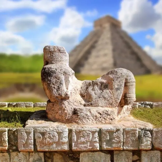
#History #secrets
The Most Baffling Ancient Mysteries Ever Discovered
This video explores the `ancient history` of our world, showcasing remarkable `ancient structures` that continue to puzzle researchers. We examine `ancient architecture` and `archaeology` from various `ancient civilizations`, offering a glimpse into the ingenuity of `forgotten civilizations`. These sites provide quiet yet powerful insights into the past.
By https://www.youtube.com/@TerrifyingMystery-z9d
Long before satellites traced the contours of the Earth
and historians began assembling the first timelines of civilization,
remarkable structures were already rising across the ancient world.
Hidden deep in deserts, carved into sheer cliffs,
or buried beneath layers of long-forgotten cities,
these sites preserve clues that continue to challenge researchers today.
Temples were carefully aligned with the sun, moon, and stars,
often marking solstices or equinoxes with striking precision.
Massive stone blocks were quarried, transported,
and fitted together with a level of skill that still impresses modern engineers.
In some ruins, inscriptions remain undeciphered,
while in others, building methods reveal a deep practical knowledge
of materials, geometry, and labor organization,
rather than technology beyond their time.
Were these achievements the result of lost techniques,
cultural exchange across distant regions,
or traditions that gradually faded from memory?
Across continents and centuries,
these quiet monuments remind us that ancient societies were highly capable,
deeply observant, and far more complex than we sometimes assume.
Across the sweeping savannas of West Africa,
spanning present-day Senegal and the Gambia,
lies one of the most remarkable and least understood megalithic landscapes on Earth.
Spread over a corridor of roughly 350 kilometers
are thousands of upright stone pillars arranged in precise circular formations.
Today, these are known as the Senegambia Stone Circles,
a UNESCO World Heritage Site,
and they have stood quietly for centuries
as the landscape around them has shifted and changed.
At first glance, they may seem like simple rings of weathered stones
rising from the grasslands,
but closer study reveals an ancient project of extraordinary scale and coordination,
one that still challenges archaeologists today.
In total, there are more than 1,000 stone circles
and nearly 28,000 individual stones across the region.
This makes the Senegambia Complex
one of the densest concentrations of megalithic architecture anywhere in the world.
And yet, unlike the well-documented stone monuments of Europe or the Near East,
the identity of the builders and the full meaning behind their work
remains only partially understood.
Most of the stones stand between 2 and 2.5 meters tall,
each weighing several tons.
They were carved from laterite,
a reddish, iron-rich stone common in the region,
and shaped into elongated, often cylindrical forms.
The circles vary in size,
sometimes containing fewer than 10 stones,
and in other cases more than 20.
While they appear simple from a distance,
their consistency and organization reveal a highly deliberate design tradition.
One of the most striking details is how uniform many of the pillars are.
They are not random slabs collected from the environment,
but carefully quarried, shaped, transported, and positioned with clear intent.
This level of planning is especially impressive
considering these monuments were built long before modern machinery,
cranes, or advanced transport systems existed in the region.
The people who created them left no written records explaining their methods,
forcing researchers to reconstruct the story entirely from archaeological evidence.
The first clues come from the quarries themselves.
In several locations, archaeologists have identified extraction sites
where laterite was cut directly from bedrock in block-like or column-like forms.
The cuts are surprisingly clean, suggesting the possible use of iron tools,
though the exact techniques remain uncertain.
Once shaped, the stones had to be transported,
sometimes over several kilometers, to their final destinations.
This raises one of the greatest mysteries of the site.
How were multi-ton pillars moved across uneven savanna terrain?
Some scholars suggest wooden rollers or sledges.
Others propose rope systems combined with manpower and earthen tracks.
No single theory has been confirmed,
but the scale of the project clearly implies a highly organized workforce.
Even more impressive is the final stage, erection.
Raising a stone weighing several tons into a perfectly stable vertical position
would have required careful digging, leverage, and precise alignment.
Builders likely created foundation pits,
tilted the stones into place,
and secured them so they would remain upright for centuries.
Remarkably, many still stand today,
despite centuries of wind, rain, and seasonal flooding.
Their stability suggests an intuitive but effective understanding
of balance, soil conditions, and structural support.
Yet perhaps the most intriguing discoveries lie beneath the stones.
Excavations have revealed that many circles are associated with burial mounds.
Human remains, along with iron tools, pottery, beads, and personal ornaments
have been found in and around several sites.
This strongly suggests that at least some of the circles functioned as funerary monuments,
marking the resting places of important individuals or community members.
However, the pattern is inconsistent.
Some circles contain clear burial evidence,
while others appear to have no graves at all.
This raises an important question.
Were these structures strictly tomb markers,
or did they also serve broader ceremonial, social, or symbolic purposes?
Another notable feature is the presence of paired front stones in some circles.
Taller uprights positioned outside the main ring,
often aligned with entrances or specific directions.
These may have functioned as symbolic gateways or markers of orientation.
A number of researchers have proposed that some alignments could relate to solar events,
such as solstices or seasonal cycles, though this remains unproven.
If such astronomical connections are correct,
the circles may have been used not only for burial,
but also for rituals tied to agriculture,
seasonal change, or spiritual beliefs connected to the sky.
Without written records, however, these interpretations remain open to debate.
Dating evidence places the construction of the Senegambia stone circles
over a remarkably long period, roughly from the 3rd century BCE to the 16th century CE.
This means the tradition lasted for more than a thousand years,
passed down through many generations of communities
who continued to build, use, and maintain these monuments.
Such continuity suggests that the practice was deeply embedded in cultural and spiritual life.
It was not the achievement of a single kingdom or ruler,
but rather a long-standing tradition shared across shifting societies over centuries.
This raises another profound question.
What belief system was strong enough to sustain such an enduring architectural tradition?
The identities of the builders remain partly hidden.
Unlike ancient Egypt or Mesopotamia,
the region does not preserve large written records or monumental cities from this period.
What survives instead are traces of organized communities,
farmers, metal workers, and skilled craftsmen capable of coordinating large-scale labor.
Evidence of ironworking in burial contexts suggests a society familiar with metallurgy,
while decorative objects point to complex social and ritual practices.
Still, many questions remain unanswered.
Were these circles built by small local groups working independently
or through cooperation between wider regional communities?
From above, the full extent of the landscape becomes striking.
Circular formations appear across the savanna like a patterned network etched into the earth.
Some stand alone in isolation, while others cluster into dense ceremonial zones.
Among the most significant sites are Wasu and Kerbach in the Gambia,
as well as Sine Nyen and Wanar in Senegal,
where well-preserved circles still display tall laterite pillars rising against the open sky.
Together, these locations form the heart of the Senegambia stone circles tradition.
And yet, despite decades of study, the core mystery remains unresolved.
Archaeologists have learned much about construction methods, burial practices, and cultural continuity,
but the deeper meaning is still elusive.
What belief system inspired communities to invest generations of effort
into building tens of thousands of stone pillars?
Were these circles ancestral memorials,
sacred spaces separating worlds of the living and the dead,
or markers of leaders whose names have been lost to time?
Perhaps they were all of these at once,
places where memory, spirituality, and identity merged into stone.
Today, the circles rest in silence under the African sun.
Their reddish pillars cast long shadows across the grasslands, just as they have for centuries.
Wind moves through the savanna, birds circle overhead, and the stones remain,
quiet witnesses to a civilization whose full story has not yet been recovered.
Each circle is a fragment of a larger puzzle, waiting for the missing pieces of history to be found.
And until new discoveries bring clearer answers,
the Senegambia stone circles will remain one of the most powerful and enduring mysteries of Africa's ancient past.
Across the windswept plains near the western shores of the Caspian Sea
lies one of the most fascinating archaeological landscapes in the world.
Scattered across rugged hills and weathered rock formations
is a vast open-air archive carved directly into stone.
This place is Gobistan in modern-day Azerbaijan,
a region where thousands of ancient carvings preserve echoes of a distant human past.
At first glance, the landscape feels quiet and almost empty, shaped by wind, dust, and time.
Yet across the rock surfaces, an extraordinary record of human activity stretches back thousands of years.
The Gobistan petroglyphs form one of the largest collections of prehistoric rock art ever discovered,
raising enduring questions about the people who created them and the world they inhabited.
More than 6,000 carvings have been identified across the area.
Some are simple outlines etched into stone, while others show surprising detail and deliberate composition.
Archaeologists believe the earliest carvings date back around 5,000 to 20,000 years, rather than 40,000,
placing them in the Upper Paleolithic and later periods.
Over time, different groups returned to the same rock surfaces, adding new images beside older ones.
The result is a layered visual record that spans from prehistoric eras through the Bronze Age and even into historical times.
Few places on Earth preserve such a continuous artistic timeline in the natural landscape.
Many of the carvings depict scenes from daily life.
Hunters pursue animals with spears, archers take aim at moving prey, and groups of people appear engaged in shared activities.
These images offer rare insight into how early communities survived.
The animals shown—wild bulls, deer, goats, and others—suggest that the region once supported far richer ecosystems than it does today.
Modern Gobistan is relatively dry and rocky,
but the presence of these animals indicates that the climate in earlier periods was likely more humid and fertile.
In this way, the carvings act not only as artistic expression, but also as a record of environmental change over thousands of years.
Beyond scenes of survival, Gobistan also reveals something more symbolic.
Among the most intriguing images are groups of human figures arranged in what appear to be dancing formations.
With raised arms and bent legs, they form lines or circles that resemble ritual movement.
Researchers believe these may represent ceremonial dances tied to seasonal events, spiritual aliefs, or communal gatherings.
Some scholars have even noted similarities between these figures and the traditional Azerbaijani dance known as yali, still performed today.
While the connection cannot be proven, it raises the possibility that certain cultural expressions may have deep roots stretching back thousands of years.
Another group of carvings has puzzled researchers for decades.
These depict long, narrow boats filled with rows of human figures, each seemingly holding an oar.
The vessels have elongated shapes that, at first glance, resemble boats known from much later cultures.
While comparisons to Viking ships are sometimes mentioned, most scholars believe the similarities reflect practical boat design rather than direct contact between distant civilizations.
Still, the images suggest that ancient peoples in this region were familiar with organized seafaring, possibly along the Caspian coastline.
They may represent fishing expeditions, travel routes, or even symbolic journeys.
The exact meaning remains uncertain, but the scenes hint at a strong connection to water and movement.
The techniques used to create the Gobistan carvings add another layer of fascination.
Many were etched into hard stone surfaces, such as limestone, using repeated strikes with stone or metal tools.
The precision and consistency of some images suggest careful planning rather than random carving.
Despite thousands of years of exposure to wind and weather, many figures remain clearly visible today.
This durability speaks to the skill of the ancient artists who created them.
Their work has endured not only as visual expression but as a lasting record of human thought and creativity.
Among the most unusual features of Gobistan is a rock known as Gaval Dash, often called the Singing Stone.
When struck, it produces a resonant sound similar to a drum.
This effect comes from the stone's internal structure and the way it vibrates.
Interestingly, the tone can change depending on temperature and moisture levels.
Some researchers believe that ancient communities may have used Gaval Dash as a musical instrument during rituals or gatherings.
If so, Gobistan may once have been a place where sound, movement and imagery combined in shared ceremonial experiences.
The site's location also raises important questions.
Gobistan lies near the Caspian Sea and geological evidence suggests that ancient shorelines may once have extended closer to the carved hills.
If water levels were different in the past, the area could have served as an important juncture for fishing groups or traveling communities moving along coastal routes.
The sheer number of carvings suggests that Gobistan was more than a settlement.
It may have been a gathering place where different groups met, shared ideas and marked significant events.
Over generations, each group may have added its own symbols, gradually transforming the landscape into a vast cultural record.
As research continues, new discoveries are still being made.
Modern scanning and mapping technologies have revealed carvings that were once difficult to see.
Some remain partially hidden beneath weathered surfaces, suggesting that many more images may still lie undiscovered.
Today, Gobistan is recognized as a UNESCO World Heritage Site, valued for both its archaeological importance and its insight into early human creativity.
Standing among the rocks, it is easy to imagine the countless individuals who once passed through this landscape, leaving behind marks that would outlast their own lifetimes.
Each carving represents a moment, a person pausing to record a thought, a memory or a belief in stone, never knowing that it would be seen thousands of years later.
In this way, Gobistan feels like a quiet conversation between past and present.
The figures carved into the rock do not speak, yet they communicate across immense stretches of time.
They show hunters at work, communities in motion, rituals under open skies and journeys across water.
At the same time, they leave many questions unanswered.
Who were the earliest artists? What meanings lay behind their symbols?
And why did generation after generation return to the same rocks to add new images?
The carvings of Gobistan remind us that long before written language, humans were already driven to record their experiences and express their understanding of the world.
These marks in stone are evidence that storytelling, creativity and the desire to leave a trace are as old as humanity itself.
Even after thousands of years, the rocks of Gobistan continue to hold those stories, waiting for modern eyes to rediscover them and to wonder once again about the people who first carved them into the stone.
High in the rugged mountains of the North Caucasus, where steep valleys slice through towering cliffs and mist drifts along the ridgelines, some of the ancient world's most intriguing structures still stand.
Scattered across the remote regions of Chechnya and Ingushetia are hundreds of tall, narrow stone towers rising sharply from rocky slopes.
Often referred to as Vynok Towers, built by the ancestors of the Vynok peoples, these structures date roughly from the 9th to the 13th centuries.
At first glance, they seem almost impossibly slender, like silent stone sentinels watching over the mountains.
Yet the more closely researchers study them, the more questions arise.
How were such precise and durable buildings constructed in one of the most challenging mountain environments in Eurasia?
What knowledge allowed their builders to create structures that have endured centuries of storms, earthquakes and conflict?
And why were so many erected across such a vast and harsh landscape?
Many of these towers reach heights of 20 to 30 meters, yet their bases are surprisingly compact, giving them a strikingly vertical profile.
From a distance, they resemble tapered stone pyramids emerging directly from the mountainsides.
Their walls are made of carefully shaped stone blocks fitted together with remarkable accuracy.
In many cases, the joints are so tight that even a thin blade can barely pass between them.
Unlike later fortifications elsewhere, these towers often rely on little or no mortar.
Their stability largely depends on the precise cutting and placement of each stone.
The walls gradually narrow toward the top, subtly directing weight downward and inward, which increases structural strength.
This refined architectural approach allowed the towers to withstand powerful mountain winds and shifting ground.
Even today, engineers studying these structures are impressed by the balance between height, narrowness and stability.
Inside, the towers typically contain several stacked levels connected by wooden floors and ladders.
Small openings in the thick walls served as observation points or defensive arrow slits.
Entrances were usually placed several meters above ground level and could only be reached by removable ladders.
In times of danger, families would pull the ladder inside, effectively sealing themselves within and turning the tower into a compact stronghold.
Archaeologists believe each tower belonged to a specific clan or extended family.
In a region historically shaped by intertribal conflict and raids through mountain passes, these structures functioned as both homes and defensive refuges.
Still, the sheer number of towers across the region raises questions about how such a widespread system was built and sustained.
Their placement across the landscape is equally fascinating.
Many stand on high ridges or rocky outcrops with sweeping views of surrounding valleys.
From one tower, it is often possible to spot another many kilometers away.
This pattern suggests that they formed a connected network of surveillance and communication.
Fires or smoke signals may have been used to send warnings quickly from one valley to another.
If danger approached, alerts could spread from tower to tower within minutes.
In this way, they may have functioned as an early warning system, allowing isolated communities to coordinate defenses across difficult terrain.
Such coordination points to a level of regional organization that historians are still working to fully understand.
Another enduring mystery lies in how these towers were actually built.
The Caucasus Mountains are known for steep slopes and limited access, making construction extremely demanding.
Transporting heavy stone blocks to elevated sites would have required careful planning and immense effort.
Yet many towers stand in places that remain difficult to reach even today.
Researchers believe builders quarried stone locally, shaping it with hand tools before hauling it into place.
Still, the precision of the masonry continues to impress experts.
Achieving such tightly fitted stonework without advanced machinery required exceptional craftsmanship.
These towers reflect a deep understanding of geometry, balance, and load distribution,
knowledge likely passed down through generations of skilled builders.
Local traditions add another layer to the story.
According to oral histories among Vynak communities, a family tower was expected to be completed within a single year.
If construction took longer, it was seen as a sign of weakness or misfortune.
As a result, clans organized large communal efforts,
with dozens of people working together to quarry, transport, and assemble materials as efficiently as possible.
Even so, the idea that such tall and carefully constructed buildings could be completed so quickly still surprises historians.
It suggests that tower building was not occasional, but part of a well-established architectural tradition with refined methods.
Another remarkable aspect of these towers is their durability.
The North Caucasus is a seismically active region, and earthquakes have occurred there throughout history.
Despite this, many towers have remained standing for centuries.
Their tapered design and thick stone walls help distribute stress evenly,
allowing them to absorb vibrations that might otherwise cause collapse.
In some cases, towers more than 700 years old remain largely intact, even after long periods of abandonment.
This resilience has drawn the attention of modern engineers,
who study them as examples of how traditional construction can achieve exceptional strength without materials like reinforced concrete or steel.
Yet perhaps the most powerful aspect of these towers lies in what they represent.
Each one was more than just a building, it was a symbol of identity, independence, and honor.
Constructing a tower signaled a family's presence and strength in a demanding environment.
They marked territory, offered protection in times of danger, and became deeply woven into the cultural fabric of Vinok society.
Over generations, they connected architecture with lineage, tradition, and survival.
Today, many of these towers still stand,
some isolated on windswept ridges, others clustered within ancient mountain villages.
They continue to inspire both admiration and curiosity.
They remind us that long before modern engineering,
communities in remote mountain regions were capable of creating structures of remarkable sophistication and endurance.
Their builders left no written guides to explain their methods, and much of their knowledge may have faded with time.
What remains are the towers themselves, silent, enduring witnesses to a remarkable architectural tradition that once flourished high in the Caucasus mountains.
As archaeologists continue to study them, and historians attempt to piece together their story, one question lingers.
How much of the ingenuity behind these towers has been lost?
And what other achievements of ancient mountain cultures still lie hidden among the peaks of the Caucasus?