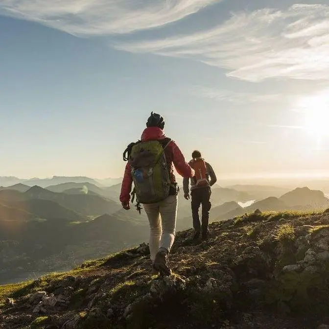
Join me as I spend 10 days solo hiking 230km from Alice Springs across the Larapinta Trail to Mount Sonder in the remote Australian outback.
I was lucky enough to complete this hike in May thankfully giving me beautiful cool weather and wonderful days on the trail. I would highly recommend this track to anyone interested in multi day hiking particularly through open mountain country.
To anyone planning on walking the track I highly recommend you walk in the cooler months, focus more on the time suggestions rather than distance guide of the trail map and see as much as you can of this incredible area, you won’t be disappointed!
Even if you are only planning a section or two I hope this gives you a rough idea what to expect and where you might like to see most.
Enjoy and thanks for being apart of the journey!
If you love hiking and a good outback adventure, then this one's for you.
Welcome to the Larapinta Trail.
Recently, I was traveling through Outback Australia, through the Red Centre and up
to Alice Springs, when I came across this incredibly remote outback hiking trail in
the West Macdonald Ranges and just knew I had to do it.
The Larapinta Trail, roughly, is a little over 220 kilometres long, consists of 12
sections for those wanting to do shorter walks, is typically walked in total over
two to three weeks, east to west, starting from Alice Springs, and offers some truly
remarkable scenery, rising above a thousand metres seven times along the trail.
There is little to no service or phone reception along the entirety of the track
and pretty limited services, so you'll need to be fully prepared for a
self-sufficient hike and booked with a return transfer company before you even set off.
I also, having driven to Alice Springs, had to organise a safe location to leave my
car for the duration of my hike and walk to the trailhead at Alice Springs Telegraph
Station along the Todd River, adding almost another 10 kilometres to my first day.
I planned to challenge myself to walk the trail end to end over 230
kilometres in just 10 days.
So without further ado, let's jump straight into this hike.
Day one, starting from the trailhead and logbook at Alice Springs Telegraph Station is a
relatively easy 24.7 kilometres walk through to Simpsons Gap campground.
The country here is quite dry and definitely has an outback feel to it, passing first by a
few historic graves, then moving over rocks and dry creek beds to head uphill and
overlook the town.
Coming from the coast, I always find the colours of this inland country so stunning and was
lucky enough to have a number of beautiful lookout points on this first day, as well as
sharing it with the local wildlife from ants and caterpillars to spiders and birdlife.
Stopping for water at the Wallaby Gap campground, one of the things I noticed and loved
already about this trail was the number of campsite options over the 200 kilometres,
giving hikers the opportunity to choose to complete the walk as quickly or slowly as they
please. For example, staying here would mean day one could simply be a 14 kilometre hike or
you could continue on a further 10 kilometres to the next campground.
Heading back out on trail, I walked in the cooler afternoon hours and had some more stunning
views passing through Hat Hill Saddle.
This campground marks the end of Section 1 and hence has a hiker's hut and water tank, as
well as a number of tent sites to spend the night.
Waking up to the beautiful colours of Simpsons Gap, I really made the most of having this
hut to myself, making breakfast, treating water and getting ready for today's section where
I'll hike another 26.2 kilometres through to Jay Creek Camp at the end of Section 2.
Despite the weather being perfect for me and the nights being quite cold, dropping almost to
zero, the days were, as you would probably expect, still quite hot and dry, especially with
such limited shade and vegetation cover.
Section 2, much like Section 1, covered some beautiful country, but for me, I found was
probably the most difficult for the simple reason that I just felt I hadn't drunk enough water
for this environment the previous day and my body was really feeling it.
It was also the worst day for flies.
I have no idea why there were so many here particularly, but stopping off at Mulga Camp, you
simply could not get away from them.
The afternoon's walk moved through dry riverbed, through grassland and gorges with stunning
little billabongs,
before lighting up the surrounding hills with sunset colours.
There was no chance I was getting tent pegs into the ground at Jay Creek.
It was just so hard and dry out there.
So here's a few rocks holding up my tent to end the day sleeping under the stars.
Knowing how hot it was getting, I decided to start day three nice and early, packing up in the
dark to walk through Jay Creek Creek Bed on sunrise.
I'd seen lots of warnings for dingoes and was hoping I might be lucky enough to see one in an
area like this, being closer to water, but didn't encounter any.
Moving up out of the gorge, I wasn't in the dark for long and caught this beautiful morning glow
on the mountains.
The colours at this time of morning were absolutely stunning and so clear in every direction.
However, as expected, warmed up pretty quickly.
I did end up taking and wearing lightweight long pants, a sunshirt and gaiters for almost the
entirety of the hike being in such exposed terrain and would highly recommend the same for anyone
hiking despite the temperatures.
Moving on to Miller's Flat, I had a lot of fun with this next section, scrambling, rock hopping
and even climbing my way towards Stanley Chasm.
Having booked the trail and brought my map the day before starting my hike, I truthfully had very
little time to research what each section actually involved and was quite excited when I got to this
one that it really wasn't just your typical walk in the park type trail.
Stanley Chasm then marks the end of section three.
Despite walking through National Park, this section is privately managed, accessible by road,
complete with a cafe and was a very welcome spot to stop off in the shade.
The chasm is quite special with incredibly vibrant red rock walls and a spot I'd really recommend
visiting, even if you only have the time to just drive through the area.
Break over, I continued on to the section four for the afternoon, moving up away from the crowded
cafe back into the hills.
The elevation gain here, whilst a little rough at the end of the day, brought view after view that I
just had to stop and take in.
The exposed landscape, however, also brought some crazy wind gusts.
So after covering just 22 kilometers today, I decided on a spot just below the summit of Brinkley
Bluff to set up camp for the night.
The sunset here was truly incredible.
And to be able to fall asleep under it with just a mosquito net and not another person or city light
in sight made it without a doubt one of my favorite camps and nights on the Larapinta.
Oh, it is absolutely freezing up here this morning, but so beautiful.
I've waited until the sun was on me to pack up because it's so cold.
But I'm about to take the tent down and head off for day four.
Sunrise up here was just as special, but also freezing cold.
So after finally crawling out of my sleeping bag, I made my way up to Brinkley Bluff at 1209 meters
to overlook the surrounding ridges.
Today, I'll cover around another 21 kilometers to finish section four and almost section five,
starting the walk once again back off the bluff along its rocky paths.
This area had unfortunately seen some recent fire damage, but offered a little more shade
and protection upon reaching the creek line and finishing section four.
Again, being the end of a section, there is a hiker's shelter and water tank here,
which, as you can probably see, I was quite happy to reach and get out of the sun.
To give you a quick tour, the huts along the trail are almost all identical with tent platforms.
Some, however, do also have a solar charging port, which given the location,
I thought was a brilliant idea, but unfortunately weren't very reliable.
They also have a map showing the distance of the trail and information on the sections ahead.
Having easy access to water and a seat that wasn't a literal rock,
I stopped for lunch here and then headed back out onto section five.
The trail here heads straight for Spencer Gorge, a beautiful and shady gorge with a rocky base
and, as I quickly found out, a whole lot of rock hopping and scrambling.
To give you an idea of the grade, the trail map suggests hikers in this section
will only be covering around a kilometre an hour, which is pretty rough going when
you think about the fact that the normal walking pace, even with a full pack, is well above this.
I, however, loved this section and found I was able to make up time in comparison to the trail guide
to reach Windy Saddle and head onto the appropriately named Razorback Ridge.
Again, this was incredibly slow going just because of the loose rocks and sheer sides
that you absolutely would not want to take a fall on. Below the ridge, I walked Fringelily
Creek and then again moved into the hills for a sunset crossover of Rocky Saddle
before spending the night in Hugh Gorge Riverbed at Hugh Gorge Junction.
This is a better look at my camp from the night before, then straight off into Hugh Gorge as
day five was about to be a big one, covering 32.6 kilometres.
Now, my first obstacle this morning was the Hugh Gorge water crossing and kind of a non-negotiable
to get through as the only permanent water crossing on the Larapinta Trail. I personally
am quite comfortable with solo hiking, but this did prove to be a bit of a challenge to keep my
pack dry without someone there to grab it, in particular coming from this direction and
lowering it down over the rocks. Thankfully, at some stage, a stick has been placed here
and that, while still a bit rickety, you could hang your gear from it and swim around to grab it.
Keep in mind, like I said before, the overnight temperatures here are all but zero and this water
is about two metres deep, seeing next to no sunlight for most of the day, so I was absolutely
hanging onto those rocks to avoid swimming and freezing as much as I could.
Also, in case you wanted to see how it could be done, this is a better demonstration by
two people who conveniently showed up right after I'd crossed.
Layering back up on the other side, I finally found some wild dog or possibly dingo tracks
like I'd been expecting around the water and made a quick stop at Hugh Gorge campsite
to complete section five before continuing on. Section six was relatively long but easy walking,
crossing more open grassy country at this stage and looking side on at the Macdonald Ranges.
I saw one snake here but was certainly not about to stop in the long grass to find out what it was.
Stopping briefly at Ghost Gum Flat, another camping option,
then walking into the afternoon to reach Ellery Creek North campground for the night.
Day six deserved a sleep in, so here's a quick look at the hut on the junction of section seven
and out onto trail for a shorter day of 20 kilometres. Again, this morning was fairly open,
involved covering a bit of distance. It had also been affected by a recent wildfire caused by
lightning and had lost a lot of its vegetation and trail markers. The landscape though was beautiful
in its harsh nature. A few kilometres more and we reach some signs and the Serpentine Gorge camp.
Whilst this is a hiker's camp, the gorge here is quite accessible to day visitors by a dirt road
inn and for that reason makes it one of the optional spots for food drops to hikers by
trek support companies. If you're not familiar with food or gear drops, this basically refers
to boxes that you have pre-packed before your hike with things like meals, snacks,
camping and hiking gear or even fresh clothes that you would like to receive at later stages
in your hike. These boxes are supplied and dropped off to various pre-arranged locations
by a support company for you to access along the way. They help hikers keep their pack weight down,
particularly for a long hike like the Larrapinta and also provide a way of offloading gear you
no longer need. Personally, I didn't have any drops organised so I unfortunately can't show
those boxes. I wanted to challenge myself a little by being as self-sufficient as possible
over this hike, so what you see me carrying through this video is everything I needed to
eat, sleep, cook and support myself over the duration of my walk. Back to the trail, I had
an afternoon of uphill trekking that gave some killer views walking once again on the top of
the ranges. I decided on Camp's Point to camp, being just a slight detour off the main track
and the best spot to look towards Mount Sonda, the end goal of the trail.
Much like Brinkley Bluff, it was so windy for a tent but 100% worth it for the surrounding sunset
views. After all but being blown off the mountain overnight, I headed on to start day seven.
The sunrise from the point was beautiful, much like the views of Mount Sonda which was still
a few days walk away. I decided to head to Serpentine Chalet Dam for breakfast to have
easy access to water and at a week into this walk I was clearly loving being out here.
Serpentine Chalet Dam is the end of section 8 and start of section 9, the longest stretch of
trail without any access to water for another 29 kilometres. I spent a while here hoping to do most
of my walking in the cooler hours. I finally headed out through Innalanga Pass, crossing
through the range and over to Open Hills to reach Waterfall Gorge. Despite the name, there were
certainly no waterfalls here this time of year, in fact no water at all. Just dry rocky riverbeds
to follow through to the Mount Giles Climb, a steep section of rough rocky terrain. There is
lookout at the summit and just beyond it is a number of flat areas that pass as unmarked campsites,
big enough to hold a tent or two. Lucky for me it only needed to fit one as I was the only one
there and had what felt like the top of the ranges all to myself. Whilst the huts are nice, I don't
think anything quite compares to the views and colours camping on mountain peaks, so once again
I slept without a rainfly and watched the stars. Good morning everyone, it is my birthday today
and I just turned 23 in the most beautiful spot, so I need to show you what I've just woken up to.
Day eight, I celebrated my birthday on trail. It had seemed a good reason to last minute take on
this bucket list hike and waking up the day of in this incredibly remote area with the entire
mountain to myself and the most unreal sunrise, I was so glad I had made the choice to be there and
honestly so so grateful. Today I wanted to cover about 22 kilometres and it was important I moved
on to get water, so as it warmed up I headed off the mountain towards Ormiston Gorge through an
interesting section of trail covering ridges, open flats, grassland and creek beds.
The Ormiston Gorge, much like Standley Chasm, has a private cafe and campground on site
as well as easily accessible short walks to the gorge, overlooking it and through it with its
vibrant colours. It's another location you could choose to get a food drop or camp, but seeing as
it was my birthday I just had to stop and get a muffin as a little birthday cake treat to celebrate
before I moved on to section 10. The afternoon walk from the gorge heads hikers to Fink River.
It's quite an easy section, just hot and quite exposed with nice views.
Meeting the river or riverbed at least, there even in the dry season are pools of water and
beautiful to camp beside. The campground marking the end of section 10 again has a hiker's hut
but I opted here for the nicer, sandier base of the riverbed itself
and ended the day under the trees by the water. All right, one big one to go now. With just two
days of trail left, section 11 was quite special because it marked my final full day of walking
as this afternoon I'd reached the last trail campsite at Red Bank Gorge. Aside from covering
distance and moving about 26 kilometres, it was quite a comfortable day taking my time at
Fink River and to sign onto the trail before heading out of camp. Crossing through wetter areas
and up along dusty tracks to Hilltop Lookout. I found these beautiful natives that someone
before me had obviously left and enjoyed a now much closer view of Mount Sonder ahead.
There is a rough camp at the top of the lookout but with little protection and more walking to
be done, I continued down still walking towards Mount Sonder before turning off and out to the
side of the range at Rocky Bar Gap, a shady dry creek bed at this time of year. Here there is
yet another campground and a water tank making it a good spot to stop and take off the pack,
enjoy the shade and really just break up the walk with 11 kilometres to go.
Nearly at the end now, just about I think maybe one or two kilometres
to go to that final campground and then that last little push tomorrow.
The final hikers camp crosses a riverbed and it's just a short walk from Red Bank Gorge,
the Mount Sonder trailhead and the car park from which I'll shortly be picked up. There were a few
others here ready to take on Mount Sonder in the morning and overall was a nice spot to finally
pitch my tent. Starting early in the dark, I rugged up to climb the final leg of the Larapinta
and summit Mount Sonder for sunrise. Despite the benefit of walking in the cooler hours,
it's actually a tradition by hikers to either start or finish like myself their journey on
the trail with a sunrise climb which I think is really quite beautiful and as you'll see shortly
was absolutely worthwhile. The total hike today is only about 16 kilometres return,
making it by far my shortest day as it finishes back at the Red Bank campground.
It was also made a whole lot easier by leaving the tent and lighter by not having to carry much
aside from water and a jacket. The climb today along with Larapinta walkers and day hikers is
popular with guided tours and hiking groups, making it after the remote solo walking of the
last week quite a busy spot to be. The trail itself was pretty straightforward to navigate
even in the dark and quite pretty following the little lights of the walkers ahead.
Reaching the peak right before first light I had a beautiful spot on the summit,
almost all to myself ready to watch sunrise as more people arrived. As expected it was
freezing on the summit but perfectly clear with a sunrise that certainly did not disappoint.
Even the shadow Mount Sonder itself cast over the ranges at this time of morning was quite
spectacular and the colours of everything around it. Believe it or not the trail got rain the day
before I started my hike then a terribly cloudy and windy sunrise on Mount Sonder the morning
after I summited. Some things really should be planned but for me this last minute hike it seemed
was obviously just meant to be and really is one of my most special hiking experiences yet
that I am so glad I'm now getting to share a little bit of its magic.
Over 230 kilometers of Aussie outback walked and just like that I have finished the Larapinta
and I've got to say what a view to end it on it is just incredible up here. Whilst the crowd
left as soon as the sun had risen I stayed for coffee, watched the little birds
and made the most of the views. I had obviously walked the trail fairly quickly and at this point
wanted to allow myself the time just to enjoy the landscape I had so enjoyed walking through.
Returning to the campground this time now obviously in daylight I decided to spend the
rest of the afternoon in Red Bank Gorge. It seems most other people that I had met
scheduled their transfer for the day they climbed Mount Sonder which I can completely understand
but I also appreciate the time for me just being able to enjoy being out there without having
anywhere else to be. So I have obviously now finished my time on the Larapinta it was just
an incredible trail I absolutely loved all of my time out here and I definitely got super super
lucky with the weather. Now I have a transfer back to Alice Springs booked but not until tomorrow I
just wanted to give myself a little bit of time flexibility obviously not knowing how quick I
would be able to do it or what the conditions on the trail would be like until I got here
but I do catch that back tomorrow about midday so I've just spent all afternoon in the gorge it's
been beautiful and I wanted to jump on really quickly and wrap this up basically to say I feel
amazing after doing this trail I've got a couple of blisters but my body my muscles all feel
absolutely incredible which I'm so impressed about my gear held up really well I felt I had
plenty of food and water without the gear drops or the food drops so I was really really happy
with my decisions there. I do hope you have enjoyed this trail with me I know I certainly have
and I cannot wait to share whatever the next adventure is as soon as I get there
I'll wait till you see when we go past