
진작 가볼걸! 서해의 숨은 비경👍 대중교통으로 쉽게 가는 14km 섬트레킹🚌 당일치기 여행💚
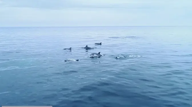
이번에는 대중교통으로 시원한 바다와 산을 한번에 경험할 수 있는 아름다운 섬에 다녀왔습니다. 동해바다라고 해도 믿을 만큼 푸른 바다가 인상적이었고요, 산에서 돌아다니는 게는 난생처음이었습니다. 관광지이지만 자연 그대로의 멋이 살아있어 걷는 내내 즐거웠답니다
#해상관광탐방로 #무의바다누리길 #실미도해수욕장 #트래블링코리아 #힐링여행 #트레킹 #당일치기 #국내여행 #TravelingKorea #인생샷명소 #해안산책로 #해안데크길 #가볼만한곳 #전망대 #GPX
무의도 GPX : https://drive.google.com/file/d/1NmvkIJ4NzwGKeLANeYVpdmrjQ1_RdPMh/view?usp=share_link
** 드론은 항공촬영 허가하에 촬영했습니다 **
@ 큰무리선착장 : 인천 중구 무의동
@ 무의대교 공영주차장 : 인천 중구 무의동 산 10-23
@ 1코스 둘레길
@ 실미도 해수욕장
@ 2코스 둘레길
@ 작은 하나개 해변
@하나개 해수욕장
@ 해상관광탐방로
@ 호룡곡산
@ 광명항 : 광명항에 주차 공간 부족시에는 무의광명항 공영주차장으로 검색하면 무료 주차장 나옴
@ 소무의도 무의바다누리길
Hello, I got out of the subway early in the morning.
Today, I'm going to go on a trip to the island that is easy to go by public transportation.
It's a charming island in nature, Mui Island.
This is Gongmyeong Station.
I'm walking to change to the airport railroad.
A few years ago, I had to take a ferry from Jamjin Island to the island.
As the Mui Bridge was opened in 2019, I was able to enter the car.
If you come out of Incheon Airport Terminal 1 Station, you can see the escalator connected to the 2nd floor.
Go to Terminal 1 Station on the 2nd floor.
If you go up to the 3rd floor, you'll see Gate 7.
If you come out of Gate 7, there's a Mui 1 bus stop on the left.
Oh, the bus is here.
The bus I took is the bus that leaves at 8 o'clock.
The gap is 40 minutes to 1 hour, which is relatively frequent.
Please refer to the bus timetable in the video for more information.
I'm crossing the Mui Bridge right now.
I'm going to get off at the big dock in front of me.
It took about 20 minutes to get to the big dock.
If you brought a car, you can park around the dock.
There is a lot of parking space.
Please note that there is a Mui Bridge public parking lot 2 minutes away by car.
I took a quick look around the dock.
I can see the Mui Bridge that I crossed earlier.
The island on the right is Jamjindo.
There is a convenience store and cafe in front of the dock.
There is also a bathroom at the end of the convenience store.
I remember that there was no bathroom between Route 1 and Route 2.
I think it would be good to refer to it before trekking.
But if you want to use the bathroom, you have to ask the convenience store owner for the password.
If you face the convenience store and walk a little to the left, you can see the entrance to Route 2.
This is the beginning of Route 1 and Route 2.
I left the big dock today and went through Route 1 and Route 2 to look around Hanak Beach.
After passing the landmark of Mui Island, Haesang Tourist Inspection Road,
I will go through Gwangmyeong Port and walk to So Mui Island.
It's about 14km away.
It seems a bit too much for me, but since I'm here, I have to try it.
I start trekking to So Mui Island at 8.47pm.
If you go up the stairs, it's a forest road.
If you walk for about 3-4 minutes, you will see a forked road that goes to Guksabong and Dullae-gil.
I headed for Dullae-gil.
The road feels like a regular hiking trail.
It can be a bit boring, but there are a lot of trees, so it's good to walk.
There is a small observatory not far away.
Oh, I can see Yeongjongdo Island.
Seeing that the plane is flying low, it seems to be near the airport.
If you walk a little further, you can see Mui Bridge.
The 1-course Dullae-gil I am walking on is a total distance of 2.21km,
which is also called Gunhak Guji-gil.
Gunhak Guji-gil is the name given by General In Gyeong-up, the famous leader of the Joseon Dynasty,
who used Mui Island as a stronghold to go to Yeonpyeong-do.
If you walk about 300m more from here, you will arrive at the northernmost Wensuburi of Mui Island.
It is named because it is a region where the waves are strong, as if it met an enemy.
In fact, when fishermen go fishing, it is difficult to pass the high waves and triangular waves,
so it is said that the call of Wensu and Buri has continued until now.
It's an interesting name.
Thinking about the story in the name, I came out of the forest road,
and suddenly the sea opened up and the sea opened at a glance.
I can see the highlight of the 1-course Dullae-gil in front of me, the coastal walkway.
I was rushing to walk in a good mood,
but I saw something moving, so I went closer and it was a dog.
Maybe I'm scared, but I'm busy running away.
Later, I found out that it was a thief dog that I could see a lot around here.
It is said that it went to a private house 1-2km away from the coast,
stole food scraps or flesh attached to fruit peels,
and was named a thief dog.
If you look at it, it really looks like a thief character.
Even this guy is busy running away because the thief is coming back.
Today, it's fun from the beginning of the trekking because of the thief dog.
If you come down the stairs, you will find the coastal walkway of the 1-course Dullae-gil.
The length is 460m, which is quite short.
It was good to be able to see the sea a little closer because it was a tide now.
The sea looks pretty clean.
When you come here, I recommend that you come to the tide.
You can check the tide on the sea time site.
I can see Silmido far away.
As I climb the stairs, I can see the Silmido beach.
I thought, was the Silmido beach originally so pretty?
Silmido is a place with the sad story of the Bupa workers.
It looks so peaceful that I can't believe it.
The clear weather with no fine dust and the blue sky make the beach look very clean.
The coastal walkway of the 1-course Dullae-gil ends at the Silmido Beach.
This is a private property, so you can't pass it.
But I only went to the water for a while. There's a lot of water.
I headed back to the 1-course Dullae-gil.
You can go in the direction of Silmido Amusement Park from here.
The Silmido Beach is a private property, so you have to turn right on the national highway.
There are a lot of trees here, so you can walk coolly.
The road sign is well made, so it's not difficult to find the way.
The forest road continues for a while.
The winding road follows the appearance of the mountainside.
Oh, the grass is scary here.
I'll have to go through the grass.
I was a little scared because I didn't know what was under my feet.
After the grass forest, there is a big road.
Walk in the direction of Silmido Amusement Park on the right.
If you walk about 50 meters, you will see the Dullae-gil sign.
I think this is the beginning of the 2-course Dullae-gil.
Face the sign and walk on the unpaved road on the left.
The 2-course Dullae-gil is also called Kkachinol-gil.
The total distance is 2.96 km.
The 2-course Dullae-gil is quite wide compared to the 1-course.
It feels like walking on a country road.
The dirt road continues for a while.
I was wondering if the right road was right on the divided road,
but there is a sign here.
Be careful as you may miss the tree.
Walk along the road.
There is a road that goes up to Guksabong on the 2-course Dullae-gil.
If you want to go up to Guksabong, please refer to it.
I can see the iron gate blocking the road through the sign.
I was wondering if I came to the wrong place for a moment.
When I got closer, I saw a sign and a passage for people to come and go.
It doesn't matter if you come and go for sightseeing purposes,
but I think it's a sign to stop collecting waste.
After passing the pine forest and walking along the soft dirt road for a while,
you can see the sand beach.
You can see Silmido on the right over there.
It's back behind the beach in Silmido.
The water here is also very clear.
You can walk to the coastal promenade in the direction of the small Hanagyo Beach.
From here, the road to the end of the beach continues again along the coast.
The length is 1.12km, which is quite long.
Wow, the open view is spreading.
For that price, you have to walk all over your body in the hot sun for a while.
Still, I feel good.
This is the world of birds.
It looks very peaceful.
Because of the rock wall, it was a little shade here,
but the sun is setting again.
Wow, the color of the sea is jade.
I feel like I'm in the East Sea.
Even though it's a sunny day, I keep walking slowly while looking at the scenery.
The joy of looking at it doesn't get old easily.
Seeing that there is a way out,
I think it would have been blocked if I went to the right.
Still, let's go.
Oh, there's an observatory.
The view is wide open and cool to the chest.
I went back and headed for the forest.
A little uphill continues.
I feel like I'm hiking.
The atmosphere changes again.
The steep hiking trail is short and the altitude increases little by little.
After about 10 minutes, there is a small shelter.
It's good to take a break in the cool shade of trees.
The sea is pretty and quiet, so it's really nice.
I was sitting for a long time to rest my tired legs.
If you come out of the shelter, it's a downhill section.
It's full speed again.
If you go down about 5 minutes along the sign, there is a deck road.
If you go to the left, it's a small Hanegae Beach.
On the right is the observatory.
The observatory is nothing special.
Maybe for those who come from the small Hanegae Beach,
I think it's made for sightseeing.
You don't have to go.
I'm walking back to the Hanegae Beach.
I can see the Hanegae Beach far away.
On the left is the small Hanegae Beach.
I'm going to pass two beaches and go to the Sea Tourism Exploration Road.
This is Jagal Beach.
After the coastal walkway, it leads back to the forest.
I'm wondering if this deck road leads to the small Hanagae Beach.
I'm a little worried that I might go back to Kuksabong if I do something wrong.
Anyway, I walk along the deck road.
There is also an observatory where you can see the cool sea.
I see the sea endlessly today.
For a while, up and down, the deck road continues.
There are some slopes, so it's a little harder than other sections.
It's a little hot, but it's not as hot as it was a few days ago.
The weather, which has been changing day by day, seems to be preparing to retreat.
For a while, the dirt road and the deck road are repeated.
I can see the sea again on the right.
I can see the sculpture in front of me.
It is an observatory with a tiger and a fairy sculpture.
Like an island with a legend that a tiger and a dragon fought,
I made the third princess of heaven and the tiger Seol-ah into a real-size sculpture.
Because of the tiger, you might be surprised at first glance.
It's an interesting story when I read the manual.
The small Hanagae Beach on the line of the observatory looks gloomy.
The simple sand beach is really pretty.
Looking at the thief sculpture, I think of the thief I pulled out earlier.
It makes me laugh.
If you go past the sign at the top of Guksabong and go forward, you will reach the top of Guksabong.
I passed Guksabong and headed for the small Hanagae Beach.
This is the small Hanagae Beach.
It looks like nature that has not been trimmed.
The waves of Pomare, which are pushing hard so that they do not reach the west, are impressive.
It's quiet and quiet, so it's perfect for a rest.
I suddenly want to eat in a deserted island in a deserted island.
On the way to Hanagae Beach, there are a lot of bumpy rocks.
The rocks look amazing and it was fun because it felt like climbing a rock mountain.
It's not high tide right now, so you can pass through the rocks like this,
but when the tide is high, you have to go over the mountain or over the rocks around you.
It's good to be able to shorten the time, but safety comes first, so make sure to check the tide and cross.
But as you get closer to Hanagae Beach, the sea water gets murky.
It's the biggest mudflat in Uido Island, so I think it's because there's a lot of mud.
It's completely different from the sea water I've seen around Ilicos so far.
It's the same island, but there's a lot of difference.
The color of the sea water seems to change a lot depending on the flow of mud and tide.
This is Hanagae Beach from here.
The color of the sea water is not only different, but the atmosphere is also very different.
There are a lot of people. It feels like a typical tourist attraction.
It looks like there's a lot to enjoy.
The sand is hard, so you can ride a dog motorcycle.
There's a mudflat experience center and a zip line.
Maybe that's why there were quite a few people who came to enjoy their last vacation.
It's not on the screen, but this is the first convenience store to come out after the big water park.
You can buy cold drinks and snacks, so keep that in mind.
I had a cold drink, too.
The Sea Tourism Exploration Route is
I'm going to go through the set of the drama, Stairway to Heaven.
It's under demolition, but it looks very old.
If you walk a little past the set, you'll see the Daegu Road Entrance.
If you pass through here, you'll see a wet road.
If you walk a little, you'll see a sign for Fantasy Road.
If you go to the right, you'll see the Sea Tourism Exploration Route.
The Daegu Road is so nice to see.
It looks like a road into the sea.
I feel like I'm floating on the water.
The seawater looks clean again.
On the left is the Gwiyam Reservoir, and on the right is the sea.
One flaw was that there was no place to avoid the sun, so it was a little hot.
But the scenery is so good that the sun is forgiven.
This rock is a lion rock, but I don't know.
Oh, I have to look at the lion rock from this side.
The Shimtaegyun Observatory has a blue sea like a panorama.
The Sea Tourism Exploration Route is only 800 meters from Hanagae Beach to the entrance to Horyonggoksan.
It's easy to get around.
It's a good place to get close to, so it's the most popular place in Mui Island.
There are a lot of unique-looking rocks, so it's fun to watch.
It is said that there is a water rock and a hamburger rock.
It is said that you can also see the Jusangjeolli, but I couldn't find it.
Anyway, there were a lot of interesting things, and the seawater was really clear.
Now I can see the end point.
You can go to the beach between the decks.
It's 12 o'clock right now.
It's been 3 hours and 20 minutes since I started trekking.
If you walk along the beach, you can see the stairs to Horyonggoksan.
I didn't go up right away and took a break in the shade of a tree.
The wind is cool and quiet, so it's nice.
There seems to be no place like this to enjoy a sweet nap.
Start trekking again at 12 o'clock 55 minutes.
This time, I headed for the top of Horyonggoksan.
If you go up the stairs for about 3-4 minutes, you will see the Ulchangha Forest Road.
Walk in the direction of the Horyonggoksan sign.
If you walk for about 5 minutes, there are two ways to go to Horyonggoksan.
The way I went straight looked shorter and better, so I went straight.
Horyonggoksan is the highest peak in Mui Island.
The name of the mountain is said to have originated from the legend that a tiger and a dragon fought.
There are many precious stones such as Madang Rock, Bucha Rock, and vertical cliffs,
so it is called the Alps of the West Sea.
I don't know if that's true.
It was good to walk because there were many trees, but the road is still a bit boring.
There are some confusing parts, but it won't be that difficult to find.
It is known that the hiking trail is not very steep, but the road is getting steeper.
There are quite a few difficult sections.
Oh, I'm out of breath here.
If you see the sign of Hanak Beach, go in the direction of the right ridge, not the direction of the arrow.
If you walk a flat road for a while, you will see a unique rock that looks like a person.
If you walk along the road past the rock, you will see the sign of Bucha Rock.
I don't think I've seen Madang Rock, but let's go to Bucha Rock first.
I think it's this rock.
It is said that the image of Buddha remains only on the top of the rock.
If there is no signboard, I don't know and just pass by.
You can see the sea far away.
If you come out of Bucha Rock and walk a little, you can see the signboard that splits into Gwangmyeonghan and Horyong Goksan.
There are 200m left to the top.
Let's walk hard.
There is also a slope here, so 200m feels quite far.
I can finally see the top.
When I came up to Horyong Goksan, it wasn't as easy and easy as it was known.
It took about 55 minutes to get to the top.
The view of Muido Ildae from the observatory spreads like a panorama.
You can see the Hanagae Beach and the Sea Tourism Exploration Route at a glance.
The Gwangmyeonghan and So-Muido on the other side are covered by trees, so you can't see them well.
Here's a drone video.
The modifier Alps in the West feels a bit exaggerated.
Still, it was the highest mountain in Muido, so the view was good.
But there is no place to avoid the sun.
It was a pity that I had to crawl into the shade of a tree to sit down.
It's time to go down at 2 o'clock.
The way down is also steep.
It was a pretty steep road.
If you go down about 200m, you will see the Gallim-gil you saw when you came up earlier.
It goes down in the direction of Gwangmyeonghan without regretting the origin.
I thought the way down would be easy, but it wasn't.
I repeated the up and down several times, so the way down wasn't comfortable.
After a while, a little comfortable road comes out.
If you go down a little more, you can see the houses.
I think I'm almost there.
It's 2 o'clock and 55 minutes now, so it took about 50 minutes to come down.
Gwangmyeonghang was a small fishing port called Senggumi to the islanders.
It was a port where ships going to So-Muido departed.
Muido has become famous, so there are many boats near the dock.
There is also a convenience store and a roadside parking lot.
If you brought a car, you can park here and go to Horyeong Goksan or So-Muido.
It is said that it is not easy to park on weekends.
In that case, it is convenient to walk to Muwi Gwangmyeonghang public parking lot, which is 8 to 10 minutes away.
Gwangmyeonghang also has a bus stop number 1, so please refer to it.
Today's final destination is So-Muido.
So-Muido can cross So-Muwi Indo Bridge from Gwangmyeonghang.
I thought I could only go around with people and bicycles because it was an Indo Bridge.
Later, I saw a small electric car and a 1-ton truck passing by.
I was surprised.
So-Muwi Indo Bridge is quite long, so it is 413m long.
The So-Muido Ddaemuri dock seen from the Indo Bridge looks really clean.
So-Muido is a small island with an area of 1.2 square kilometers.
It used to be an island where shrimp fishing was a main job.
When you cross the bridge, the logo of the island, which is a symbol of So-Muido, welcomes you.
So-Muido Dulle-gil is called Muwi Bada Nuri-gil.
It is a roundabout that goes around the island from So-Muwi Indo Bridge.
It is made up of 8 sections, but it is only 2.48 km away.
Even if you walk slowly while admiring the beautiful scenery of the West Sea, 1.5 hours is enough.
I decided to walk from the 8th section in the direction of Bansik.
You can go up the stairs on the left side of the guide arm.
You have to climb about 215m steeply to the top of Ansan, where the Hadojeong Observatory is located.
My legs are shaking from the start.
Once you go up like this, I thought it would be easier from then on, so I decided to walk the 8th section first.
Wow, I can't see the end of the stairs. It's getting blurry for a while.
The stairs are a bit heavy because I went up to Horyong Goksan.
I think my legs are getting tight.
I think I've been up for about 15 minutes.
I can see Haenyeo Island. I think I'm almost at the top.
I can finally see the top.
This is Hadojeong, the highest observatory in Seomul Island.
The bridge you see in the distance seems to be the Incheon Bridge that connects Yeongjongdo and Incheon.
The small island in front of me is Haenyeo Island that I saw earlier.
It is said that Haenyeo, who digs abalones, took a break while diving.
The weather is clear today, so I can see far away.
I hope the air is always clean like this.
Let's take a break and move on to the next course.
Wow, the view from here is a picture of Hanpok.
The small pine trees are impressive.
It's the most beautiful scenery on Seomul Island.
From here on, it's a downhill road.
If you pass the sign of Haenyeo Island, the first beach you meet is Yeongsa Beach.
In the 1960s, President Park Chung-hee's family used it as a resort.
It's a small and pretty beach.
There are a lot of unique stones.
Walk along the cobbled road behind Yeongsa Beach.
It's a scary staircase.
Fortunately, it wasn't as long as it was going up all day.
If you walk a little along the forest road, you will see Mongyo Beach.
There are quite a few restaurants, cafes, and guesthouses here.
The sea is so beautiful.
If you walk along the beach, you will see the stairs to the observatory.
The stairs are going up a lot today.
I think I'll be scared if I look at the stairs for a while.
The coastal road to the observatory is really nice to see.
If you walk for about a minute or two, you can see the observatory.
You can see the clean sea from the observatory.
The crescent-shaped Mongyo Beach is cool.
This is a fan ant.
In the past, it was said that it was a place where cattle were caught as a tribute
to wish good health and safety for the residents of Muido Island.
If you walk along the forest road for a while, you will see Ttaemuri Beach.
There is also a slow post box and a tourist guide.
I've been around the island.
Today's Muido-Jongju trekking starts at the Muido-led Kutmuri Beach.
After passing through the Illikos Dulle-gil and Hanagi Beach,
After climbing the highest mountain in Muido,
I went down to Gwangmyeong Port and crossed the Indo Bridge
It was a course that went around the Muido Sea.
The travel distance is 14km.
It took about 5 hours to walk.
I took a break, ate, filmed, and played for 3 and a half hours.
It's hard, but I think today's trip will stay in my head for a long time.
Despite the large number of tourists,
It felt like a primitive island.
As soon as I sat on the bus, I was sleepy.
I walked a lot.
That's it for today's trip.
Thank you for watching.